TopoQuest Logo
Do you find TopoQuest useful?
Help keep TopoQuest running and adding new maps/features by donating!
Bitcoin:  19c7KJd3qBynnjoSw5npx9KScwjBe4ifkT
Litecoin:  LXs6TkuXGGXo1vDsWCkWVdjQX94eUKd6ui
Home View Maps Find Maps Find Places Resources & Links


Bliss, Idaho Topographic Map

USGS Map Title: Bliss, ID
USGS Map MRC: 42114H8
DRG (GeoTIFF) Download: o42114h8.tif


Neighboring USGS Topographic Map Quads:


  Hog Creek, ID  
43115A1
 

  Davis Mountain SW, ID  
43114A8
 

  McKinney Butte, ID  
43114A7
 

  Ticeska, ID  
42115H1
 

  Bliss, ID  
42114H8
 

  Gooding Butte, ID  
42114H7
 

  Indian Butte, ID  
42115G1
 

  Hagerman, ID  
42114G8
 

  Tuttle, ID  
42114G7


Map MRC Location:

N43°
W115°
N43°
W114°
H8 H7 H6 H5 H4 H3 H2 H1
G8 G7 G6 G5 G4 G3 G2 G1
F8 F7 F6 F5 F4 F3 F2 F1
E8 E7 E6 E5 E4 E3 E2 E1
D8 D7 D6 D5 D4 D3 D2 D1
C8 C7 C6 C5 C4 C3 C2 C1
B8 B7 B6 B5 B4 B3 B2 B1
A8 A7 A6 A5 A4 A3 A2 A1
N42°
W115°
N42°
W114°

Bliss, ID USGS 1:24K Topographic Map Preview:
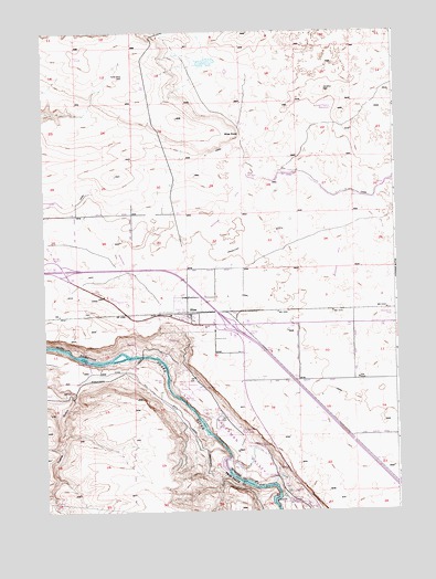
Bliss, ID USGS Topographic Map
Click on map above to begin viewing in our Map Viewer.

This topographic map contains these locations and features:
Feature Name Type Latitude Longitude GNIS ID View Map
BlissPopulated PlaceN42.9268°W114.9495°371602View Map
Bliss Community ChurchChurchN42.9235°W114.9451°395713View Map
Bliss Fire District StationBuildingN42.9243°W114.9486°2619112View Map
Bliss PointCapeN42.9741°W114.9323°371603View Map
Bliss Post OfficePost OfficeN42.9245°W114.9493°2766893View Map
Bliss Public SchoolSchoolN42.9232°W114.9426°401426View Map
Bliss Quick ResponseBuildingN42.9243°W114.9486°2642809View Map
Bliss SchoolSchoolN42.9232°W114.9425°395714View Map
City of BlissCivilN42.9242°W114.9480°2409864View Map
Last Chance ReservoirReservoirN42.9810°W114.8948°395770View Map
Lateral Y-4CanalN42.9455°W114.9229°2569193View Map
Lateral Z-4CanalN42.9278°W114.9309°2569198View Map
Lateral Z-6CanalN42.9164°W114.9234°2569199View Map
North Bliss WellWellN42.9877°W114.9709°395787View Map
Pioneer Cemetery (historical)CemeteryN42.9227°W114.9453°395871View Map
Windmill WellWellN42.9849°W114.9003°395814View Map
Y CanalCanalN42.9588°W114.9598°376421View Map
Z CanalCanalN42.9302°W114.9387°376422View Map

Note: Coordinates in the location and feature list above are referenced to NAD83 datum.


Copyright (C) 2008-2024 Ryan Niemi / Sunset Dynamics ... All Rights Reserved