TopoQuest Logo
Do you find TopoQuest useful?
Help keep TopoQuest running and adding new maps/features by donating!
Bitcoin:  19c7KJd3qBynnjoSw5npx9KScwjBe4ifkT
Litecoin:  LXs6TkuXGGXo1vDsWCkWVdjQX94eUKd6ui
Home View Maps Find Maps Find Places Resources & Links


Sunrise Flat, Nevada Topographic Map

USGS Map Title: Sunrise Flat, NV
USGS Map MRC: 38118E1
DRG (GeoTIFF) Download: o38118e1.tif


Neighboring USGS Topographic Map Quads:


  Mount Ferguson, NV  
38118F2
 

  Gabbs Mountain, NV  
38118F1
 

  Granny Goose Well, NV  
38117F8
 

  Luning, NV  
38118E2
 

  Sunrise Flat, NV  
38118E1
 

  Stewart Spring, NV  
38117E8
 

  Black Dyke Mountain, NV  
38118D2
 

  Mina, NV  
38118D1
 

  Bettles Well, NV  
38117D8


Map MRC Location:

N39°
W119°
N39°
W118°
H8 H7 H6 H5 H4 H3 H2 H1
G8 G7 G6 G5 G4 G3 G2 G1
F8 F7 F6 F5 F4 F3 F2 F1
E8 E7 E6 E5 E4 E3 E2 E1
D8 D7 D6 D5 D4 D3 D2 D1
C8 C7 C6 C5 C4 C3 C2 C1
B8 B7 B6 B5 B4 B3 B2 B1
A8 A7 A6 A5 A4 A3 A2 A1
N38°
W119°
N38°
W118°

Sunrise Flat, NV USGS 1:24K Topographic Map Preview:
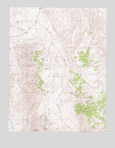
Sunrise Flat, NV USGS Topographic Map
Click on map above to begin viewing in our Map Viewer.

This topographic map contains these locations and features:
Feature Name Type Latitude Longitude GNIS ID View Map
Buffington SpringSpringN38.5631°W118.0763°850713View Map
Calavada FlatFlatN38.6016°W118.0860°850710View Map
Calavada SummitGapN38.5994°W118.1057°850709View Map
Champion Anderson MineMineN38.5113°W118.1037°853417View Map
Copper Head MineMineN38.5477°W118.0557°853422View Map
Copper Queen MineMineN38.5763°W118.1057°853426View Map
Dunbarton SpringSpringN38.5385°W118.0428°850714View Map
Eagle MineMineN38.5527°W118.0985°853425View Map
Emma MineMineN38.5696°W118.1123°853424View Map
Giroux MineMineN38.5874°W118.0904°853429View Map
Ideal MineMineN38.5066°W118.1154°853418View Map
Iron Butte MineMineN38.5308°W118.0215°853421View Map
Iron Gate MineMineN38.5099°W118.1004°853419View Map
Jasper MineMineN38.5249°W118.0218°853445View Map
Mayflower MineMineN38.5055°W118.0943°853420View Map
Muller MountainSummitN38.5308°W118.0285°849718View Map
Santa Fe Mining DistrictCivilN38.5369°W118.0948°853437View Map
Stone Cabin SpringSpringN38.5736°W118.0813°850712View Map
Sunrise FlatFlatN38.5313°W118.0629°850715View Map
Volcano PeakSummitN38.5013°W118.0885°850716View Map
Wallstreet and Turk MinesMineN38.5135°W118.1021°853416View Map
Wedge Copper MineMineN38.5655°W118.1048°853427View Map
Western Metals MineMineN38.5383°W118.0387°847940View Map
York MineMineN38.5783°W118.0918°853428View Map
York SpringSpringN38.5770°W118.0877°850711View Map

Note: Coordinates in the location and feature list above are referenced to NAD83 datum.


Copyright (C) 2008-2024 Ryan Niemi / Sunset Dynamics ... All Rights Reserved