TopoQuest Logo
Do you find TopoQuest useful?
Help keep TopoQuest running and adding new maps/features by donating!
Bitcoin:  19c7KJd3qBynnjoSw5npx9KScwjBe4ifkT
Litecoin:  LXs6TkuXGGXo1vDsWCkWVdjQX94eUKd6ui
Home View Maps Find Maps Find Places Resources & Links


Summer Hill, Illinois Topographic Map

USGS Map Title: Summer Hill, IL
USGS Map MRC: 39090E8
DRG (GeoTIFF) Download: o39090e8.tif


Neighboring USGS Topographic Map Quads:


  Barry, IL  
39091F1
 

  Baylis, IL  
39090F8
 

  New Salem, IL  
39090F7
 

  Rockport, IL  
39091E1
 

  Summer Hill, IL  
39090E8
 

  Pittsfield, IL  
39090E7
 

  Louisiana, MO  
39091D1
 

  Pleasant Hill West, IL  
39090D8
 

  Pleasant Hill East, IL  
39090D7


Map MRC Location:

N40°
W91°
N40°
W90°
H8 H7 H6 H5 H4 H3 H2 H1
G8 G7 G6 G5 G4 G3 G2 G1
F8 F7 F6 F5 F4 F3 F2 F1
E8 E7 E6 E5 E4 E3 E2 E1
D8 D7 D6 D5 D4 D3 D2 D1
C8 C7 C6 C5 C4 C3 C2 C1
B8 B7 B6 B5 B4 B3 B2 B1
A8 A7 A6 A5 A4 A3 A2 A1
N39°
W91°
N39°
W90°

Summer Hill, IL USGS 1:24K Topographic Map Preview:
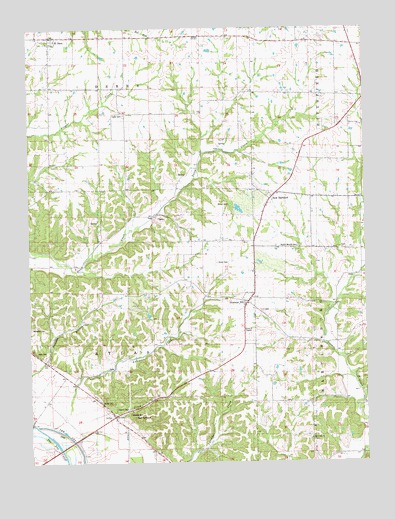
Summer Hill, IL USGS Topographic Map
Click on map above to begin viewing in our Map Viewer.

This topographic map contains these locations and features:
Feature Name Type Latitude Longitude GNIS ID View Map
Adams CemeteryCemeteryN39.5156°W90.9685°1725354View Map
Ambrosia CreekStreamN39.5092°W90.9890°403479View Map
AtlasPopulated PlaceN39.5139°W90.9696°422420View Map
Bald Bluff CemeteryCemeteryN39.5134°W90.9621°1725357View Map
Black Oak CemeteryCemeteryN39.5062°W90.8951°1852461View Map
Black Oak ChurchChurchN39.5067°W90.8960°1725364View Map
Black Oak School (historical)SchoolN39.5073°W90.8968°404497View Map
Brown CemeteryCemeteryN39.5742°W90.9260°1725367View Map
Central School (historical)SchoolN39.5364°W90.8818°405885View Map
Clark 54 Drive-InLocaleN39.5367°W90.9194°2634353View Map
Coldwater School (historical)SchoolN39.6206°W90.8899°406342View Map
Dutch Creek School (historical)SchoolN39.5637°W90.9726°407534View Map
El DaraPopulated PlaceN39.6225°W90.9918°407829View Map
Miller CemeteryCemeteryN39.5178°W90.9740°1725413View Map
Moomey CemeteryCemeteryN39.5142°W90.9635°1725416View Map
New HartfordPopulated PlaceN39.5756°W90.9101°423017View Map
Petty CemeteryCemeteryN39.5317°W90.9979°1725428View Map
Pike CountyCivilN39.6225°W90.8863°1784941View Map
Pleasant View School (historical)SchoolN39.6225°W90.9365°415928View Map
Prairie Mound CemeteryCemeteryN39.5623°W90.9001°1725436View Map
Prairie Mound School (historical)SchoolN39.5614°W90.8949°416151View Map
Shinn CemeteryCemeteryN39.5575°W90.9301°1725447View Map
Spatterdock LakeLakeN39.5055°W90.9880°418881View Map
Stony Point School (historical)SchoolN39.5973°W90.9204°419191View Map
Summer HillPopulated PlaceN39.5464°W90.9193°419343View Map
Summer Hill CemeteryCemeteryN39.5437°W90.9129°1852495View Map
TaylorPopulated PlaceN39.6003°W90.9635°423233View Map
Taylor-Martin CemeteryCemeteryN39.6003°W90.9646°1725459View Map
The Sny CutoffCanalN39.5031°W90.9885°1725453View Map
Township of DerryCivilN39.6238°W90.9730°428891View Map
Union School (historical)SchoolN39.5967°W90.8862°420108View Map
Village of El DaraCivilN39.6227°W90.9912°2398792View Map
West Point School (historical)SchoolN39.5639°W90.9362°420894View Map
Wombles CemeteryCemeteryN39.5389°W90.9996°1725473View Map

Note: Coordinates in the location and feature list above are referenced to NAD83 datum.


Copyright (C) 2008-2024 Ryan Niemi / Sunset Dynamics ... All Rights Reserved