TopoQuest Logo
Do you find TopoQuest useful?
Help keep TopoQuest running and adding new maps/features by donating!
Bitcoin:  19c7KJd3qBynnjoSw5npx9KScwjBe4ifkT
Litecoin:  LXs6TkuXGGXo1vDsWCkWVdjQX94eUKd6ui
Home View Maps Find Maps Find Places Resources & Links


Sugarloaf Peak, Washington Topographic Map

USGS Map Title: Sugarloaf Peak, WA
USGS Map MRC: 47120G5
DRG (GeoTIFF) Download: o47120g5.tif


Neighboring USGS Topographic Map Quads:


  Chikamin Creek, WA  
47120H6
 

  Silver Falls, WA  
47120H5
 

  Brief, WA  
47120H4
 

  Plain, WA  
47120G6
 

  Sugarloaf Peak, WA  
47120G5
 

  Tyee Mountain, WA  
47120G4
 

  Winton, WA  
47120F6
 

  Van Creek, WA  
47120F5
 

  Chumstick Mountain, WA  
47120F4


Map MRC Location:

N48°
W121°
N48°
W120°
H8 H7 H6 H5 H4 H3 H2 H1
G8 G7 G6 G5 G4 G3 G2 G1
F8 F7 F6 F5 F4 F3 F2 F1
E8 E7 E6 E5 E4 E3 E2 E1
D8 D7 D6 D5 D4 D3 D2 D1
C8 C7 C6 C5 C4 C3 C2 C1
B8 B7 B6 B5 B4 B3 B2 B1
A8 A7 A6 A5 A4 A3 A2 A1
N47°
W121°
N47°
W120°

Sugarloaf Peak, WA USGS 1:24K Topographic Map Preview:
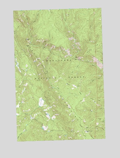
Sugarloaf Peak, WA USGS Topographic Map
Click on map above to begin viewing in our Map Viewer.

This topographic map contains these locations and features:
Feature Name Type Latitude Longitude GNIS ID View Map
Alma CreekStreamN47.8254°W120.5331°1515820View Map
Berg CampLocaleN47.8376°W120.5848°1516426View Map
Berg CreekStreamN47.8393°W120.5862°1516428View Map
Billy CreekStreamN47.8335°W120.5356°1516556View Map
Billy RidgeRidgeN47.8432°W120.5051°1516563View Map
Chelan CountyCivilN47.8692°W120.6190°1531932View Map
Cougar CreekStreamN47.8265°W120.5401°1518164View Map
Cougar Creek ShelterLocaleN47.8279°W120.5404°1518168View Map
Deer Camp CampsiteLocaleN47.8081°W120.5941°2554701View Map
Entiat MountainsRangeN47.7726°W120.5448°1519361View Map
Jimmy CreekStreamN47.8598°W120.6045°1521381View Map
Maverick PeakSummitN47.8465°W120.6079°1522811View Map
Maverick SaddleGapN47.8404°W120.6040°1522812View Map
Miners CorralLocaleN47.8001°W120.5720°1523224View Map
Miners CreekStreamN47.8329°W120.5723°1523227View Map
Miners RidgeRidgeN47.7985°W120.5379°1523233View Map
Morrow MeadowFlatN47.8204°W120.6212°1523378View Map
South Fork Beaver CreekStreamN47.7751°W120.6076°1526157View Map
Sugarloaf PeakSummitN47.7573°W120.5279°1526671View Map
Sugarloaf Peak LookoutLocaleN47.7574°W120.5283°2554698View Map
Wilma CreekStreamN47.8110°W120.5006°1528196View Map

Note: Coordinates in the location and feature list above are referenced to NAD83 datum.


Copyright (C) 2008-2024 Ryan Niemi / Sunset Dynamics ... All Rights Reserved