TopoQuest Logo
Do you find TopoQuest useful?
Help keep TopoQuest running and adding new maps/features by donating!
Bitcoin:  19c7KJd3qBynnjoSw5npx9KScwjBe4ifkT
Litecoin:  LXs6TkuXGGXo1vDsWCkWVdjQX94eUKd6ui
Home View Maps Find Maps Find Places Resources & Links


Suffield, Ohio Topographic Map

USGS Map Title: Suffield, OH
USGS Map MRC: 41081A3
DRG (GeoTIFF) Download: o41081a3.tif


Neighboring USGS Topographic Map Quads:


  Hudson, OH  
41081B4
 

  Kent, OH  
41081B3
 

  Ravenna, OH  
41081B2
 

  Akron East, OH  
41081A4
 

  Suffield, OH  
41081A3
 

  Atwater, OH  
41081A2
 

  North Canton, OH  
40081H4
 

  Hartville, OH  
40081H3
 

  Limaville, OH  
40081H2


Map MRC Location:

N42°
W82°
N42°
W81°
H8 H7 H6 H5 H4 H3 H2 H1
G8 G7 G6 G5 G4 G3 G2 G1
F8 F7 F6 F5 F4 F3 F2 F1
E8 E7 E6 E5 E4 E3 E2 E1
D8 D7 D6 D5 D4 D3 D2 D1
C8 C7 C6 C5 C4 C3 C2 C1
B8 B7 B6 B5 B4 B3 B2 B1
A8 A7 A6 A5 A4 A3 A2 A1
N41°
W82°
N41°
W81°

Suffield, OH USGS 1:24K Topographic Map Preview:
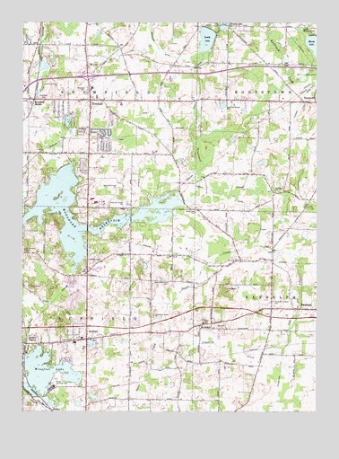
Suffield, OH USGS Topographic Map
Click on map above to begin viewing in our Map Viewer.

This topographic map contains these locations and features:
Feature Name Type Latitude Longitude GNIS ID View Map
Bacon HillSummitN41.0034°W81.2912°1067182View Map
BrimfieldPopulated PlaceN41.1001°W81.3465°1064494View Map
Brimfield Census Designated PlaceCensusN41.0941°W81.3482°2393350View Map
Brimfield Elementary SchoolSchoolN41.1037°W81.3454°1058229View Map
Brimfield Fire DepartmentBuildingN41.1008°W81.3459°2550459View Map
Brimfield Plaza Shopping CenterLocaleN41.1087°W81.3493°1058230View Map
Brimfield Post Office (historical)Post OfficeN41.1001°W81.3471°2056317View Map
Brimfield StationPopulated PlaceN41.0998°W81.3704°1056720View Map
Brimfield Township Police DepartmentBuildingN41.1004°W81.3472°2732598View Map
Brimfield Water Treatment PlantLocaleN41.0919°W81.3617°2678279View Map
Bunkers CornersPopulated PlaceN41.0828°W81.3471°1062416View Map
Central Elementary SchoolSchoolN41.0673°W81.3401°1058233View Map
Congress Lake OutletStreamN41.0528°W81.2720°1039306View Map
Cranberry CreekStreamN41.0203°W81.2640°1039442View Map
East Lawn CemeteryCemeteryN41.0232°W81.3453°1964010View Map
Feeder CanalCanalN41.0912°W81.3043°1040403View Map
Field High SchoolSchoolN41.0681°W81.3454°1058235View Map
Field Junior High SchoolSchoolN41.0670°W81.3437°1058234View Map
Five CornersPopulated PlaceN41.0445°W81.3473°1062472View Map
German Reformed CemeteryCemeteryN41.0314°W81.2695°1964000View Map
Green Hills Golf CourseLocaleN41.1012°W81.3540°1058231View Map
Hilltown (historical)Populated PlaceN41.0737°W81.3287°1067188View Map
Hudson DitchCanalN41.0853°W81.2534°1041849View Map
Interchange 33CrossingN41.1078°W81.3471°1080256View Map
Little Mussy LakeLakeN41.1230°W81.2568°1042676View Map
Mogadore ReservoirReservoirN41.0640°W81.3588°1058178View Map
Muzzy LakeLakeN41.1176°W81.2509°1061166View Map
North Dyke CemeteryCemeteryN41.0648°W81.3011°1043936View Map
Paradise Lake Golf CourseLocaleN41.0476°W81.3268°1058228View Map
Potter CreekStreamN41.0542°W81.2765°1066908View Map
Randolph Acres Mobile Home ParkPopulated PlaceN41.0311°W81.2661°2513651View Map
Randolph Hillside CemeteryCemeteryN41.0350°W81.2685°1044856View Map
Restland CemeteryCemeteryN41.1023°W81.3481°1044952View Map
Sackett Field (historical)AirportN41.0801°W81.3173°1082764View Map
Saint JosephPopulated PlaceN41.0273°W81.2993°1049145View Map
Saint Joseph CemeteryCemeteryN41.0298°W81.2978°1964008View Map
Saint Joseph Post Office (historical)Post OfficeN41.0278°W81.2998°2055545View Map
Saint Michaels CemeteryCemeteryN41.0513°W81.3734°1045711View Map
Saint Peters CemeteryCemeteryN41.0714°W81.2676°1964009View Map
Saint Peters ChurchChurchN41.0717°W81.2676°1045798View Map
Sandy LakeLakeN41.1200°W81.2963°1045956View Map
Sober PitMineN41.0936°W81.2917°2633431View Map
SuffieldPopulated PlaceN41.0231°W81.3473°1065399View Map
Suffield Elementary SchoolSchoolN41.0220°W81.3526°1058236View Map
Suffield Post Office (historical)Post OfficeN41.0237°W81.3471°2055554View Map
Suffield StationPopulated PlaceN41.0217°W81.3729°1049221View Map
Suffield Township Fire DepartmentBuildingN41.0228°W81.3488°2549665View Map
Sunny Hills Golf CourseLocaleN41.0917°W81.3698°1058232View Map
Thorndyke CemeteryCemeteryN41.1004°W81.3659°1047043View Map
Township of BrimfieldCivilN41.0986°W81.3449°1086823View Map
Township of SuffieldCivilN41.0266°W81.3468°1086841View Map
Triangle Lake Bog State Nature PreserveParkN41.1189°W81.2615°1964012View Map
Upson Meacham CemeteryCemeteryN41.0417°W81.3125°1047378View Map
Victorian FarmsLocaleN41.0264°W81.3014°2724369View Map
Wingfoot LakeReservoirN41.0184°W81.3732°1070998View Map
Wingfoot Lake DamDamN41.0184°W81.3732°1078776View Map
Wingfoot Lake Test Operations BalloonportAirportN41.0095°W81.3579°1082452View Map
WNIR-FM (Kent)TowerN41.1078°W81.3551°1083845View Map

Note: Coordinates in the location and feature list above are referenced to NAD83 datum.


Copyright (C) 2008-2024 Ryan Niemi / Sunset Dynamics ... All Rights Reserved