TopoQuest Logo
Do you find TopoQuest useful?
Help keep TopoQuest running and adding new maps/features by donating!
Bitcoin:  19c7KJd3qBynnjoSw5npx9KScwjBe4ifkT
Litecoin:  LXs6TkuXGGXo1vDsWCkWVdjQX94eUKd6ui
Home View Maps Find Maps Find Places Resources & Links


Sturgeon Bay West, Wisconsin Topographic Map

USGS Map Title: Sturgeon Bay West, WI
USGS Map MRC: 44087G4
DRG (GeoTIFF) Download: o44087g4.tif


Neighboring USGS Topographic Map Quads:


  Idlewild, WI  
44087H4
 

  Institute, WI  
44087H3
 

  Little Sturgeon, WI  
44087G5
 

  Sturgeon Bay West, WI  
44087G4
 

  Sturgeon Bay East, WI  
44087G3
 

  Brussels, WI  
44087F5
 

  Forestville, WI  
44087F4
 

  Algoma NE, WI  
44087F3


Map MRC Location:

N45°
W88°
N45°
W87°
H8 H7 H6 H5 H4 H3 H2 H1
G8 G7 G6 G5 G4 G3 G2 G1
F8 F7 F6 F5 F4 F3 F2 F1
E8 E7 E6 E5 E4 E3 E2 E1
D8 D7 D6 D5 D4 D3 D2 D1
C8 C7 C6 C5 C4 C3 C2 C1
B8 B7 B6 B5 B4 B3 B2 B1
A8 A7 A6 A5 A4 A3 A2 A1
N44°
W88°
N44°
W87°

Sturgeon Bay West, WI USGS 1:24K Topographic Map Preview:
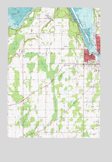
Sturgeon Bay West, WI USGS Topographic Map
Click on map above to begin viewing in our Map Viewer.

This topographic map contains these locations and features:
Feature Name Type Latitude Longitude GNIS ID View Map
Bay View Evangelical Lutheran ChurchChurchN44.8292°W87.3909°1838040View Map
Bayside CemeteryCemeteryN44.8590°W87.3804°1561328View Map
Bayview ParkParkN44.8308°W87.3845°1578124View Map
Bradley LakeLakeN44.8479°W87.3837°1562130View Map
Carnegie LibraryBuildingN44.8347°W87.3754°1838041View Map
Corpus Christi Roman Catholic ChurchChurchN44.8292°W87.3957°1838043View Map
Cunningham SwampSwampN44.8203°W87.4512°1563625View Map
Door County Cherryland AirportAirportN44.8415°W87.4249°1582226View Map
Door County JailBuildingN44.8120°W87.4017°1838046View Map
Door County Sheriff's OfficeBuildingN44.8124°W87.4012°2759783View Map
Dunlap ReefBarN44.8375°W87.3882°1564185View Map
First Baptist ChurchChurchN44.8419°W87.3770°1838049View Map
First Methodist ChurchChurchN44.8372°W87.3754°1838051View Map
Friends Community ChurchChurchN44.8292°W87.3890°1838052View Map
Greenwood SwampSwampN44.8103°W87.4262°1565888View Map
Hainesville CemeteryCemeteryN44.8647°W87.4459°1565966View Map
Hainesville ChurchChurchN44.8614°W87.4570°1578128View Map
Hainesville School (historical)SchoolN44.8606°W87.4573°1565967View Map
Highland Heights Mobile VillagePopulated PlaceN44.8192°W87.4086°2631377View Map
Hills PointCapeN44.8592°W87.4054°1566447View Map
Hope Congregational ChurchChurchN44.8356°W87.3754°1838056View Map
Kinnard FarmLocaleN44.8200°W87.4356°2711227View Map
Larson CreekStreamN44.8661°W87.4734°1578115View Map
Larson SwampSwampN44.8633°W87.4701°1578118View Map
Lincoln School (historical)SchoolN44.7828°W87.4890°1568116View Map
Lost Creek Golf CourseLocaleN44.8675°W87.4457°1578117View Map
Maplewood SwampSwampN44.7697°W87.4745°1569011View Map
May SwampSwampN44.8347°W87.4932°1578165View Map
Morning Star School (historical)SchoolN44.8350°W87.4270°1569743View Map
Mount LoweSummitN44.8681°W87.3754°1577473View Map
Mount Olive ChurchChurchN44.7803°W87.3773°1569823View Map
Ottumba ParkParkN44.8306°W87.3887°1578123View Map
Para Tran Medical TransportBuildingN44.8242°W87.3984°2698279View Map
Potawatomi State ParkParkN44.8644°W87.4151°1571836View Map
Roder FarmsLocaleN44.8175°W87.4814°2711220View Map
Saint John Bosco Catholic SchoolSchoolN44.8299°W87.3959°1578130View Map
Saint Peter's Lutheran SchoolSchoolN44.8295°W87.3871°2716178View Map
Saint Peters Evangelical Lutheran ChurchChurchN44.8292°W87.3870°1838073View Map
Salem CemeteryCemeteryN44.8273°W87.4791°1573618View Map
Salem ChurchChurchN44.8317°W87.4801°1573625View Map
Sand BayBayN44.8589°W87.4901°1577474View Map
Sawyer Elementary SchoolSchoolN44.8225°W87.3842°2716222View Map
Schulties CemeteryCemeteryN44.8277°W87.4796°1578116View Map
Schumacher CemeteryCemeteryN44.8207°W87.4236°1570105View Map
Sixel FarmsLocaleN44.7839°W87.4411°2711218View Map
Southern Door Volunteer Fire Department Station 2BuildingN44.8349°W87.4272°2698115View Map
Sperber FarmsLocaleN44.7686°W87.4083°2711223View Map
Stokes School (historical)SchoolN44.8003°W87.4479°1574914View Map
Stony Creek SwampSwampN44.7781°W87.4348°1574953View Map
Sturgeon BayBayN44.8542°W87.3945°1574999View Map
Sturgeon BayPopulated PlaceN44.8342°W87.3770°1575000View Map
Sturgeon Bay BridgeBridgeN44.8319°W87.3812°1838076View Map
Sturgeon Bay City HallBuildingN44.8339°W87.3757°1838077View Map
Sturgeon Bay Fire Department - West StationBuildingN44.8219°W87.3784°2698171View Map
Sturgeon Bay Post OfficePost OfficeN44.8353°W87.3759°1838081View Map
Sturgeon Bay Yacht ClubLocaleN44.8253°W87.3754°1578125View Map
Sturgeon Yacht HarborLocaleN44.8256°W87.3757°1578120View Map
Sunset ParkParkN44.8447°W87.3834°1578129View Map
Third Avenue Historic DistrictParkN44.8347°W87.3765°1838082View Map
Thrift School (historical)SchoolN44.7700°W87.4184°1575423View Map
Town of NasewaupeeCivilN44.8413°W87.4624°1583778View Map
Waniger School (historical)SchoolN44.8353°W87.4776°1576197View Map
West Side Elementary SchoolSchoolN44.8267°W87.3848°1578126View Map
Wilson School (historical)SchoolN44.7981°W87.3982°1576836View Map

Note: Coordinates in the location and feature list above are referenced to NAD83 datum.


Copyright (C) 2008-2024 Ryan Niemi / Sunset Dynamics ... All Rights Reserved