TopoQuest Logo
Do you find TopoQuest useful?
Help keep TopoQuest running and adding new maps/features by donating!
Bitcoin:  19c7KJd3qBynnjoSw5npx9KScwjBe4ifkT
Litecoin:  LXs6TkuXGGXo1vDsWCkWVdjQX94eUKd6ui
Home View Maps Find Maps Find Places Resources & Links


Stottville, New York Topographic Map

USGS Map Title: Stottville, NY
USGS Map MRC: 42073C6
DRG (GeoTIFF) Download: o42073c6.tif


Neighboring USGS Topographic Map Quads:


  Ravena, NY  
42073D7
 

  Kinderhook, NY  
42073D6
 

  East Chatham, NY  
42073D5
 

  Hudson North, NY  
42073C7
 

  Stottville, NY  
42073C6
 

  Chatham, NY  
42073C5
 

  Hudson South, NY  
42073B7
 

  Claverack, NY  
42073B6
 

  Hillsdale, NY  
42073B5


Map MRC Location:

N43°
W74°
N43°
W73°
H8 H7 H6 H5 H4 H3 H2 H1
G8 G7 G6 G5 G4 G3 G2 G1
F8 F7 F6 F5 F4 F3 F2 F1
E8 E7 E6 E5 E4 E3 E2 E1
D8 D7 D6 D5 D4 D3 D2 D1
C8 C7 C6 C5 C4 C3 C2 C1
B8 B7 B6 B5 B4 B3 B2 B1
A8 A7 A6 A5 A4 A3 A2 A1
N42°
W74°
N42°
W73°

Stottville, NY USGS 1:24K Topographic Map Preview:
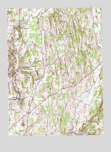
Stottville, NY USGS Topographic Map
Click on map above to begin viewing in our Map Viewer.

This topographic map contains these locations and features:
Feature Name Type Latitude Longitude GNIS ID View Map
Agawamuck CreekStreamN42.2529°W73.6651°969280View Map
Brick TavernPopulated PlaceN42.2726°W73.7235°972258View Map
Brick Tavern-Mount Ida Limestone QuarryMineN42.2619°W73.7311°2633293View Map
Calvary Assembly of God ChurchChurchN42.2869°W73.7461°2496360View Map
Claverack CreekStreamN42.3173°W73.7457°970007View Map
Columbia CountyCivilN42.2501°W73.6319°974109View Map
Columbia County AirportAirportN42.2939°W73.7120°978077View Map
Columbia County Commerce CenterLocaleN42.2778°W73.7189°2667551View Map
Columbia Villa Mobile Home ParkPopulated PlaceN42.3250°W73.7497°2426829View Map
Country Estates EastPopulated PlaceN42.2708°W73.7053°2426830View Map
Fitting CreekStreamN42.3131°W73.7421°950189View Map
Fowlers PondLakeN42.3481°W73.6673°950548View Map
German Church CemeteryCemeteryN42.2942°W73.6571°2555949View Map
Ghent Reformed ChurchChurchN42.3183°W73.6981°2496359View Map
Ghent Union CemeteryCemeteryN42.3133°W73.6278°968197View Map
Holy Family ChurchChurchN42.2858°W73.7453°2496361View Map
Ichabod Crane HomeLocaleN42.3623°W73.6785°953578View Map
Katchkie FarmLocaleN42.3747°W73.6903°2555716View Map
Kinderhook CreekStreamN42.3172°W73.7460°607496View Map
Kinderhook Creek BridgeBridgeN42.3573°W73.7334°2614933View Map
Klaverack AirportAirportN42.2632°W73.6969°978078View Map
Kline Kill AirportAirportN42.3510°W73.6365°978035View Map
Love Apple FarmsLocaleN42.3122°W73.7047°2516848View Map
Martin Van Buren HomesteadLocaleN42.3698°W73.7040°956596View Map
Martin Van Buren National Historic SiteParkN42.3667°W73.7153°1888943View Map
Meadowgreens Golf CourseLocaleN42.3014°W73.7069°2615437View Map
MellenvillePopulated PlaceN42.2531°W73.6676°956923View Map
Mellenville Post OfficePost OfficeN42.2524°W73.6687°2618019View Map
Mellenville Union CemeteryCemeteryN42.2537°W73.6607°968149View Map
Mellenville Volunteer Fire Company 1BuildingN42.2555°W73.6666°2718579View Map
Merwin LakeLakeN42.3697°W73.6792°957020View Map
Mount IdaSummitN42.2615°W73.7321°953581View Map
North CreekStreamN42.2529°W73.6648°958764View Map
OmiPopulated PlaceN42.3251°W73.6815°972893View Map
Paulies Mobile Home ParkPopulated PlaceN42.3003°W73.7200°2496638View Map
Pentecostal Gospel LighthouseChurchN42.2864°W73.7408°2496362View Map
Philmont Methodist ChurchChurchN42.2503°W73.6529°2616229View Map
Pine Haven Nursing HomeBuildingN42.2522°W73.6386°2614754View Map
PulversPopulated PlaceN42.2804°W73.6482°972976View Map
RossmanPopulated PlaceN42.3315°W73.7437°962950View Map
Rossman FallsFallsN42.3331°W73.7432°962952View Map
Sacred Heart CemeteryCemeteryN42.2506°W73.6346°963186View Map
Saint Mary's ChurchChurchN42.3609°W73.7336°2667418View Map
Saint Marys CemeteryCemeteryN42.3505°W73.7432°964093View Map
Saint Pauls ChurchChurchN42.3612°W73.7335°964116View Map
Shufelt CemeteryCemeteryN42.3538°W73.6442°2555953View Map
Snyder CemeteryCemeteryN42.3251°W73.6422°2555952View Map
StockportPopulated PlaceN42.3095°W73.7462°966472View Map
Stockport Volunteer Fire Company 1BuildingN42.3091°W73.7460°2734723View Map
StottvillePopulated PlaceN42.2862°W73.7387°970675View Map
Stottville Fire DepartmentBuildingN42.2878°W73.7480°2718528View Map
Stottville Post OfficePost OfficeN42.2864°W73.7428°2618144View Map
Stuyvesant FallsPopulated PlaceN42.3554°W73.7310°966673View Map
Stuyvesant Falls CemeteryCemeteryN42.3540°W73.7412°966674View Map
Town of GhentCivilN42.3119°W73.6509°979000View Map
Waltermire SchoolSchoolN42.2981°W73.6665°968729View Map
West GhentPopulated PlaceN42.3187°W73.7001°973227View Map
West Ghent CemeteryCemeteryN42.3192°W73.6986°2555951View Map
West Ghent Volunteer Fire CompanyBuildingN42.2800°W73.7194°2734727View Map
Whittier Place Assisted Living CenterBuildingN42.2806°W73.7032°2614850View Map
Whittier Rehabilitation and Skilled Nursing CenterBuildingN42.2820°W73.7046°2614851View Map
Widows CreekStreamN42.3162°W73.7332°971225View Map

Note: Coordinates in the location and feature list above are referenced to NAD83 datum.


Copyright (C) 2008-2024 Ryan Niemi / Sunset Dynamics ... All Rights Reserved