TopoQuest Logo
Do you find TopoQuest useful?
Help keep TopoQuest running and adding new maps/features by donating!
Bitcoin:  19c7KJd3qBynnjoSw5npx9KScwjBe4ifkT
Litecoin:  LXs6TkuXGGXo1vDsWCkWVdjQX94eUKd6ui
Home View Maps Find Maps Find Places Resources & Links


Stone Hill, Missouri Topographic Map

USGS Map Title: Stone Hill, MO
USGS Map MRC: 37091E3
DRG (GeoTIFF) Download: o37091e3.tif


Neighboring USGS Topographic Map Quads:


  Short Bend, MO  
37091F4
 

  Howes Mill Spring, MO  
37091F3
 

  Viburnum West, MO  
37091F2
 

  Doss, MO  
37091E4
 

  Stone Hill, MO  
37091E3
 

  Greeley, MO  
37091E2
 

  Gladden, MO  
37091D4
 

  Loggers Lake, MO  
37091D3
 

  Bunker, MO  
37091D2


Map MRC Location:

N38°
W92°
N38°
W91°
H8 H7 H6 H5 H4 H3 H2 H1
G8 G7 G6 G5 G4 G3 G2 G1
F8 F7 F6 F5 F4 F3 F2 F1
E8 E7 E6 E5 E4 E3 E2 E1
D8 D7 D6 D5 D4 D3 D2 D1
C8 C7 C6 C5 C4 C3 C2 C1
B8 B7 B6 B5 B4 B3 B2 B1
A8 A7 A6 A5 A4 A3 A2 A1
N37°
W92°
N37°
W91°

Stone Hill, MO USGS 1:24K Topographic Map Preview:
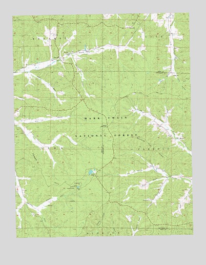
Stone Hill, MO USGS Topographic Map
Click on map above to begin viewing in our Map Viewer.

This topographic map contains these locations and features:
Feature Name Type Latitude Longitude GNIS ID View Map
Bishop DamDamN37.6067°W91.3168°764886View Map
Brook CemeteryCemeteryN37.5178°W91.3532°749030View Map
Bunker Camp (historical)Populated PlaceN37.5064°W91.2535°749110View Map
Crossville SchoolSchoolN37.5320°W91.2510°749541View Map
Dalton HollowValleyN37.5912°W91.2637°749564View Map
Hayes BranchStreamN37.5328°W91.2657°753264View Map
Howes MillPopulated PlaceN37.6178°W91.2918°758436View Map
Howes Mill Post OfficePost OfficeN37.6178°W91.2918°765609View Map
Johnson BranchStreamN37.5325°W91.2657°750524View Map
Junction Lookout (historical)Populated PlaceN37.6184°W91.3579°750552View Map
Kay BranchStreamN37.5375°W91.2768°750560View Map
Little Scotia CampgroundLocaleN37.5295°W91.3304°754394View Map
Little Scotia PondReservoirN37.5280°W91.3307°750798View Map
MacIntire HollowValleyN37.6009°W91.3326°750896View Map
MarcootPopulated PlaceN37.5545°W91.2585°750927View Map
Marcoot LookoutLocaleN37.5614°W91.3090°750928View Map
Marcoot School (historical)SchoolN37.5600°W91.2690°730432View Map
Nelson BranchStreamN37.5620°W91.2679°751274View Map
Nelson School (historical)SchoolN37.6128°W91.2626°751278View Map
Nelson Schoolyard GraveyardCemeteryN37.6129°W91.2629°2725631View Map
Ozark Foothills Planning RegionCivilN37.5333°W91.2503°754109View Map
Parker CemeteryCemeteryN37.5903°W91.2624°751498View Map
Parker HollowValleyN37.5889°W91.2593°751500View Map
Rye HollowValleyN37.5862°W91.2551°751994View Map
Scotia CemeteryCemeteryN37.5200°W91.3371°753263View Map
Scotia Demonstration AreaParkN37.5306°W91.3182°754386View Map
Scotia Iron MineMineN37.5278°W91.3360°753262View Map
Scotia PondReservoirN37.5363°W91.3218°752062View Map
Scotia Pond DamDamN37.5350°W91.3218°765274View Map
Scotia ValleyValleyN37.5164°W91.3610°752063View Map
Stone HillPopulated PlaceN37.6017°W91.3421°752377View Map
Stone Hill CemeteryCemeteryN37.6042°W91.3327°2725641View Map
Stone Hill ChurchChurchN37.6034°W91.3357°732633View Map
Stone Hill School (historical)SchoolN37.6034°W91.3379°735472View Map
Stooping Tree RidgeRidgeN37.5470°W91.2746°752381View Map
Teague HollowValleyN37.5939°W91.3632°753261View Map
Tower HillSummitN37.5437°W91.3643°752564View Map
Township of LinnCivilN37.5494°W91.3697°766603View Map

Note: Coordinates in the location and feature list above are referenced to NAD83 datum.


Copyright (C) 2008-2024 Ryan Niemi / Sunset Dynamics ... All Rights Reserved