TopoQuest Logo
Do you find TopoQuest useful?
Help keep TopoQuest running and adding new maps/features by donating!
Bitcoin:  19c7KJd3qBynnjoSw5npx9KScwjBe4ifkT
Litecoin:  LXs6TkuXGGXo1vDsWCkWVdjQX94eUKd6ui
Home View Maps Find Maps Find Places Resources & Links


Stiffarm Coulee, Montana Topographic Map

USGS Map Title: Stiffarm Coulee, MT
USGS Map MRC: 48108A6
DRG (GeoTIFF) Download: o48108a6.tif


Neighboring USGS Topographic Map Quads:


  Lake Seventeen NE, MT  
48108B7
 

  Lodge Pole NW, MT  
48108B6
 

  Lodge Pole NE, MT  
48108B5
 

  Lake Seventeen East, MT  
48108A7
 

  Stiffarm Coulee, MT  
48108A6
 

  Lodge Pole, MT  
48108A5
 

  Crazyman Coulee, MT  
47108H7
 

  Hays, MT  
47108H6
 

  Zortman, MT  
47108H5


Map MRC Location:

N49°
W109°
N49°
W108°
H8 H7 H6 H5 H4 H3 H2 H1
G8 G7 G6 G5 G4 G3 G2 G1
F8 F7 F6 F5 F4 F3 F2 F1
E8 E7 E6 E5 E4 E3 E2 E1
D8 D7 D6 D5 D4 D3 D2 D1
C8 C7 C6 C5 C4 C3 C2 C1
B8 B7 B6 B5 B4 B3 B2 B1
A8 A7 A6 A5 A4 A3 A2 A1
N48°
W109°
N48°
W108°

Stiffarm Coulee, MT USGS 1:24K Topographic Map Preview:
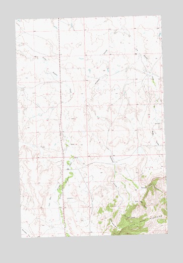
Stiffarm Coulee, MT USGS Topographic Map
Click on map above to begin viewing in our Map Viewer.

This topographic map contains these locations and features:
Feature Name Type Latitude Longitude GNIS ID View Map
26N23E01BCB_01 WellWellN48.0405°W108.7121°825764View Map
26N23E01BCCD01 WellWellN48.0386°W108.7115°825733View Map
26N23E01BDCC01 WellWellN48.0389°W108.7077°825737View Map
26N23E01CBAB01 WellWellN48.0375°W108.7099°825728View Map
26N23E01CBB_01 WellWellN48.0375°W108.7127°825729View Map
26N23E01DBCD01 WellWellN48.0350°W108.7010°825702View Map
26N23E02ADAD01 WellWellN48.0405°W108.7138°825765View Map
26N23E02DAAC01 WellWellN48.0367°W108.7152°825717View Map
26N23E02DDB_01 WellWellN48.0344°W108.7171°825697View Map
26N23E11ABD_01 WellWellN48.0283°W108.7202°825644View Map
26N23E11ABD_02 WellWellN48.0286°W108.7207°825646View Map
26N23E11ADAA01 WellWellN48.0269°W108.7138°825632View Map
26N23E11DBC_01 WellWellN48.0208°W108.7221°825581View Map
26N23E11DBC_02 WellWellN48.0203°W108.7221°825574View Map
26N23E12ABAC01 WellWellN48.0300°W108.6988°825653View Map
26N23E12ACA_01 WellWellN48.0258°W108.6996°825619View Map
26N23E12ADDD01 WellWellN48.0242°W108.6929°825602View Map
26N23E12CBB_01 WellWellN48.0233°W108.7127°825599View Map
26N23E12DCBB01 WellWellN48.0194°W108.7015°825572View Map
26N23E12DCBB02 WellWellN48.0208°W108.7007°825580View Map
26N23E13CBB_01 WellWellN48.0086°W108.7127°825494View Map
26N23E13CBBC01 WellWellN48.0078°W108.7124°825485View Map
26N23E13CBC_01 WellWellN48.0067°W108.7132°825482View Map
26N23E13CBDD01 WellWellN48.0058°W108.7096°825478View Map
26N23E14ABCB01 WellWellN48.0142°W108.7240°825538View Map
26N23E14ABCD01 WellWellN48.0130°W108.7224°825532View Map
26N23E14ABDD01 WellWellN48.0130°W108.7199°825531View Map
26N23E14ACBB01 WellWellN48.0125°W108.7240°825528View Map
26N23E14ACBB02 WellWellN48.0125°W108.7240°825529View Map
26N23E14ADA_01 WellWellN48.0117°W108.7024°825515View Map
26N23E14ADC_01 WellWellN48.0108°W108.6999°825503View Map
26N23E14ADCB01 WellWellN48.0108°W108.7179°825504View Map
26N23E14ADD_01 WellWellN48.0094°W108.7138°825497View Map
26N23E14ADD_02 WellWellN48.0094°W108.7140°825498View Map
26N23E14BDBA01 WellWellN48.0125°W108.7268°825530View Map
26N23E14DAAA01 WellWellN48.0083°W108.7052°825487View Map
26N23E14DDA_01 WellWellN48.0042°W108.7140°825461View Map
26N23E14DDA_02 WellWellN48.0053°W108.7157°825473View Map
26N23E14DDA_03 WellWellN48.0053°W108.7160°825474View Map
26N23E14DDA_04 WellWellN48.0039°W108.7149°825458View Map
26N23E14DDA_05 WellWellN48.0044°W108.7143°825462View Map
26N23E14DDB_01 WellWellN48.0047°W108.7174°825464View Map
26N23E14DDB_02 WellWellN48.0047°W108.7171°825463View Map
26N23E14DDD_01 WellWellN48.0022°W108.7140°825456View Map
26N24E05BBC_01 WellWellN48.0428°W108.6696°825775View Map
26N24E05CBB_01 WellWellN48.0344°W108.6696°825696View Map
26N24E05CBC_02 WellWellN48.0358°W108.6688°825707View Map
26N24E07BBDB01 WellWellN48.0286°W108.6890°825645View Map
26N24E07BBDB02 WellWellN48.0283°W108.6888°825643View Map
26N24E17BAAD01 WellWellN48.0147°W108.6610°825540View Map
27N23E10DDDD01 WellWellN48.1033°W108.7354°826265View Map
27N23E14CAAD01 WellWellN48.0944°W108.7252°826177View Map
27N23E14CADA01 WellWellN48.0950°W108.7252°826180View Map
27N23E14DDBD01 WellWellN48.0908°W108.7179°826147View Map
27N23E23AAAA01 WellWellN48.0883°W108.7143°826126View Map
27N23E23AADC01 WellWellN48.0850°W108.7160°826105View Map
27N23E25BCCD01 WellWellN48.0678°W108.7118°825965View Map
27N23E25BCDC01 WellWellN48.1089°W108.7102°826310View Map
27N23E25CBAD01 WellWellN48.0658°W108.7088°825945View Map
27N23E35AAAA01 WellWellN48.0592°W108.7140°825897View Map
27N23E35ADD_01 WellWellN48.0533°W108.7152°825854View Map
27N23E35DABA01 WellWellN48.0522°W108.7163°825844View Map
27N23E36BBCD01 WellWellN48.0567°W108.7118°825877View Map
27N23E36CBBA01 WellWellN48.0517°W108.7110°825840View Map
27N23E36CBD_01 WellWellN48.0497°W108.7093°825827View Map
27N23E36CBD_02 WellWellN48.0500°W108.7093°825828View Map
27N23E36CBD_03 WellWellN48.0503°W108.7093°825829View Map
27N23E36CBDB01 WellWellN48.0505°W108.7099°825831View Map
27N23E36CCCD01 WellWellN48.0461°W108.7118°825797View Map
27N23E36CCDC01 WellWellN48.0461°W108.7104°825796View Map
27N23E36CCDC02 WellWellN48.0461°W108.7102°825795View Map
27N23E36CCDC03 WellWellN48.0464°W108.7102°825801View Map
27N23E36CCDD01 WellWellN48.0461°W108.7085°825793View Map
27N23E36CCDD02 WellWellN48.0461°W108.7088°825794View Map
27N24E16BABC01 WellWellN48.1014°W108.6432°826234View Map
27N24E31DBA_01 WellWellN48.0517°W108.6779°825839View Map
Carry Water BenchBenchN48.0055°W108.6707°780977View Map
Curly Head CanyonValleyN48.0192°W108.6532°770378View Map
Dry LakePopulated PlaceN48.0511°W108.6465°1722387View Map
Four Bear CouleeValleyN48.0325°W108.7127°771545View Map
Hays Census Designated PlaceCensusN48.0104°W108.6607°2408362View Map
Mouse CouleeValleyN48.0697°W108.6324°774441View Map
Owl Head CanyonValleyN48.0117°W108.6640°775010View Map
Powder Face CanyonValleyN48.0269°W108.6485°775413View Map
Spotted Bird CreekStreamN48.1172°W108.6590°1722167View Map
Stiffarm CouleeValleyN48.1169°W108.6627°777214View Map
Warneke FlatFlatN48.0011°W108.7457°778118View Map

Note: Coordinates in the location and feature list above are referenced to NAD83 datum.


Copyright (C) 2008-2024 Ryan Niemi / Sunset Dynamics ... All Rights Reserved