TopoQuest Logo
Do you find TopoQuest useful?
Help keep TopoQuest running and adding new maps/features by donating!
Bitcoin:  19c7KJd3qBynnjoSw5npx9KScwjBe4ifkT
Litecoin:  LXs6TkuXGGXo1vDsWCkWVdjQX94eUKd6ui
Home View Maps Find Maps Find Places Resources & Links


Stevinson, California Topographic Map

USGS Map Title: Stevinson, CA
USGS Map MRC: 37120C7
DRG (GeoTIFF) Download: o37120c7.tif


Neighboring USGS Topographic Map Quads:


  Hatch, CA  
37120D8
 

  Turlock, CA  
37120D7
 

  Cressey, CA  
37120D6
 

  Gustine, CA  
37120C8
 

  Stevinson, CA  
37120C7
 

  Arena, CA  
37120C6
 

  Ingomar, CA  
37120B8
 

  San Luis Ranch, CA  
37120B7
 

  Turner Ranch, CA  
37120B6


Map MRC Location:

N38°
W121°
N38°
W120°
H8 H7 H6 H5 H4 H3 H2 H1
G8 G7 G6 G5 G4 G3 G2 G1
F8 F7 F6 F5 F4 F3 F2 F1
E8 E7 E6 E5 E4 E3 E2 E1
D8 D7 D6 D5 D4 D3 D2 D1
C8 C7 C6 C5 C4 C3 C2 C1
B8 B7 B6 B5 B4 B3 B2 B1
A8 A7 A6 A5 A4 A3 A2 A1
N37°
W121°
N37°
W120°

Stevinson, CA USGS 1:24K Topographic Map Preview:
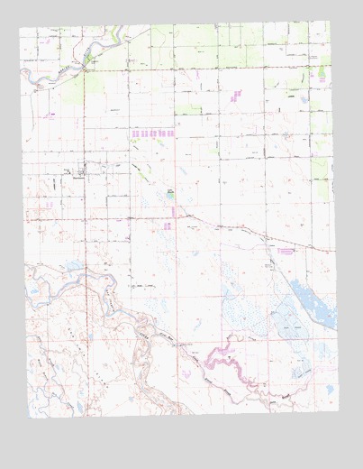
Stevinson, CA USGS Topographic Map
Click on map above to begin viewing in our Map Viewer.

This topographic map contains these locations and features:
Feature Name Type Latitude Longitude GNIS ID View Map
Adams DitchCanalN37.3344°W120.8271°217968View Map
Bear CreekStreamN37.2791°W120.8280°233464View Map
Bear SloughGutN37.2733°W120.7902°218875View Map
Bravel SloughGutN37.2588°W120.7996°219789View Map
East Branch Salt SloughLakeN37.2710°W120.8703°222862View Map
East Side Irrigation CanalCanalN37.3310°W120.8344°222926View Map
Gallo Bamboo DairyLocaleN37.3219°W120.7828°2707849View Map
Gallo Bear Creek DairyLocaleN37.3014°W120.7711°2707850View Map
Hagaman ParkParkN37.3647°W120.8488°224770View Map
Howard LateralCanalN37.3369°W120.7649°234049View Map
Lake HondaLakeN37.3194°W120.8171°225513View Map
Livingston SubstationLocaleN37.3627°W120.7608°1654312View Map
McCoy LateralCanalN37.3569°W120.7730°234262View Map
Merced County Fire Department Station 97 StevinsonBuildingN37.3274°W120.8509°2624304View Map
Merquin Elementary SchoolSchoolN37.3280°W120.8571°228523View Map
Middle Branch Salt SloughGutN37.2649°W120.8721°228575View Map
Milliken BridgeBridgeN37.3624°W120.8513°252043View Map
Modesto Gun ClubLocaleN37.2980°W120.7771°1654333View Map
Riverside DitchCanalN37.3688°W120.8652°231646View Map
StevinsonPopulated PlaceN37.3277°W120.8516°1659870View Map
Stevinson Branch Merced County LibraryBuildingN37.3280°W120.8566°1813008View Map
Stevinson Census Designated PlaceCensusN37.3247°W120.8497°2583152View Map
Stevinson Post OfficePost OfficeN37.3276°W120.8527°2758836View Map
Stevinson StripAirportN37.3272°W120.8618°1654026View Map
Titus LateralCanalN37.3502°W120.7705°236401View Map
Wickstrom Jersey FarmsLocaleN37.3694°W120.8667°2707867View Map

Note: Coordinates in the location and feature list above are referenced to NAD83 datum.


Copyright (C) 2008-2024 Ryan Niemi / Sunset Dynamics ... All Rights Reserved