TopoQuest Logo
Do you find TopoQuest useful?
Help keep TopoQuest running and adding new maps/features by donating!
Bitcoin:  19c7KJd3qBynnjoSw5npx9KScwjBe4ifkT
Litecoin:  LXs6TkuXGGXo1vDsWCkWVdjQX94eUKd6ui
Home View Maps Find Maps Find Places Resources & Links


Stevens Pass, Washington Topographic Map

USGS Map Title: Stevens Pass, WA
USGS Map MRC: 47121F1
DRG (GeoTIFF) Download: o47121f1.tif


Neighboring USGS Topographic Map Quads:


  Captain Point, WA  
47121G2
 

  Labyrinth Mountain, WA  
47121G1
 

  Mount Howard, WA  
47120G8
 

  Scenic, WA  
47121F2
 

  Stevens Pass, WA  
47121F1
 

  Chiwaukum Mountains, WA  
47120F8
 

  Mount Daniel, WA  
47121E2
 

  The Cradle, WA  
47121E1
 

  Jack Ridge, WA  
47120E8


Map MRC Location:

N48°
W122°
N48°
W121°
H8 H7 H6 H5 H4 H3 H2 H1
G8 G7 G6 G5 G4 G3 G2 G1
F8 F7 F6 F5 F4 F3 F2 F1
E8 E7 E6 E5 E4 E3 E2 E1
D8 D7 D6 D5 D4 D3 D2 D1
C8 C7 C6 C5 C4 C3 C2 C1
B8 B7 B6 B5 B4 B3 B2 B1
A8 A7 A6 A5 A4 A3 A2 A1
N47°
W122°
N47°
W121°

Stevens Pass, WA USGS 1:24K Topographic Map Preview:
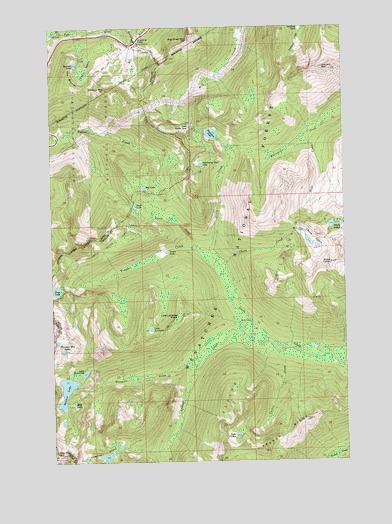
Stevens Pass, WA USGS Topographic Map
Click on map above to begin viewing in our Map Viewer.

This topographic map contains these locations and features:
Feature Name Type Latitude Longitude GNIS ID View Map
Bark CabinLocaleN47.6648°W121.0379°1516136View Map
Basin CreekStreamN47.6854°W121.0601°1516175View Map
Big Chief MountainSummitN47.7465°W121.0626°1516476View Map
Bulls ToothSummitN47.6818°W121.0034°1517088View Map
Cascade TunnelTunnelN47.7426°W121.0695°1517452View Map
Chain CreekStreamN47.6812°W121.0545°1517603View Map
Chain LakesLakeN47.6882°W121.0129°1517607View Map
Cowboy MountainSummitN47.7323°W121.0987°1518218View Map
Cuitin CreekStreamN47.6562°W121.0262°1518396View Map
Doelle LakesLakeN47.6923°W121.0034°1518834View Map
Doughgod CreekStreamN47.6554°W121.0012°1518893View Map
French RidgeRidgeN47.6323°W121.0268°1519803View Map
Grace LakesLakeN47.7384°W121.1068°1520177View Map
Grass LakeLakeN47.6851°W121.0732°1520248View Map
Hope LakeLakeN47.6990°W121.0868°1520907View Map
Jim Hill MountainSummitN47.7379°W121.0065°1521375View Map
Josephine LakeLakeN47.7192°W121.0570°1521475View Map
Lake CuitinLakeN47.6321°W121.0480°1518397View Map
Lake LorraineLakeN47.6632°W121.0807°1522454View Map
Lake Lorraine PointCapeN47.6668°W121.0690°1521853View Map
Lake Susan JaneLakeN47.7218°W121.0623°1526805View Map
Lake WolverineLakeN47.6506°W121.1126°1528288View Map
Leland CreekStreamN47.6607°W121.0357°1522002View Map
Mac PeakSummitN47.6276°W121.1248°1522617View Map
Mig LakeLakeN47.7037°W121.0826°1523119View Map
Milk LakeLakeN47.6418°W121.1178°1523138View Map
Mule CreekStreamN47.7184°W121.0145°1523502View Map
New Cascade TunnelTunnelN47.7400°W121.0656°2573587View Map
Pacific Crest TrailheadLocaleN47.7437°W121.0895°1530221View Map
Prospect CreekStreamN47.6543°W121.0634°1524661View Map
Square LakeReservoirN47.6455°W121.1207°1526446View Map
Square Lake DamDamN47.6482°W121.1162°1532222View Map
Steven Pass Org SiteLocaleN47.7448°W121.0890°1529683View Map
Stevens PassGapN47.7462°W121.0859°1526553View Map
Stevens Pass Guard StationLocaleN47.7457°W121.0884°1529684View Map
Stevens Pass Recreation AreaLocaleN47.7448°W121.0890°1534128View Map
Summit LakeLakeN47.7394°W121.1149°1526716View Map
Swallow LakesLakeN47.6257°W121.1037°1526816View Map
Swimming Deer LakeLakeN47.7107°W121.0582°1526868View Map
The BarrierRidgeN47.7348°W121.1134°1527024View Map
Thunder MountainSummitN47.6579°W121.1198°1527192View Map
Trap LakeLakeN47.6748°W121.1207°1527353View Map
Trapper CreekStreamN47.6812°W121.0543°1527354View Map
TyeLocaleN47.7493°W121.1207°1530262View Map

Note: Coordinates in the location and feature list above are referenced to NAD83 datum.


Copyright (C) 2008-2024 Ryan Niemi / Sunset Dynamics ... All Rights Reserved