TopoQuest Logo
Do you find TopoQuest useful?
Help keep TopoQuest running and adding new maps/features by donating!
Bitcoin:  19c7KJd3qBynnjoSw5npx9KScwjBe4ifkT
Litecoin:  LXs6TkuXGGXo1vDsWCkWVdjQX94eUKd6ui
Home View Maps Find Maps Find Places Resources & Links


Sterling South, Colorado Topographic Map

USGS Map Title: Sterling South, CO
USGS Map MRC: 40103E2
DRG (GeoTIFF) Download: o40103e2.tif


Neighboring USGS Topographic Map Quads:


  Atwood NE, CO  
40103F3
 

  Sterling North, CO  
40103F2
 

  Galien, CO  
40103F1
 

  Atwood, CO  
40103E3
 

  Sterling South, CO  
40103E2
 

  Reiradon Hill, CO  
40103E1
 

  Merino, CO  
40103D3
 

  Buffalo Springs Ranch NW, CO  
40103D2
 

  Buffalo Springs Ranch NE, CO  
40103D1


Map MRC Location:

N41°
W104°
N41°
W103°
H8 H7 H6 H5 H4 H3 H2 H1
G8 G7 G6 G5 G4 G3 G2 G1
F8 F7 F6 F5 F4 F3 F2 F1
E8 E7 E6 E5 E4 E3 E2 E1
D8 D7 D6 D5 D4 D3 D2 D1
C8 C7 C6 C5 C4 C3 C2 C1
B8 B7 B6 B5 B4 B3 B2 B1
A8 A7 A6 A5 A4 A3 A2 A1
N40°
W104°
N40°
W103°

Sterling South, CO USGS 1:24K Topographic Map Preview:
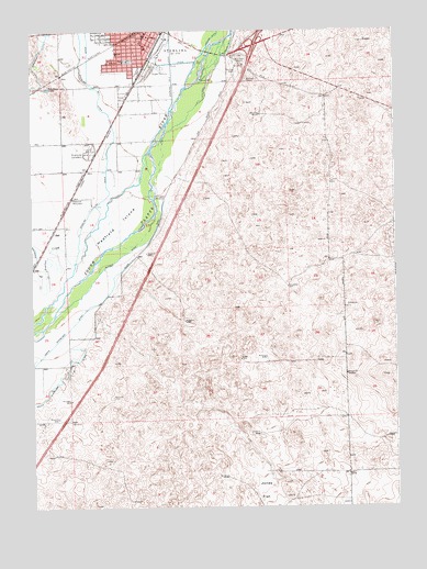
Sterling South, CO USGS Topographic Map
Click on map above to begin viewing in our Map Viewer.

This topographic map contains these locations and features:
Feature Name Type Latitude Longitude GNIS ID View Map
Batten DitchCanalN40.5694°W103.2174°182802View Map
Cheairs ParkParkN40.6172°W103.2158°182798View Map
City of SterlingCivilN40.6207°W103.1919°2411978View Map
Colorado State Patrol Troop 3B SterlingBuildingN40.6239°W103.1781°2757340View Map
Columbine ParkParkN40.6150°W103.2133°182797View Map
Franklin SchoolSchoolN40.6172°W103.2169°182799View Map
Hadfield IslandIslandN40.5750°W103.2199°202909View Map
HallLocaleN40.5722°W103.2424°182803View Map
Heart Center of the RockiesHospitalN40.6108°W103.2209°2736087View Map
Jones FlatFlatN40.5042°W103.1713°202908View Map
KSTC-AM (Sterling)TowerN40.6178°W103.1758°204066View Map
Life Care Medical AmbulanceBuildingN40.6200°W103.2116°2716981View Map
Logan County Detention CenterBuildingN40.6227°W103.1786°2736091View Map
Logan County Sheriff's OfficeBuildingN40.6220°W103.1788°2757300View Map
North Schneider DitchCanalN40.5389°W103.2485°202907View Map
Northeastern PitMineN40.6172°W103.2119°1684018View Map
Overland Trail MuseumBuildingN40.6186°W103.1802°1853489View Map
Overland Trail Park and MuseumParkN40.6186°W103.1802°182795View Map
Pawnee CreekStreamN40.5642°W103.2358°182794View Map
Pre-Ten PitMineN40.6172°W103.2119°1684019View Map
Riverside CemeteryCemeteryN40.5928°W103.2302°182801View Map
Salud Family Health CenterHospitalN40.6118°W103.2219°2736095View Map
Schumans LakeLakeN40.6101°W103.2441°182800View Map
Sterling Correctional FacilityBuildingN40.6113°W103.1623°2736096View Map
Sterling Ready Mix PitMineN40.6172°W103.2119°1684017View Map
Sterling Regional Medical CenterHospitalN40.6126°W103.2207°2695622View Map
Sterling Regional Medical Center HeliportAirportN40.6122°W103.2202°204589View Map
Sterling WellsWellN40.6144°W103.1802°182796View Map
Twin MillsPopulated PlaceN40.5736°W103.1263°182804View Map
Van Gundy PitMineN40.6172°W103.2119°1684020View Map

Note: Coordinates in the location and feature list above are referenced to NAD83 datum.


Copyright (C) 2008-2024 Ryan Niemi / Sunset Dynamics ... All Rights Reserved