TopoQuest Logo
Do you find TopoQuest useful?
Help keep TopoQuest running and adding new maps/features by donating!
Bitcoin:  19c7KJd3qBynnjoSw5npx9KScwjBe4ifkT
Litecoin:  LXs6TkuXGGXo1vDsWCkWVdjQX94eUKd6ui
Home View Maps Find Maps Find Places Resources & Links


Blairsden, California Topographic Map

USGS Map Title: Blairsden, CA
USGS Map MRC: 39120G5
DRG (GeoTIFF) Download: o39120g5.tif


Neighboring USGS Topographic Map Quads:


  Mount Ingalls, CA  
39120H6
 

  Grizzly Valley, CA  
39120H5
 

  Crocker Mountain, CA  
39120H4
 

  Johnsville, CA  
39120G6
 

  Blairsden, CA  
39120G5
 

  Portola, CA  
39120G4
 

  Gold Lake, CA  
39120F6
 

  Clio, CA  
39120F5
 

  Calpine, CA  
39120F4


Map MRC Location:

N40°
W121°
N40°
W120°
H8 H7 H6 H5 H4 H3 H2 H1
G8 G7 G6 G5 G4 G3 G2 G1
F8 F7 F6 F5 F4 F3 F2 F1
E8 E7 E6 E5 E4 E3 E2 E1
D8 D7 D6 D5 D4 D3 D2 D1
C8 C7 C6 C5 C4 C3 C2 C1
B8 B7 B6 B5 B4 B3 B2 B1
A8 A7 A6 A5 A4 A3 A2 A1
N39°
W121°
N39°
W120°

Blairsden, CA USGS 1:24K Topographic Map Preview:
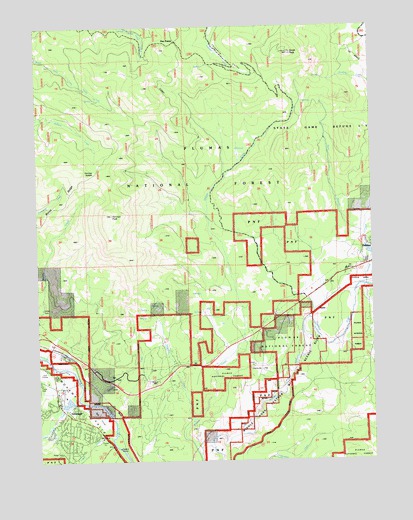
Blairsden, CA USGS Topographic Map
Click on map above to begin viewing in our Map Viewer.

This topographic map contains these locations and features:
Feature Name Type Latitude Longitude GNIS ID View Map
Betterton CreekStreamN39.7613°W120.5688°256855View Map
BlairsdenPopulated PlaceN39.7810°W120.6166°1658075View Map
Blairsden Census Designated PlaceCensusN39.7752°W120.6108°2407861View Map
Blairsden Graeagle Post OfficePost OfficeN39.7692°W120.6187°2783816View Map
Bonta RidgeRidgeN39.8213°W120.6233°257346View Map
Bontes (historical)Populated PlaceN39.7832°W120.6230°1701338View Map
C Road Fire DepartmentBuildingN39.7557°W120.5854°2622089View Map
C-Road Census Designated PlaceCensusN39.7627°W120.5770°2407682View Map
Claireville FlatFlatN39.7768°W120.5433°258389View Map
Clio Census Designated PlaceCensusN39.7506°W120.5667°2407637View Map
Delaney (historical)Populated PlaceN39.7966°W120.5255°1701350View Map
Denten CreekStreamN39.7663°W120.6052°259278View Map
Dentens (historical)Populated PlaceN39.7727°W120.6122°1701351View Map
Eastern Plumas Rural Fire Protection District Station 3BuildingN39.7866°W120.5000°2621981View Map
Five PointsPopulated PlaceN39.8710°W120.5724°1658545View Map
Frazier CreekStreamN39.7568°W120.5986°260351View Map
Gold Mountain Census Designated PlaceCensusN39.7613°W120.5191°2583025View Map
GraeaglePopulated PlaceN39.7663°W120.6186°1659728View Map
Graeagle Fire Protection District Station 1BuildingN39.7699°W120.6193°2621926View Map
Graeagle Meadows Golf CourseLocaleN39.7624°W120.6033°1701362View Map
Gray Eagle CreekStreamN39.7680°W120.6116°266769View Map
Gray Eagle ValleyValleyN39.7671°W120.6130°1701363View Map
Humbug CreekStreamN39.8246°W120.5010°261616View Map
Humbug ValleyValleyN39.8013°W120.5127°261618View Map
MabiePopulated PlaceN39.7935°W120.5213°1659029View Map
Mabie Census Designated PlaceCensusN39.7770°W120.5448°2612134View Map
Mohawk VistaPopulated PlaceN39.7807°W120.5786°1853401View Map
Mohawk Vista Census Designated PlaceCensusN39.8048°W120.5883°2408852View Map
Otis Ranch (historical)LocaleN39.7935°W120.5508°1701382View Map
Penman PeakSummitN39.8207°W120.5977°264634View Map
Penman SaddleGapN39.8332°W120.6038°264635View Map
Smith PeakSummitN39.8677°W120.5305°266333View Map
Sulphur SpringsSpringN39.7505°W120.5583°1666679View Map
West Branch Humbug CreekStreamN39.8146°W120.5038°268872View Map

Note: Coordinates in the location and feature list above are referenced to NAD83 datum.


Copyright (C) 2008-2024 Ryan Niemi / Sunset Dynamics ... All Rights Reserved