TopoQuest Logo
Do you find TopoQuest useful?
Help keep TopoQuest running and adding new maps/features by donating!
Bitcoin:  19c7KJd3qBynnjoSw5npx9KScwjBe4ifkT
Litecoin:  LXs6TkuXGGXo1vDsWCkWVdjQX94eUKd6ui
Home View Maps Find Maps Find Places Resources & Links


Stanley, New Mexico Topographic Map

USGS Map Title: Stanley, NM
USGS Map MRC: 35105B8
DRG (GeoTIFF) Download: o35105b8.tif


Neighboring USGS Topographic Map Quads:


  Captain Davis Mountain, NM  
35106C1
 

  Ojo Hedionda, NM  
35105C8
 

  Wildhorse Mesa, NM  
35105C7
 

  King Draw, NM  
35106B1
 

  Stanley, NM  
35105B8
 

  White Lakes, NM  
35105B7
 

  Moriarty North, NM  
35106A1
 

  Longhorn Reservoir, NM  
35105A8
 

  El Cuervo Butte, NM  
35105A7


Map MRC Location:

N36°
W106°
N36°
W105°
H8 H7 H6 H5 H4 H3 H2 H1
G8 G7 G6 G5 G4 G3 G2 G1
F8 F7 F6 F5 F4 F3 F2 F1
E8 E7 E6 E5 E4 E3 E2 E1
D8 D7 D6 D5 D4 D3 D2 D1
C8 C7 C6 C5 C4 C3 C2 C1
B8 B7 B6 B5 B4 B3 B2 B1
A8 A7 A6 A5 A4 A3 A2 A1
N35°
W106°
N35°
W105°

Stanley, NM USGS 1:24K Topographic Map Preview:
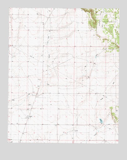
Stanley, NM USGS Topographic Map
Click on map above to begin viewing in our Map Viewer.

This topographic map contains these locations and features:
Feature Name Type Latitude Longitude GNIS ID View Map
10078 Water WellWellN35.2409°W105.9550°922623View Map
Bill Kamradt Ranch (historical)LocaleN35.2414°W105.9542°886381View Map
Fisher RanchLocaleN35.1764°W105.9425°889051View Map
Fronabarger RanchLocaleN35.1673°W105.9611°889247View Map
K and R ReservoirReservoirN35.1460°W105.8952°897945View Map
Kamradt DrawValleyN35.1817°W105.9586°890625View Map
Kamradt RanchLocaleN35.2189°W105.9561°890626View Map
Kinsell DrawValleyN35.1345°W105.9003°890717View Map
Kinsell RanchLocaleN35.1387°W105.9003°890718View Map
Kinsell Reservoir DamDamN35.1384°W105.8889°923953View Map
Landon WindmillLocaleN35.1648°W105.9964°890918View Map
Miller RanchLocaleN35.2003°W105.9636°892061View Map
Mitchell RanchLocaleN35.2000°W105.9559°892126View Map
Santa Fe County Volunteer Fire Stanley District Station 2BuildingN35.1469°W105.9799°2657805View Map
StanleyPopulated PlaceN35.1475°W105.9770°895302View Map
Stanley CemeteryCemeteryN35.1600°W105.9739°933095View Map
Stanley Post OfficePost OfficeN35.1475°W105.9770°937756View Map
Watson RanchLocaleN35.1345°W105.9800°896287View Map
West Otto SiteLocaleN35.1475°W105.9770°935991View Map

Note: Coordinates in the location and feature list above are referenced to NAD83 datum.


Copyright (C) 2008-2024 Ryan Niemi / Sunset Dynamics ... All Rights Reserved