TopoQuest Logo
Do you find TopoQuest useful?
Help keep TopoQuest running and adding new maps/features by donating!
Bitcoin:  19c7KJd3qBynnjoSw5npx9KScwjBe4ifkT
Litecoin:  LXs6TkuXGGXo1vDsWCkWVdjQX94eUKd6ui
Home View Maps Find Maps Find Places Resources & Links


Stanford NE, Montana Topographic Map

USGS Map Title: Stanford NE, MT
USGS Map MRC: 47110B1
DRG (GeoTIFF) Download: o47110b1.tif


Neighboring USGS Topographic Map Quads:


  Arrow Creek, MT  
47110C2
 

  Coffee Creek, MT  
47110C1
 

  Denton, MT  
47109C8
 

  Stanford, MT  
47110B2
 

  Stanford NE, MT  
47110B1
 

  Big Spring, MT  
47109B8
 

  Windham, MT  
47110A2
 

  Benchland, MT  
47110A1
 

  Moccasin, MT  
47109A8


Map MRC Location:

N48°
W111°
N48°
W110°
H8 H7 H6 H5 H4 H3 H2 H1
G8 G7 G6 G5 G4 G3 G2 G1
F8 F7 F6 F5 F4 F3 F2 F1
E8 E7 E6 E5 E4 E3 E2 E1
D8 D7 D6 D5 D4 D3 D2 D1
C8 C7 C6 C5 C4 C3 C2 C1
B8 B7 B6 B5 B4 B3 B2 B1
A8 A7 A6 A5 A4 A3 A2 A1
N47°
W111°
N47°
W110°

Stanford NE, MT USGS 1:24K Topographic Map Preview:
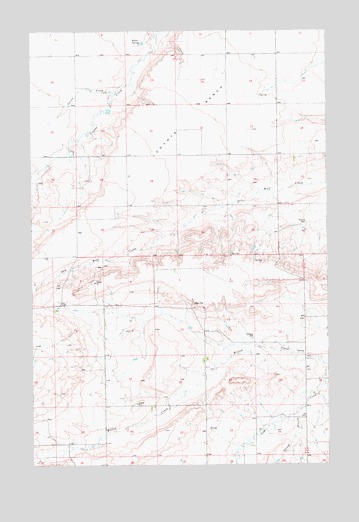
Stanford NE, MT USGS Topographic Map
Click on map above to begin viewing in our Map Viewer.

This topographic map contains these locations and features:
Feature Name Type Latitude Longitude GNIS ID View Map
16N13E01DDBD02 WellWellN47.1733°W110.0135°821227View Map
16N13E05DDD_01 WellWellN47.1722°W110.0958°821224View Map
16N13E11DADA01 WellWellN47.1616°W110.0321°821146View Map
16N13E12DDD_01 SpringSpringN47.1569°W110.0110°821104View Map
16N13E14BBB_01 WellWellN47.1547°W110.0519°821078View Map
16N13E15CCAD01 WellWellN47.1439°W110.0696°820993View Map
16N13E15CCC_01 WellWellN47.1436°W110.0694°820992View Map
16N13E15DAC_01 WellWellN47.1450°W110.0602°821003View Map
16N13E18AB__01 WellWellN47.1544°W110.1244°821076View Map
16N13E19AAC_01 WellWellN47.1389°W110.1194°820963View Map
16N13E19AACD01 WellWellN47.1386°W110.1194°820961View Map
16N13E20CDB_01 WellWellN47.1305°W110.1102°820923View Map
16N13E20DDA_01 WellWellN47.1308°W110.0969°820928View Map
16N13E23AAD_01 WellWellN47.1389°W110.0319°820962View Map
16N13E23DDA_01 WellWellN47.1308°W110.0333°820927View Map
16N14E07BBDA01 WellWellN47.1683°W110.0052°821204View Map
16N14E07BDBB01 WellWellN47.1672°W110.0052°821198View Map
16N14E07BDDB01 WellWellN47.1644°W110.0016°821171View Map
16N14E18BDD_01 WellWellN47.1505°W110.0019°821042View Map
17N13E14ABB_01 WellWellN47.2422°W110.0296°821646View Map
17N13E14ABB_02 WellWellN47.2422°W110.0296°821647View Map
17N13E25BAB_01 WellWellN47.2127°W110.0138°821476View Map
17N13E26ADAD01 WellWellN47.2100°W110.0221°821461View Map
17N13E26CDC_01 WellWellN47.2000°W110.0355°821390View Map
17N13E26DAA_01 WellWellN47.2061°W110.0219°821428View Map
17N13E30DBD_01 WellWellN47.2033°W110.1124°821415View Map
17N13E32ACD_01 WellWellN47.1936°W110.0902°821356View Map
17N13E32CBB_01 WellWellN47.1922°W110.1060°821342View Map
17N13E36ACB_01 WellWellN47.1941°W110.0096°821361View Map
Coyote BenchBenchN47.2366°W110.0419°770246View Map
Coyote Post Office (historical)Post OfficeN47.2389°W110.0430°1750624View Map
Coyote School (historical)SchoolN47.2389°W110.0430°1750754View Map
Lewis Post Office (historical)Post OfficeN47.1264°W110.0410°1750607View Map
Spring BranchStreamN47.1394°W110.0144°776952View Map
Spring CreekStreamN47.2325°W110.0896°777006View Map
Walker SpringSpringN47.2464°W110.0785°778083View Map

Note: Coordinates in the location and feature list above are referenced to NAD83 datum.


Copyright (C) 2008-2024 Ryan Niemi / Sunset Dynamics ... All Rights Reserved