TopoQuest Logo
Do you find TopoQuest useful?
Help keep TopoQuest running and adding new maps/features by donating!
Bitcoin:  19c7KJd3qBynnjoSw5npx9KScwjBe4ifkT
Litecoin:  LXs6TkuXGGXo1vDsWCkWVdjQX94eUKd6ui
Home View Maps Find Maps Find Places Resources & Links


Stafford, Ohio Topographic Map

USGS Map Title: Stafford, OH
USGS Map MRC: 39081F3
DRG (GeoTIFF) Download: o39081f3.tif


Neighboring USGS Topographic Map Quads:


  Sarahsville, OH  
39081G4
 

  Summerfield, OH  
39081G3
 

  Lewisville, OH  
39081G2
 

  Macksburg, OH  
39081F4
 

  Stafford, OH  
39081F3
 

  Graysville, OH  
39081F2
 

  Lower Salem, OH  
39081E4
 

  Dalzell, OH  
39081E3
 

  Rinard Mills, OH  
39081E2


Map MRC Location:

N40°
W82°
N40°
W81°
H8 H7 H6 H5 H4 H3 H2 H1
G8 G7 G6 G5 G4 G3 G2 G1
F8 F7 F6 F5 F4 F3 F2 F1
E8 E7 E6 E5 E4 E3 E2 E1
D8 D7 D6 D5 D4 D3 D2 D1
C8 C7 C6 C5 C4 C3 C2 C1
B8 B7 B6 B5 B4 B3 B2 B1
A8 A7 A6 A5 A4 A3 A2 A1
N39°
W82°
N39°
W81°

Stafford, OH USGS 1:24K Topographic Map Preview:
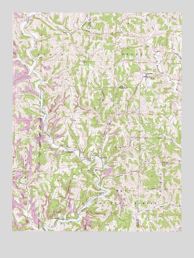
Stafford, OH USGS Topographic Map
Click on map above to begin viewing in our Map Viewer.

This topographic map contains these locations and features:
Feature Name Type Latitude Longitude GNIS ID View Map
CarlislePopulated PlaceN39.7456°W81.3637°1075525View Map
Cliffyville (historical)Populated PlaceN39.7062°W81.3323°1050993View Map
Cliffyville Post Office (historical)Post OfficeN39.7056°W81.3318°2041253View Map
Creighton Ridge CemeteryCemeteryN39.6628°W81.2604°1963756View Map
Creighton Ridge Church of ChristChurchN39.6637°W81.2604°1075649View Map
Creighton RunStreamN39.6495°W81.3087°1075650View Map
Crum Ridge CemeteryCemeteryN39.6884°W81.3323°1963673View Map
Crum Ridge ChurchChurchN39.6884°W81.3318°1075657View Map
ElkPopulated PlaceN39.6731°W81.3359°1075794View Map
Elk ForkStreamN39.7473°W81.3646°1075798View Map
Elk Post Office (historical)Post OfficeN39.6737°W81.3359°2041256View Map
Elk Township SchoolSchoolN39.6462°W81.3104°1083184View Map
FlagPopulated PlaceN39.6865°W81.3048°1075856View Map
Flag Post Office (historical)Post OfficeN39.6862°W81.3054°2041259View Map
Flag RunStreamN39.6856°W81.3043°1075857View Map
Greasy RunStreamN39.7490°W81.3604°1075956View Map
HarriettsvillePopulated PlaceN39.6315°W81.3376°1076011View Map
Harriettsville CemeteryCemeteryN39.6326°W81.3344°1963680View Map
Harriettsville Post Office (historical)Post OfficeN39.6320°W81.3373°2041265View Map
Huffman Covered BridgeBridgeN39.6517°W81.3662°1069716View Map
Jerles (historical)Populated PlaceN39.7387°W81.2951°1051018View Map
Jerles Post Office (historical)Post OfficeN39.7390°W81.2957°2037315View Map
McBride RunStreamN39.7409°W81.3265°1077263View Map
Mount Tabor CemeteryCemeteryN39.7217°W81.3232°1877645View Map
Mount Tabor ChurchChurchN39.7217°W81.3232°1076460View Map
Road ForkStreamN39.6665°W81.3090°1076747View Map
Road ForkPopulated PlaceN39.6673°W81.3093°1060587View Map
Road Fork Baptist ChurchChurchN39.6684°W81.3137°1060588View Map
Road Fork CemeteryCemeteryN39.6687°W81.3140°1963697View Map
Rocky RunStreamN39.6309°W81.3351°1076761View Map
Saint Henry Roman Catholic ChurchChurchN39.6295°W81.3382°1069717View Map
Schwab RunStreamN39.7167°W81.3604°1076850View Map
Southerland Methodist CemeteryCemeteryN39.7281°W81.2693°1963804View Map
StaffordPopulated PlaceN39.7134°W81.2762°1076954View Map
Stafford CemeteryCemeteryN39.7129°W81.2723°1963805View Map
Stafford Post OfficePost OfficeN39.7140°W81.2762°2037376View Map
Stewart CemeteryCemeteryN39.6701°W81.3243°1076967View Map
Sutherland ChurchChurchN39.7273°W81.2690°1077005View Map
Township of ElkCivilN39.6469°W81.3172°1086743View Map
Township of FranklinCivilN39.7258°W81.2740°1086650View Map
Township of StockCivilN39.7402°W81.3596°1086752View Map
Village of StaffordCivilN39.7124°W81.2766°2399882View Map
Zion CemeteryCemeteryN39.6281°W81.3032°1077251View Map
Zion CemeteryCemeteryN39.6353°W81.2993°1077252View Map

Note: Coordinates in the location and feature list above are referenced to NAD83 datum.


Copyright (C) 2008-2024 Ryan Niemi / Sunset Dynamics ... All Rights Reserved