TopoQuest Logo
Do you find TopoQuest useful?
Help keep TopoQuest running and adding new maps/features by donating!
Bitcoin:  19c7KJd3qBynnjoSw5npx9KScwjBe4ifkT
Litecoin:  LXs6TkuXGGXo1vDsWCkWVdjQX94eUKd6ui
Home View Maps Find Maps Find Places Resources & Links


Springfield, South Dakota Topographic Map

USGS Map Title: Springfield, SD
USGS Map MRC: 42097G8
DRG (GeoTIFF) Download: o42097g8.tif


Neighboring USGS Topographic Map Quads:


  Niobrara NE, SD  
42098H1
 

  Kingsburg, SD  
42097H8
 

  Tyndall, SD  
42097H7
 

  Niobrara, NE  
42098G1
 

  Springfield, SD  
42097G8
 

  Santee, NE  
42097G7
 

  Verdigre NE, NE  
42098F1
 

  Sparta, NE  
42097F8
 

  Howe Creek, NE  
42097F7


Map MRC Location:

N43°
W98°
N43°
W97°
H8 H7 H6 H5 H4 H3 H2 H1
G8 G7 G6 G5 G4 G3 G2 G1
F8 F7 F6 F5 F4 F3 F2 F1
E8 E7 E6 E5 E4 E3 E2 E1
D8 D7 D6 D5 D4 D3 D2 D1
C8 C7 C6 C5 C4 C3 C2 C1
B8 B7 B6 B5 B4 B3 B2 B1
A8 A7 A6 A5 A4 A3 A2 A1
N42°
W98°
N42°
W97°

Springfield, SD USGS 1:24K Topographic Map Preview:
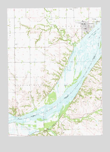
Springfield, SD USGS Topographic Map
Click on map above to begin viewing in our Map Viewer.

This topographic map contains these locations and features:
Feature Name Type Latitude Longitude GNIS ID View Map
Bazile CreekStreamN42.7794°W97.9287°827225View Map
Bazile Creek State Wildlife Management AreaParkN42.7639°W97.9531°1884734View Map
Breckenridge Post Office (historical)Post OfficeN42.7567°W97.9476°1884784View Map
City of SpringfieldCivilN42.8624°W97.8965°1267590View Map
Emanuel CemeteryCemeteryN42.8400°W97.9906°1254930View Map
Emanuel CreekStreamN42.8367°W97.9109°1254931View Map
Emanuel Creek Recreation AreaParkN42.8394°W97.9112°1263476View Map
Evelyn Lang Public LibraryBuildingN42.8540°W97.8930°2723681View Map
KSTI-FM (Springfield)TowerN42.8500°W97.9003°1259284View Map
Lost CreekStreamN42.7786°W97.9226°830904View Map
Maidens LeapSummitN42.7558°W97.9487°831004View Map
Mike Durfee State PrisonBuildingN42.8609°W97.9009°2727765View Map
Running WaterPopulated PlaceN42.7700°W97.9840°1257520View Map
Running Water Census Designated PlaceCensusN42.7822°W97.9817°2612514View Map
Saint Vincents CemeteryCemeteryN42.8750°W97.9131°1257760View Map
School Number 37 (historical)SchoolN42.8725°W97.9759°1264452View Map
School Number 38 (historical)SchoolN42.8375°W97.9462°1264453View Map
School Number 39 (historical)SchoolN42.8728°W97.9217°1264451View Map
School Number 6 (historical)SchoolN42.8083°W97.9698°1264454View Map
SpringfieldPopulated PlaceN42.8542°W97.8973°1258297View Map
Springfield Ambulance ServiceBuildingN42.8550°W97.8962°2781025View Map
Springfield CemeteryCemeteryN42.8733°W97.9137°1258298View Map
Springfield City HallBuildingN42.8540°W97.8930°2725280View Map
Springfield College MuseumBuildingN42.8540°W97.8946°2729340View Map
Springfield Elementary SchoolSchoolN42.8571°W97.8917°2728425View Map
Springfield Fire DepartmentBuildingN42.8550°W97.8966°2580721View Map
Springfield Historical Society MuseumBuildingN42.8540°W97.8948°2729341View Map
Springfield Police DepartmentBuildingN42.8551°W97.8960°2755615View Map
Springfield Post OfficePost OfficeN42.8540°W97.8962°2711901View Map
Springfield Recreation AreaParkN42.8600°W97.8809°1258299View Map
Township of Running WaterCivilN42.8003°W97.9912°1269082View Map
Township of SpringfieldCivilN42.8728°W97.9215°1269081View Map
University of South Dakota at Springfield (historical)SchoolN42.8603°W97.8995°1258715View Map

Note: Coordinates in the location and feature list above are referenced to NAD83 datum.


Copyright (C) 2008-2024 Ryan Niemi / Sunset Dynamics ... All Rights Reserved