TopoQuest Logo
Do you find TopoQuest useful?
Help keep TopoQuest running and adding new maps/features by donating!
Bitcoin:  19c7KJd3qBynnjoSw5npx9KScwjBe4ifkT
Litecoin:  LXs6TkuXGGXo1vDsWCkWVdjQX94eUKd6ui
Home View Maps Find Maps Find Places Resources & Links


Spring Hill, Florida Topographic Map

USGS Map Title: Spring Hill, FL
USGS Map MRC: 30086G8
DRG (GeoTIFF) Download: o30086g8.tif


Neighboring USGS Topographic Map Quads:


  Fidelis, FL  
30087H1
 

  McLellan, FL  
30086H8
 

  Hurricane Lake, FL  
30086H7
 

  Allentown, FL  
30087G1
 

  Spring Hill, FL  
30086G8
 

  Munson, FL  
30086G7
 

  Milton North, FL  
30087F1
 

  Harold, FL  
30086F8
 

  Floridale, FL  
30086F7


Map MRC Location:

N31°
W87°
N31°
W86°
H8 H7 H6 H5 H4 H3 H2 H1
G8 G7 G6 G5 G4 G3 G2 G1
F8 F7 F6 F5 F4 F3 F2 F1
E8 E7 E6 E5 E4 E3 E2 E1
D8 D7 D6 D5 D4 D3 D2 D1
C8 C7 C6 C5 C4 C3 C2 C1
B8 B7 B6 B5 B4 B3 B2 B1
A8 A7 A6 A5 A4 A3 A2 A1
N30°
W87°
N30°
W86°

Spring Hill, FL USGS 1:24K Topographic Map Preview:
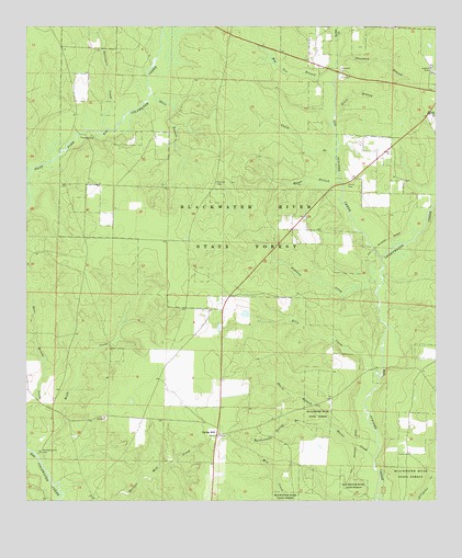
Spring Hill, FL USGS Topographic Map
Click on map above to begin viewing in our Map Viewer.

This topographic map contains these locations and features:
Feature Name Type Latitude Longitude GNIS ID View Map
Clark BranchStreamN30.8405°W86.9050°280494View Map
Dunn BranchStreamN30.8560°W86.9622°281872View Map
Ellis CreekStreamN30.7841°W86.8925°282177View Map
Green BranchStreamN30.8516°W86.9050°283376View Map
Gunstock BranchStreamN30.8655°W86.9047°283568View Map
Hog Pen BranchStreamN30.8605°W86.9058°284097View Map
Horns CreekStreamN30.7613°W86.8936°284269View Map
Maria BranchStreamN30.7696°W86.9069°286417View Map
Mason BranchStreamN30.8344°W86.9039°286501View Map
Munson Census Designated PlaceCensusN30.8418°W86.8870°2583367View Map
Munson DivisionCivilN30.8386°W86.8852°2648028View Map
Munson High SchoolSchoolN30.8513°W86.8755°287470View Map
Munson Lookout TowerTowerN30.8638°W86.8763°301642View Map
Munson Volunteer Fire Department Station 2BuildingN30.7985°W86.9405°2644182View Map
Munson-McLellen Division (historical)CensusN30.8646°W86.9244°1935860View Map
Old Spring Hill CemeteryCemeteryN30.7627°W86.9958°288118View Map
Pittman CreekStreamN30.8071°W86.8925°289003View Map
Rattlesnake Spring BranchStreamN30.7696°W86.9069°289507View Map
Spring HillPopulated PlaceN30.7674°W86.9416°294934View Map
Springhill Census Designated PlaceCensusN30.7566°W86.9329°2629562View Map
Sullivan CemeteryCemeteryN30.8341°W86.9413°291791View Map
Surveyors CreekStreamN30.8477°W86.9777°291897View Map
Sweetwater CreekStreamN30.8144°W86.8914°160701View Map
Turkey CreekStreamN30.8727°W86.9044°292518View Map
Wolfe CreekStreamN30.7602°W86.9955°293478View Map

Note: Coordinates in the location and feature list above are referenced to NAD83 datum.


Copyright (C) 2008-2024 Ryan Niemi / Sunset Dynamics ... All Rights Reserved