TopoQuest Logo
Do you find TopoQuest useful?
Help keep TopoQuest running and adding new maps/features by donating!
Bitcoin:  19c7KJd3qBynnjoSw5npx9KScwjBe4ifkT
Litecoin:  LXs6TkuXGGXo1vDsWCkWVdjQX94eUKd6ui
Home View Maps Find Maps Find Places Resources & Links


Spring Hill, Kansas Topographic Map

USGS Map Title: Spring Hill, KS
USGS Map MRC: 38094F7
DRG (GeoTIFF) Download: o38094f7.tif


Neighboring USGS Topographic Map Quads:


  Gardner, KS  
38094G8
 

  Ocheltree, KS  
38094G7
 

  Stilwell, KS  
38094G6
 

  Antioch, KS  
38094F8
 

  Spring Hill, KS  
38094F7
 

  Bucyrus, KS  
38094F6
 

  Paola West, KS  
38094E8
 

  Paola East, KS  
38094E7
 

  Louisburg, KS  
38094E6


Map MRC Location:

N39°
W95°
N39°
W94°
H8 H7 H6 H5 H4 H3 H2 H1
G8 G7 G6 G5 G4 G3 G2 G1
F8 F7 F6 F5 F4 F3 F2 F1
E8 E7 E6 E5 E4 E3 E2 E1
D8 D7 D6 D5 D4 D3 D2 D1
C8 C7 C6 C5 C4 C3 C2 C1
B8 B7 B6 B5 B4 B3 B2 B1
A8 A7 A6 A5 A4 A3 A2 A1
N38°
W95°
N38°
W94°

Spring Hill, KS USGS 1:24K Topographic Map Preview:
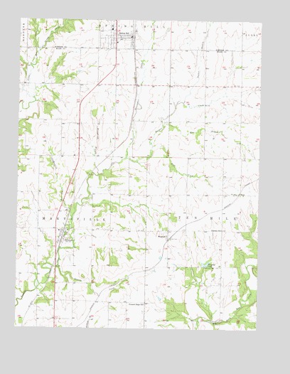
Spring Hill, KS USGS Topographic Map
Click on map above to begin viewing in our Map Viewer.

This topographic map contains these locations and features:
Feature Name Type Latitude Longitude GNIS ID View Map
Beverly Health and Rehabilitation Center of Spring HillBuildingN38.7446°W94.8223°2510036View Map
Blackhawk Retail CenterLocaleN38.7224°W94.8314°2692209View Map
ChilesPopulated PlaceN38.6797°W94.7616°479401View Map
Cottonwood CreekStreamN38.6700°W94.8466°479405View Map
Drummond BranchStreamN38.6872°W94.8333°479402View Map
Elm BranchStreamN38.7067°W94.8002°479404View Map
Farmers Union Co - Operative Company Grain Elevator Number 1LocaleN38.7427°W94.8151°2695189View Map
Flying Z Ranch AirportAirportN38.7340°W94.7994°2651051View Map
Glendale School (historical)SchoolN38.6650°W94.7686°479400View Map
HillsdalePopulated PlaceN38.6597°W94.8502°479414View Map
Hillsdale Cemetery - NewCemeteryN38.6642°W94.8482°2574897View Map
Hillsdale Cemetery - OldCemeteryN38.6656°W94.8481°2574896View Map
Hillsdale Census Designated PlaceCensusN38.6597°W94.8569°2629161View Map
Hillsdale Elementary SchoolSchoolN38.6647°W94.8531°480688View Map
Hillsdale Post OfficePost OfficeN38.6638°W94.8519°2693773View Map
Hillsdale Presbyerian ChurchChurchN38.6648°W94.8489°2690117View Map
Insight School of KansasSchoolN38.7379°W94.8246°2506448View Map
Jubilee Family Ministry CenterChurchN38.7432°W94.8172°2098520View Map
Life Spring ChurchChurchN38.7433°W94.8260°2510315View Map
Linders Cow-Chip AirportAirportN38.6273°W94.7695°481353View Map
Pleasant Ridge School (historical)SchoolN38.6350°W94.8086°479409View Map
Shannon Square Shopping CenterLocaleN38.7440°W94.8243°2511184View Map
Sixmile CreekStreamN38.6503°W94.8536°479411View Map
Southside Baptist ChurchChurchN38.7308°W94.8257°2510208View Map
Spring CreekStreamN38.7375°W94.8650°479408View Map
Spring HillPopulated PlaceN38.7431°W94.8255°479558View Map
Spring Hill Baptist ChurchChurchN38.7441°W94.8304°2509679View Map
Spring Hill CemeteryCemeteryN38.7467°W94.8358°2087373View Map
Spring Hill Church of ChristChurchN38.7430°W94.8320°2098427View Map
Spring Hill City HallBuildingN38.7468°W94.8269°2099230View Map
Spring Hill Elementary SchoolSchoolN38.7408°W94.8238°2099350View Map
Spring Hill Intermediate SchoolSchoolN38.7398°W94.8213°2506449View Map
Spring Hill LibraryBuildingN38.7429°W94.8258°2099299View Map
Spring Hill Middle SchoolSchoolN38.7377°W94.8208°2099351View Map
Spring Hill Plaza Shopping CenterLocaleN38.7440°W94.8259°2511160View Map
Spring Hill Police DepartmentBuildingN38.7439°W94.8178°2099282View Map
Spring Hill Post OfficePost OfficeN38.7454°W94.8236°2098847View Map
Spring Hill School District OficesSchoolN38.7380°W94.8246°2506386View Map
Spring Hill United Methodist ChurchChurchN38.7440°W94.8243°2098428View Map
Spring Hill Wastewater Treatment FacilityLocaleN38.7403°W94.8101°2510944View Map
Sweetwater CreekStreamN38.6939°W94.8194°479406View Map
Ten Mile (historical)LocaleN38.6708°W94.8489°482022View Map
Township of MarysvilleCivilN38.6720°W94.8625°479724View Map
Township of Ten MileCivilN38.6786°W94.7542°479725View Map
Trinity Lutheran SchoolSchoolN38.6460°W94.8086°2506611View Map
Tucker BranchStreamN38.7170°W94.7900°479407View Map
WagstaffPopulated PlaceN38.6650°W94.7963°479413View Map
Wagstaff CemeteryCemeteryN38.6658°W94.7964°2575133View Map
Wagstaff LakeReservoirN38.6508°W94.7775°479412View Map
Weiss Airport (historical)AirportN38.7058°W94.8247°481293View Map
Wolf CreekStreamN38.6986°W94.8058°479403View Map

Note: Coordinates in the location and feature list above are referenced to NAD83 datum.


Copyright (C) 2008-2024 Ryan Niemi / Sunset Dynamics ... All Rights Reserved