TopoQuest Logo
Do you find TopoQuest useful?
Help keep TopoQuest running and adding new maps/features by donating!
Bitcoin:  19c7KJd3qBynnjoSw5npx9KScwjBe4ifkT
Litecoin:  LXs6TkuXGGXo1vDsWCkWVdjQX94eUKd6ui
Home View Maps Find Maps Find Places Resources & Links


Spring Grove, Minnesota Topographic Map

USGS Map Title: Spring Grove, MN
USGS Map MRC: 43091E6
DRG (GeoTIFF) Download: o43091e6.tif


Neighboring USGS Topographic Map Quads:


  Bratsberg, MN  
43091F7
 

  Yucatan, MN  
43091F6
 

  Sheldon, MN  
43091F5
 

  Mabel, MN  
43091E7
 

  Spring Grove, MN  
43091E6
 

  Wilmington, MN  
43091E5
 

  Burr Oak, IA  
43091D7
 

  Highlandville, IA  
43091D6
 

  Dorchester, IA  
43091D5


Map MRC Location:

N44°
W92°
N44°
W91°
H8 H7 H6 H5 H4 H3 H2 H1
G8 G7 G6 G5 G4 G3 G2 G1
F8 F7 F6 F5 F4 F3 F2 F1
E8 E7 E6 E5 E4 E3 E2 E1
D8 D7 D6 D5 D4 D3 D2 D1
C8 C7 C6 C5 C4 C3 C2 C1
B8 B7 B6 B5 B4 B3 B2 B1
A8 A7 A6 A5 A4 A3 A2 A1
N43°
W92°
N43°
W91°

Spring Grove, MN USGS 1:24K Topographic Map Preview:
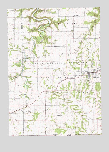
Spring Grove, MN USGS Topographic Map
Click on map above to begin viewing in our Map Viewer.

This topographic map contains these locations and features:
Feature Name Type Latitude Longitude GNIS ID View Map
Bellview CemeteryCemeteryN43.5291°W91.7293°2050428View Map
Black HammerPopulated PlaceN43.6164°W91.6610°654607View Map
Black Hammer BluffSummitN43.5986°W91.6649°640211View Map
Black Hammer Lutheran Church CemeteryCemeteryN43.6161°W91.6599°2050426View Map
Black Hammer Post Office (historical)Post OfficeN43.6164°W91.6610°2050507View Map
Calvary Evangelical Free ChurchChurchN43.5611°W91.6360°2050570View Map
City of Spring GroveCivilN43.5607°W91.6370°2395931View Map
Deters Farms AirportAirportN43.5609°W91.6790°660423View Map
Faith Lutheran ChurchChurchN43.6161°W91.6607°2050567View Map
Gunderson Lutheran - Spring Grove ClinicBuildingN43.5598°W91.6287°2050559View Map
Holy Trinity CemeteryCemeteryN43.5602°W91.6499°645135View Map
KQYB-FM (Spring Grove)TowerN43.5566°W91.6613°663337View Map
Maranatha FellowshipChurchN43.5366°W91.6363°2050566View Map
Mid Town Mobile Home ParkPopulated PlaceN43.5611°W91.6360°2050569View Map
NewhousePopulated PlaceN43.5250°W91.7001°654846View Map
Newhouse (historical)LocaleN43.5250°W91.7001°2050492View Map
Newhouse Post Office (historical)Post OfficeN43.5250°W91.7001°2050493View Map
Old Black Hammer CemeteryCemeteryN43.6244°W91.6515°2050427View Map
Onstad Trailer ParkPopulated PlaceN43.5611°W91.6360°2050568View Map
RicefordPopulated PlaceN43.5761°W91.7268°650057View Map
Riceford Norwegian CemeteryCemeteryN43.5755°W91.7299°2050429View Map
Riceford Post Office (historical)Post OfficeN43.5761°W91.7268°2050486View Map
Saint Marys CemeteryCemeteryN43.6227°W91.7410°650837View Map
Sportsman ParkParkN43.5597°W91.7335°652412View Map
Spring GrovePopulated PlaceN43.5611°W91.6360°652451View Map
Spring Grove (historical)LocaleN43.5614°W91.6376°2050556View Map
Spring Grove City HallBuildingN43.5614°W91.6382°2050564View Map
Spring Grove City ParkParkN43.5569°W91.6432°2050560View Map
Spring Grove City ParkParkN43.5614°W91.6349°2050561View Map
Spring Grove Fire DepartmentBuildingN43.5609°W91.6397°2666297View Map
Spring Grove High SchoolSchoolN43.5608°W91.6418°2050563View Map
Spring Grove LibraryBuildingN43.5608°W91.6357°2050562View Map
Spring Grove Lutheran CemeteryCemeteryN43.5616°W91.6340°2050431View Map
Spring Grove Police DepartmentBuildingN43.5615°W91.6379°2050565View Map
Spring Grove Post OfficePost OfficeN43.5601°W91.6358°2050558View Map
Spring Grove Trinity Lutheran Church CemeteryCemeteryN43.5605°W91.6501°2050430View Map
Supersaw Valley CampgroundLocaleN43.6027°W91.7085°2050555View Map
Sylling Landing Field (historical)AirportN43.5200°W91.6854°2050432View Map
Township of Spring GroveCivilN43.5435°W91.6718°665673View Map
Trinity Lutheran ChurchChurchN43.5614°W91.6343°2050557View Map

Note: Coordinates in the location and feature list above are referenced to NAD83 datum.


Copyright (C) 2008-2024 Ryan Niemi / Sunset Dynamics ... All Rights Reserved