TopoQuest Logo
Do you find TopoQuest useful?
Help keep TopoQuest running and adding new maps/features by donating!
Bitcoin:  19c7KJd3qBynnjoSw5npx9KScwjBe4ifkT
Litecoin:  LXs6TkuXGGXo1vDsWCkWVdjQX94eUKd6ui
Home View Maps Find Maps Find Places Resources & Links


Spring Creek Junction, Montana Topographic Map

USGS Map Title: Spring Creek Junction, MT
USGS Map MRC: 47109B5
DRG (GeoTIFF) Download: o47109b5.tif


Neighboring USGS Topographic Map Quads:


  Toney Bench, MT  
47109C6
 

  Seventytwo Hills, MT  
47109C5
 

  Kendall, MT  
47109C4
 

  Danvers, MT  
47109B6
 

  Spring Creek Junction, MT  
47109B5
 

  Brooks, MT  
47109B4
 

  Ross Fork, MT  
47109A6
 

  Glengarry, MT  
47109A5
 

  Lewistown, MT  
47109A4


Map MRC Location:

N48°
W110°
N48°
W109°
H8 H7 H6 H5 H4 H3 H2 H1
G8 G7 G6 G5 G4 G3 G2 G1
F8 F7 F6 F5 F4 F3 F2 F1
E8 E7 E6 E5 E4 E3 E2 E1
D8 D7 D6 D5 D4 D3 D2 D1
C8 C7 C6 C5 C4 C3 C2 C1
B8 B7 B6 B5 B4 B3 B2 B1
A8 A7 A6 A5 A4 A3 A2 A1
N47°
W110°
N47°
W109°

Spring Creek Junction, MT USGS 1:24K Topographic Map Preview:
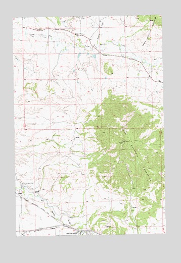
Spring Creek Junction, MT USGS Topographic Map
Click on map above to begin viewing in our Map Viewer.

This topographic map contains these locations and features:
Feature Name Type Latitude Longitude GNIS ID View Map
16N17E17BCD_01 WellWellN47.1508°W109.6057°821045View Map
16N17E18BAD_01 WellWellN47.1541°W109.6207°821075View Map
16N17E18BDDA01 WellWellN47.1511°W109.6210°821046View Map
16N17E19DCD_01 WellWellN47.1286°W109.6160°820910View Map
16N17E19DCD_02 WellWellN47.1289°W109.6163°820911View Map
16N17E21ADD_01 WellWellN47.1366°W109.5688°820953View Map
16N17E22DCD_01 WellWellN47.1297°W109.5510°820915View Map
16N17E28ABC_01 WellWellN47.1261°W109.5749°820893View Map
17N17E18DADB01 WellWellN47.2341°W109.5977°821596View Map
AmherstLocaleN47.1497°W109.6249°1722789View Map
AmherstPopulated PlaceN47.1497°W109.6249°768230View Map
Bank Ranch DitchCanalN47.2380°W109.5919°768493View Map
Cottonwood CreekStreamN47.1278°W109.5702°781728View Map
Crazy Creek Reservoir DamDamN47.2283°W109.5707°798483View Map
Duck CreekStreamN47.2466°W109.5827°770866View Map
Hutterisshe Society School (historical)SchoolN47.1430°W109.6230°1722665View Map
KingstonPopulated PlaceN47.1297°W109.5974°773059View Map
Lincoln DitchCanalN47.2372°W109.5938°773354View Map
McDonnell School (historical)SchoolN47.1266°W109.5752°1722664View Map
Meadow CreekStreamN47.2328°W109.5544°774060View Map
Petticoat Junction DamDamN47.2250°W109.5391°798628View Map
Shiny Mountain School (historical)SchoolN47.1964°W109.5199°1722675View Map
South Moccasin MountainsRangeN47.1725°W109.5238°776901View Map
Spring Creek ColonyLocaleN47.1544°W109.6207°777067View Map
Spring Creek Colony SchoolSchoolN47.1536°W109.6210°1722588View Map
Spring Creek JunctionPopulated PlaceN47.1272°W109.5741°777068View Map
Stahlville Post Office (historical)Post OfficeN47.1497°W109.6249°1722788View Map
Warm Spring Creek School (historical)SchoolN47.2403°W109.5732°778112View Map

Note: Coordinates in the location and feature list above are referenced to NAD83 datum.


Copyright (C) 2008-2024 Ryan Niemi / Sunset Dynamics ... All Rights Reserved