TopoQuest Logo
Do you find TopoQuest useful?
Help keep TopoQuest running and adding new maps/features by donating!
Bitcoin:  19c7KJd3qBynnjoSw5npx9KScwjBe4ifkT
Litecoin:  LXs6TkuXGGXo1vDsWCkWVdjQX94eUKd6ui
Home View Maps Find Maps Find Places Resources & Links


Spirit, Wisconsin Topographic Map

USGS Map Title: Spirit, WI
USGS Map MRC: 45090D1
DRG (GeoTIFF) Download: o45090d1.tif


Neighboring USGS Topographic Map Quads:


  Big Briens Lake, WI  
45090E2
 

  Brantwood, WI  
45090E1
 

  Tripoli, WI  
45089E8
 

  Timms Hill, WI  
45090D2
 

  Spirit, WI  
45090D1
 

  Spirit Falls, WI  
45089D8
 

  Rib Lake, WI  
45090C2
 

  Wood Lake, WI  
45090C1
 

  Natzke Camp, WI  
45089C8


Map MRC Location:

N46°
W91°
N46°
W90°
H8 H7 H6 H5 H4 H3 H2 H1
G8 G7 G6 G5 G4 G3 G2 G1
F8 F7 F6 F5 F4 F3 F2 F1
E8 E7 E6 E5 E4 E3 E2 E1
D8 D7 D6 D5 D4 D3 D2 D1
C8 C7 C6 C5 C4 C3 C2 C1
B8 B7 B6 B5 B4 B3 B2 B1
A8 A7 A6 A5 A4 A3 A2 A1
N45°
W91°
N45°
W90°

Spirit, WI USGS 1:24K Topographic Map Preview:
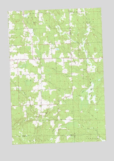
Spirit, WI USGS Topographic Map
Click on map above to begin viewing in our Map Viewer.

This topographic map contains these locations and features:
Feature Name Type Latitude Longitude GNIS ID View Map
1 ReservoirReservoirN45.4666°W90.0835°1793317View Map
Flanigan CreekStreamN45.4844°W90.0168°1565056View Map
Gus Johnson CreekStreamN45.4077°W90.0668°1565946View Map
Hillcrest CemeteryCemeteryN45.4550°W90.0868°1566430View Map
Johnson CreekStreamN45.3989°W90.0960°1567222View Map
Knox CreekStreamN45.4652°W90.0863°1567586View Map
Liberty School (historical)SchoolN45.4105°W90.0843°1833521View Map
Marheime CreekStreamN45.4316°W90.0143°1569028View Map
Mission Church (historical)ChurchN45.4539°W90.0424°1838362View Map
North Fork Spirit RiverStreamN45.4330°W90.0076°1570439View Map
Ritchie CreekStreamN45.4405°W90.0113°1572345View Map
SpiritPopulated PlaceN45.4541°W90.1143°1574553View Map
Spirit Center School (historical)SchoolN45.4539°W90.1249°1833557View Map
Spirit TownhallBuildingN45.4544°W90.1049°1833558View Map
Thomas Breakey and Ray Bush G5995 DamDamN45.4666°W90.0835°1793316View Map
Town of SpiritCivilN45.4320°W90.1044°1584186View Map
Twin CreekStreamN45.4172°W90.0454°1575772View Map
Wilson School (historical)SchoolN45.4544°W90.0904°1833566View Map

Note: Coordinates in the location and feature list above are referenced to NAD83 datum.


Copyright (C) 2008-2024 Ryan Niemi / Sunset Dynamics ... All Rights Reserved