TopoQuest Logo
Do you find TopoQuest useful?
Help keep TopoQuest running and adding new maps/features by donating!
Bitcoin:  19c7KJd3qBynnjoSw5npx9KScwjBe4ifkT
Litecoin:  LXs6TkuXGGXo1vDsWCkWVdjQX94eUKd6ui
Home View Maps Find Maps Find Places Resources & Links


Spencerburg, Missouri Topographic Map

USGS Map Title: Spencerburg, MO
USGS Map MRC: 39091D4
DRG (GeoTIFF) Download: o39091d4.tif


Neighboring USGS Topographic Map Quads:


  Center, MO  
39091E5
 

  New London, MO  
39091E4
 

  Hannibal SE, MO  
39091E3
 

  Perry NE, MO  
39091D5
 

  Spencerburg, MO  
39091D4
 

  Frankford, MO  
39091D3
 

  Farber, MO  
39091C5
 

  Vandalia, MO  
39091C4
 

  Curryville, MO  
39091C3


Map MRC Location:

N40°
W92°
N40°
W91°
H8 H7 H6 H5 H4 H3 H2 H1
G8 G7 G6 G5 G4 G3 G2 G1
F8 F7 F6 F5 F4 F3 F2 F1
E8 E7 E6 E5 E4 E3 E2 E1
D8 D7 D6 D5 D4 D3 D2 D1
C8 C7 C6 C5 C4 C3 C2 C1
B8 B7 B6 B5 B4 B3 B2 B1
A8 A7 A6 A5 A4 A3 A2 A1
N39°
W92°
N39°
W91°

Spencerburg, MO USGS 1:24K Topographic Map Preview:
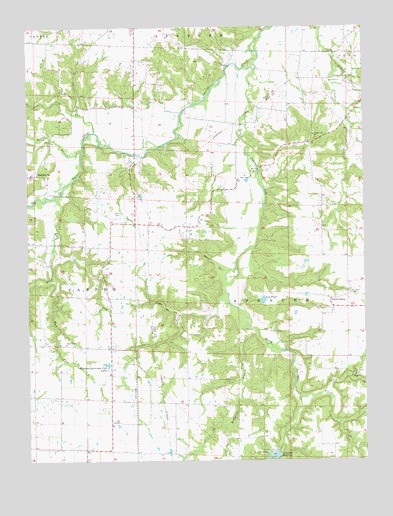
Spencerburg, MO USGS Topographic Map
Click on map above to begin viewing in our Map Viewer.

This topographic map contains these locations and features:
Feature Name Type Latitude Longitude GNIS ID View Map
Adiel CemeteryCemeteryN39.4464°W91.4660°713152View Map
Adiel ChurchChurchN39.4437°W91.4585°742278View Map
Brice School (historical)SchoolN39.3864°W91.4893°742276View Map
Bridgewater School (historical)SchoolN39.4331°W91.4690°742275View Map
Clifty ForkStreamN39.3948°W91.3904°715986View Map
Coon CreekStreamN39.4234°W91.4271°716245View Map
Crigler BranchStreamN39.4170°W91.4440°716499View Map
Denny RunStreamN39.4325°W91.4227°716839View Map
East ForkStreamN39.4270°W91.4915°717274View Map
Elk Lick Springs (historical)LocaleN39.4531°W91.4271°744251View Map
Elk Lick Springs Post Office (historical)Post OfficeN39.4531°W91.4271°759551View Map
Hays Creek ChurchChurchN39.4084°W91.4865°729320View Map
Hippo BranchStreamN39.4645°W91.4799°719635View Map
Jug RunStreamN39.4698°W91.4749°720452View Map
Lewis LakeReservoirN39.4101°W91.3779°761869View Map
Lewis Lake DamDamN39.4100°W91.3785°761868View Map
Lick School (historical)SchoolN39.4656°W91.4229°742277View Map
MadisonvillePopulated PlaceN39.4573°W91.4965°741034View Map
Madisonville School (historical)SchoolN39.4700°W91.4879°742273View Map
McDowell BranchStreamN39.4150°W91.4190°722093View Map
Neal PondLakeN39.4212°W91.4130°723137View Map
Pleasant Hill ChurchChurchN39.4687°W91.3935°729612View Map
Rose School (historical)SchoolN39.3812°W91.4238°742280View Map
Scott School (historical)SchoolN39.4381°W91.4365°742279View Map
Seely School (historical)SchoolN39.4759°W91.4485°742274View Map
South Spencer CreekStreamN39.4906°W91.4146°726790View Map
SpencerburgPopulated PlaceN39.4217°W91.3877°729656View Map
Township of SpencerCivilN39.3905°W91.3752°767195View Map
Vandalia Lake DamDamN39.3779°W91.4084°761073View Map
Vandalia Sportsman Club LakesLakeN39.4027°W91.4707°728137View Map
Weldon H. 'Pete' Steiner ReservoirReservoirN39.3758°W91.4113°728136View Map

Note: Coordinates in the location and feature list above are referenced to NAD83 datum.


Copyright (C) 2008-2024 Ryan Niemi / Sunset Dynamics ... All Rights Reserved