TopoQuest Logo
Do you find TopoQuest useful?
Help keep TopoQuest running and adding new maps/features by donating!
Bitcoin:  19c7KJd3qBynnjoSw5npx9KScwjBe4ifkT
Litecoin:  LXs6TkuXGGXo1vDsWCkWVdjQX94eUKd6ui
Home View Maps Find Maps Find Places Resources & Links


Blacksher, Alabama Topographic Map

USGS Map Title: Blacksher, AL
USGS Map MRC: 31087B6
DRG (GeoTIFF) Download: o31087b6.tif


Neighboring USGS Topographic Map Quads:


  Carlton, AL  
31087C7
 

  Chrysler, AL  
31087C6
 

  Uriah West, AL  
31087C5
 

  Tensaw, AL  
31087B7
 

  Blacksher, AL  
31087B6
 

  McCullough, AL  
31087B5
 

  Vaughn, AL  
31087A7
 

  Perdido, AL  
31087A6
 

  Freemanville, AL  
31087A5


Map MRC Location:

N32°
W88°
N32°
W87°
H8 H7 H6 H5 H4 H3 H2 H1
G8 G7 G6 G5 G4 G3 G2 G1
F8 F7 F6 F5 F4 F3 F2 F1
E8 E7 E6 E5 E4 E3 E2 E1
D8 D7 D6 D5 D4 D3 D2 D1
C8 C7 C6 C5 C4 C3 C2 C1
B8 B7 B6 B5 B4 B3 B2 B1
A8 A7 A6 A5 A4 A3 A2 A1
N31°
W88°
N31°
W87°

Blacksher, AL USGS 1:24K Topographic Map Preview:
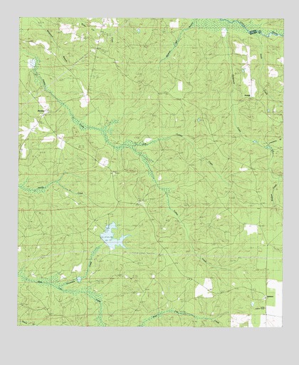
Blacksher, AL USGS Topographic Map
Click on map above to begin viewing in our Map Viewer.

This topographic map contains these locations and features:
Feature Name Type Latitude Longitude GNIS ID View Map
Beaverdam CreekStreamN31.2479°W87.6347°113768View Map
Blacks Mill (historical)LocaleN31.2307°W87.7430°149377View Map
BlacksherPopulated PlaceN31.2107°W87.7383°156071View Map
Blacksher Oil FieldOilfieldN31.2046°W87.7083°151136View Map
Bledsoe BranchStreamN31.1852°W87.6258°114489View Map
Brown Crosby CampLocaleN31.1796°W87.6875°114993View Map
Dixie Church CemeteryCemeteryN31.1446°W87.7242°161659View Map
Horseneck CreekStreamN31.2488°W87.6492°120417View Map
Limestone BranchStreamN31.1985°W87.6322°121642View Map
Little River Oil FieldOilfieldN31.2405°W87.6328°151144View Map
Little Turkey CreekStreamN31.1974°W87.6964°121897View Map
Lottie Lookout TowerTowerN31.1327°W87.6330°134623View Map
Montpelier (historical)LocaleN31.2224°W87.6903°134637View Map
Patterson DamDamN31.1602°W87.7067°129678View Map
Patterson LakeReservoirN31.1614°W87.7054°129677View Map
RedtownPopulated PlaceN31.1380°W87.6325°125507View Map
SerangePopulated PlaceN31.2180°W87.6392°157039View Map
Sevenmile CreekStreamN31.1410°W87.7283°126562View Map
Smith CreekStreamN31.2441°W87.6344°153475View Map
Southern Pine HillsAreaN31.1668°W87.6667°148950View Map
Steadham CemeteryCemeteryN31.2407°W87.7455°127338View Map
Tate Creek Missionary Baptist ChurchChurchN31.2203°W87.7440°2580489View Map

Note: Coordinates in the location and feature list above are referenced to NAD83 datum.


Copyright (C) 2008-2024 Ryan Niemi / Sunset Dynamics ... All Rights Reserved