TopoQuest Logo
Do you find TopoQuest useful?
Help keep TopoQuest running and adding new maps/features by donating!
Bitcoin:  19c7KJd3qBynnjoSw5npx9KScwjBe4ifkT
Litecoin:  LXs6TkuXGGXo1vDsWCkWVdjQX94eUKd6ui
Home View Maps Find Maps Find Places Resources & Links


Spar Lake, Montana Topographic Map

USGS Map Title: Spar Lake, MT
USGS Map MRC: 48115C8
DRG (GeoTIFF) Download: o48115c8.tif


Neighboring USGS Topographic Map Quads:


  Smith Mountain, ID  
48116D1
 

  Troy, MT  
48115D8
 

  Kootenai Falls, MT  
48115D7
 

  Benning Mountain, ID  
48116C1
 

  Spar Lake, MT  
48115C8
 

  Crowell Mountain, MT  
48115C7
 

  Scotchman Peak, ID  
48116B1
 

  Sawtooth Mountain, MT  
48115B8
 

  Ibex Peak, MT  
48115B7


Map MRC Location:

N49°
W116°
N49°
W115°
H8 H7 H6 H5 H4 H3 H2 H1
G8 G7 G6 G5 G4 G3 G2 G1
F8 F7 F6 F5 F4 F3 F2 F1
E8 E7 E6 E5 E4 E3 E2 E1
D8 D7 D6 D5 D4 D3 D2 D1
C8 C7 C6 C5 C4 C3 C2 C1
B8 B7 B6 B5 B4 B3 B2 B1
A8 A7 A6 A5 A4 A3 A2 A1
N48°
W116°
N48°
W115°

Spar Lake, MT USGS 1:24K Topographic Map Preview:
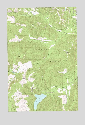
Spar Lake, MT USGS Topographic Map
Click on map above to begin viewing in our Map Viewer.

This topographic map contains these locations and features:
Feature Name Type Latitude Longitude GNIS ID View Map
Bimetalic MineMineN48.3549°W115.8941°804072View Map
Blue Bird MineMineN48.3624°W115.9071°804086View Map
Briar CreekStreamN48.2985°W115.9946°780389View Map
Carr DrawValleyN48.3655°W115.9360°780971View Map
Club CreekStreamN48.2516°W115.9518°781420View Map
Drift CreekStreamN48.2972°W115.9829°782533View Map
Fairway CreekStreamN48.2811°W115.8938°783274View Map
Grouse LakeLakeN48.3722°W115.8958°784383View Map
Grouse Lake TrailTrailN48.3580°W115.8932°794378View Map
Grouse Mountain Number 2 MineMineN48.3736°W115.9127°804082View Map
Grouse Mountain Number 5 MineMineN48.3591°W115.9071°804074View Map
Hiatt CreekStreamN48.2702°W115.9524°784813View Map
Keeler MountainSummitN48.3205°W115.8943°785646View Map
Keeler Mountain Lookout StationLocaleN48.3202°W115.8943°794379View Map
Lime ButteSummitN48.3602°W115.8777°786124View Map
North Fork Keeler CreekStreamN48.3419°W115.8968°788192View Map
Pony MountainSummitN48.3544°W115.9566°789083View Map
South Fork Keeler CreekStreamN48.3330°W115.9185°790992View Map
Spar CreekStreamN48.2513°W115.9524°791129View Map
Spar LakeLakeN48.2636°W115.9460°791130View Map
Spar Lake CampgroundLocaleN48.2697°W115.9532°791131View Map
Spruce LakeLakeN48.2974°W115.9912°791345View Map
Spruce MountainSummitN48.3158°W115.9824°791347View Map
Stanley MountainSummitN48.2619°W115.8813°791428View Map
Stanley PeakSummitN48.2894°W115.9749°791429View Map
Surprise DrawValleyN48.3652°W115.9538°791737View Map
Thicket CreekStreamN48.2838°W115.8877°792062View Map
Twilight CreekStreamN48.2755°W115.9182°792496View Map
Whoopee CreekStreamN48.2594°W115.9546°793260View Map

Note: Coordinates in the location and feature list above are referenced to NAD83 datum.


Copyright (C) 2008-2024 Ryan Niemi / Sunset Dynamics ... All Rights Reserved