TopoQuest Logo
Do you find TopoQuest useful?
Help keep TopoQuest running and adding new maps/features by donating!
Bitcoin:  19c7KJd3qBynnjoSw5npx9KScwjBe4ifkT
Litecoin:  LXs6TkuXGGXo1vDsWCkWVdjQX94eUKd6ui
Home View Maps Find Maps Find Places Resources & Links


South Whitley West, Indiana Topographic Map

USGS Map Title: South Whitley West, IN
USGS Map MRC: 41085A6
DRG (GeoTIFF) Download: o41085a6.tif


Neighboring USGS Topographic Map Quads:


  Warsaw, IN  
41085B7
 

  Pierceton, IN  
41085B6
 

  Lorane, IN  
41085B5
 

  North Manchester North, IN  
41085A7
 

  South Whitley West, IN  
41085A6
 

  South Whitley East, IN  
41085A5
 

  North Manchester South, IN  
40085H7
 

  Servia, IN  
40085H6
 

  Bippus, IN  
40085H5


Map MRC Location:

N42°
W86°
N42°
W85°
H8 H7 H6 H5 H4 H3 H2 H1
G8 G7 G6 G5 G4 G3 G2 G1
F8 F7 F6 F5 F4 F3 F2 F1
E8 E7 E6 E5 E4 E3 E2 E1
D8 D7 D6 D5 D4 D3 D2 D1
C8 C7 C6 C5 C4 C3 C2 C1
B8 B7 B6 B5 B4 B3 B2 B1
A8 A7 A6 A5 A4 A3 A2 A1
N41°
W86°
N41°
W85°

South Whitley West, IN USGS 1:24K Topographic Map Preview:
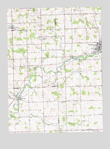
South Whitley West, IN USGS Topographic Map
Click on map above to begin viewing in our Map Viewer.

This topographic map contains these locations and features:
Feature Name Type Latitude Longitude GNIS ID View Map
Chester Township Fire DepartmentBuildingN41.0007°W85.7421°2625581View Map
Circle CemeteryCemeteryN41.1223°W85.7153°432523View Map
Cleveland Township Volunteer Fire DepartmentBuildingN41.0859°W85.6283°2625894View Map
CollamerPopulated PlaceN41.0759°W85.6647°432761View Map
Cook DitchCanalN41.0325°W85.6625°432916View Map
Crazy CreekStreamN41.0642°W85.7033°433105View Map
Glenwood CemeteryCemeteryN41.0350°W85.7458°435124View Map
Heckman LakeLakeN41.0934°W85.7031°435969View Map
Hurricane CreekStreamN41.0575°W85.7172°436649View Map
KinseyPopulated PlaceN41.0962°W85.7050°437345View Map
Koontz DitchCanalN41.1098°W85.7139°437436View Map
Liberty MillsPopulated PlaceN41.0337°W85.7358°437841View Map
Mishler DitchCanalN41.0848°W85.6778°439283View Map
Mishler Landing Strip (historical)AirportN41.0864°W85.6822°449351View Map
Pleasant View ChurchChurchN41.0175°W85.6255°441346View Map
Plunge CreekStreamN41.0578°W85.7175°441378View Map
SidneyPopulated PlaceN41.1056°W85.7436°443479View Map
Sidney - Jackson Township Volunteer Fire DepartmentBuildingN41.1052°W85.7430°2626417View Map
Sidney Elementary SchoolSchoolN41.1034°W85.7425°447461View Map
Simonton CreekStreamN41.0173°W85.7444°443524View Map
South WhitleyPopulated PlaceN41.0848°W85.6280°443869View Map
South Whitley Elementary SchoolSchoolN41.0834°W85.6333°447457View Map
South Whitley Middle SchoolSchoolN41.0834°W85.6333°447458View Map
South Whitley Police DepartmentBuildingN41.0844°W85.6266°2758212View Map
South Whitley Wastewater PlantLocaleN41.0797°W85.6286°2743445View Map
Sycamore CreekStreamN41.0053°W85.6828°444510View Map
T LakeLakeN41.0747°W85.6632°444532View Map
Town of SidneyCivilN41.1050°W85.7426°2397662View Map
Town of South WhitleyCivilN41.0838°W85.6278°2397668View Map
Township of ClevelandCivilN41.0606°W85.6261°453226View Map
Township of JacksonCivilN41.0811°W85.7410°453453View Map
Union CemeteryCemeteryN41.0156°W85.7217°445066View Map
Westrick Airport (historical)AirportN41.0562°W85.6905°2676931View Map
Wheeler CreekStreamN41.0470°W85.7230°445886View Map

Note: Coordinates in the location and feature list above are referenced to NAD83 datum.


Copyright (C) 2008-2024 Ryan Niemi / Sunset Dynamics ... All Rights Reserved