TopoQuest Logo
Do you find TopoQuest useful?
Help keep TopoQuest running and adding new maps/features by donating!
Bitcoin:  19c7KJd3qBynnjoSw5npx9KScwjBe4ifkT
Litecoin:  LXs6TkuXGGXo1vDsWCkWVdjQX94eUKd6ui
Home View Maps Find Maps Find Places Resources & Links


South Fork West, Colorado Topographic Map

USGS Map Title: South Fork West, CO
USGS Map MRC: 37106F6
DRG (GeoTIFF) Download: o37106f6.tif


Neighboring USGS Topographic Map Quads:


  Wagon Wheel Gap, CO  
37106G7
 

  Pool Table Mountain, CO  
37106G6
 

  Pine Cone Knob, CO  
37106G5
 

  Lake Humphreys, CO  
37106F7
 

  South Fork West, CO  
37106F6
 

  South Fork East, CO  
37106F5
 

  Mount Hope, CO  
37106E7
 

  Beaver Creek Reservoir, CO  
37106E6
 

  Del Norte Peak, CO  
37106E5


Map MRC Location:

N38°
W107°
N38°
W106°
H8 H7 H6 H5 H4 H3 H2 H1
G8 G7 G6 G5 G4 G3 G2 G1
F8 F7 F6 F5 F4 F3 F2 F1
E8 E7 E6 E5 E4 E3 E2 E1
D8 D7 D6 D5 D4 D3 D2 D1
C8 C7 C6 C5 C4 C3 C2 C1
B8 B7 B6 B5 B4 B3 B2 B1
A8 A7 A6 A5 A4 A3 A2 A1
N37°
W107°
N37°
W106°

South Fork West, CO USGS 1:24K Topographic Map Preview:
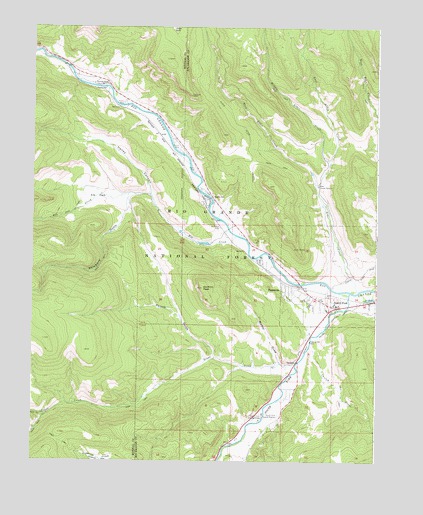
South Fork West, CO USGS Topographic Map
Click on map above to begin viewing in our Map Viewer.

This topographic map contains these locations and features:
Feature Name Type Latitude Longitude GNIS ID View Map
Alder CreekStreamN37.6744°W106.6314°190272View Map
Alder Guard StationLocaleN37.7044°W106.6470°190271View Map
BaxtervillePopulated PlaceN37.6742°W106.6578°190273View Map
Chapel of the South ForkChurchN37.6753°W106.6502°2696393View Map
Church CreekStreamN37.6578°W106.6498°190277View Map
Church DitchCanalN37.6581°W106.6509°190276View Map
Coller Wildlife AreaParkN37.7261°W106.7087°197153View Map
East Alder CreekStreamN37.7044°W106.6478°189586View Map
Elk CreekStreamN37.6900°W106.6767°190533View Map
Elk Creek Number 1 DamDamN37.6883°W106.6889°199568View Map
Elk Creek Number 1 ReservoirReservoirN37.6879°W106.6879°199569View Map
Elk ParkFlatN37.7014°W106.7270°190268View Map
Emmanuel Christian AcademyChurchN37.6724°W106.6469°2696386View Map
Haney CanyonValleyN37.7017°W106.7076°190266View Map
Masonic ParkLocaleN37.7017°W106.6848°190269View Map
Middle Alder CreekStreamN37.7103°W106.6431°189585View Map
Mill Creek DamDamN37.6317°W106.6673°199582View Map
Mill Creek ReservoirReservoirN37.6317°W106.6673°199583View Map
Model T ParkFlatN37.6264°W106.6373°196467View Map
Poison GulchValleyN37.6548°W106.6837°190265View Map
Raspberry GulchValleyN37.7010°W106.7156°190551View Map
Rio Grande PalisadesCliffN37.7250°W106.7089°169348View Map
Riverside RanchLocaleN37.7333°W106.7253°190267View Map
Salt CanyonValleyN37.6668°W106.6966°196464View Map
Sentinel PeakSummitN37.6750°W106.6884°190270View Map
South ForkPopulated PlaceN37.6700°W106.6398°203420View Map
South Fork CampgroundsLocaleN37.6375°W106.6667°190275View Map
South Fork Church of ChristChurchN37.6677°W106.6455°2696387View Map
South Fork Emergency Medical ServicesBuildingN37.6694°W106.6320°2695551View Map
South Fork Fire and RescueBuildingN37.6693°W106.6321°2667003View Map
South Fork Guard StationLocaleN37.6381°W106.6612°190278View Map
South Fork Police DepartmentBuildingN37.6696°W106.6420°2696624View Map
South Fork Post OfficePost OfficeN37.6663°W106.6451°2759241View Map
South Fork Rio GrandeStreamN37.6736°W106.6350°190279View Map
Town of South ForkCivilN37.6694°W106.6426°2413307View Map
Trout CreekStreamN37.6539°W106.6539°190552View Map
Walker DrawValleyN37.6531°W106.6603°190264View Map
West Alder CreekStreamN37.7044°W106.6478°189579View Map

Note: Coordinates in the location and feature list above are referenced to NAD83 datum.


Copyright (C) 2008-2024 Ryan Niemi / Sunset Dynamics ... All Rights Reserved