TopoQuest Logo
Do you find TopoQuest useful?
Help keep TopoQuest running and adding new maps/features by donating!
Bitcoin:  19c7KJd3qBynnjoSw5npx9KScwjBe4ifkT
Litecoin:  LXs6TkuXGGXo1vDsWCkWVdjQX94eUKd6ui
Home View Maps Find Maps Find Places Resources & Links


South Butte, Wyoming Topographic Map

USGS Map Title: South Butte, WY
USGS Map MRC: 43105F7
DRG (GeoTIFF) Download: o43105f7.tif


Neighboring USGS Topographic Map Quads:


  North Butte, WY  
43105G8
 

  Savageton, WY  
43105G7
 

  Greasewood Reservoir, WY  
43105G6
 

  Rolling Pin Ranch, WY  
43105F8
 

  South Butte, WY  
43105F7
 

  Baker Spring, WY  
43105F6
 

  Artesian Draw, WY  
43105E8
 

  Pine Tree, WY  
43105E7
 

  Turnercrest, WY  
43105E6


Map MRC Location:

N44°
W106°
N44°
W105°
H8 H7 H6 H5 H4 H3 H2 H1
G8 G7 G6 G5 G4 G3 G2 G1
F8 F7 F6 F5 F4 F3 F2 F1
E8 E7 E6 E5 E4 E3 E2 E1
D8 D7 D6 D5 D4 D3 D2 D1
C8 C7 C6 C5 C4 C3 C2 C1
B8 B7 B6 B5 B4 B3 B2 B1
A8 A7 A6 A5 A4 A3 A2 A1
N43°
W106°
N43°
W105°

South Butte, WY USGS 1:24K Topographic Map Preview:
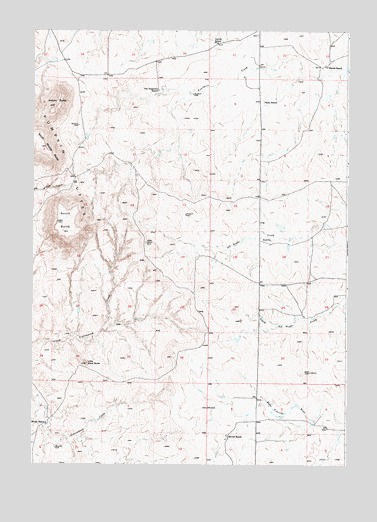
South Butte, WY USGS Topographic Map
Click on map above to begin viewing in our Map Viewer.

This topographic map contains these locations and features:
Feature Name Type Latitude Longitude GNIS ID View Map
Betty Number Twelve MineMineN43.6741°W105.8720°1746343View Map
Brown RanchLocaleN43.6364°W105.8689°1585971View Map
Cactus SchoolSchoolN43.7466°W105.8003°1586267View Map
Campbin and West MineMineN43.7400°W105.8611°1746344View Map
Cellers Wildlife 9-499-3 DamDamN43.7500°W105.8339°1608086View Map
Cellers Wildlife 9-499-3 ReservoirReservoirN43.7500°W105.8339°1608087View Map
Field 9-207-5 DamDamN43.7500°W105.8339°1608088View Map
Field 9-207-5 ReservoirReservoirN43.7500°W105.8339°1608089View Map
Fillbrink Fee Land MineMineN43.7253°W105.8608°1746345View Map
Four Mile CemeteryCemeteryN43.7490°W105.7862°2774527View Map
Hardin RanchLocaleN43.7402°W105.7569°1589307View Map
Indian ButteSummitN43.7283°W105.8656°1589872View Map
Little Black ButteSummitN43.6536°W105.8531°1590743View Map
Pumpkin ButtesRangeN43.7153°W105.8725°1609185View Map
Ruby RanchLocaleN43.7294°W105.7811°1593695View Map
Sievers RanchLocaleN43.6327°W105.7956°1594318View Map
South ButteSummitN43.6947°W105.8642°1594600View Map
South Middle ButteSummitN43.7166°W105.8711°1594706View Map
Syl Del MineMineN43.7291°W105.8556°1746346View Map
Van Buggenem RanchLocaleN43.7330°W105.8233°1595908View Map
Van Eugenum Number Two MineMineN43.7433°W105.8522°1746347View Map
Wyo Roc MineMineN43.6997°W105.7947°1746348View Map

Note: Coordinates in the location and feature list above are referenced to NAD83 datum.


Copyright (C) 2008-2024 Ryan Niemi / Sunset Dynamics ... All Rights Reserved