TopoQuest Logo
Do you find TopoQuest useful?
Help keep TopoQuest running and adding new maps/features by donating!
Bitcoin:  19c7KJd3qBynnjoSw5npx9KScwjBe4ifkT
Litecoin:  LXs6TkuXGGXo1vDsWCkWVdjQX94eUKd6ui
Home View Maps Find Maps Find Places Resources & Links


Souse Springs, New Mexico Topographic Map

USGS Map Title: Souse Springs, NM
USGS Map MRC: 32107E2
DRG (GeoTIFF) Download: o32107e2.tif


Neighboring USGS Topographic Map Quads:


  Arroyo Cuervo, NM  
32107F3
 

  Hatch, NM  
32107F2
 

  Rincon, NM  
32107F1
 

  Hockett, NM  
32107E3
 

  Souse Springs, NM  
32107E2
 

  Sierra Alta, NM  
32107E1
 

  Good Sight Peak NE, NM  
32107D3
 

  Magdalena Peak, NM  
32107D2
 

  Rough and Ready Hills, NM  
32107D1


Map MRC Location:

N33°
W108°
N33°
W107°
H8 H7 H6 H5 H4 H3 H2 H1
G8 G7 G6 G5 G4 G3 G2 G1
F8 F7 F6 F5 F4 F3 F2 F1
E8 E7 E6 E5 E4 E3 E2 E1
D8 D7 D6 D5 D4 D3 D2 D1
C8 C7 C6 C5 C4 C3 C2 C1
B8 B7 B6 B5 B4 B3 B2 B1
A8 A7 A6 A5 A4 A3 A2 A1
N32°
W108°
N32°
W107°

Souse Springs, NM USGS 1:24K Topographic Map Preview:
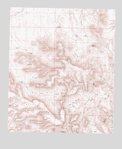
Souse Springs, NM USGS Topographic Map
Click on map above to begin viewing in our Map Viewer.

This topographic map contains these locations and features:
Feature Name Type Latitude Longitude GNIS ID View Map
Alamo TankReservoirN32.5570°W107.1422°885635View Map
Alamo WindmillsLocaleN32.5343°W107.1514°885638View Map
Augustine TankReservoirN32.5765°W107.1670°885949View Map
Augustine TankReservoirN32.5804°W107.1722°885950View Map
Big White GapGapN32.5254°W107.1861°886363View Map
Blanco TankReservoirN32.5971°W107.1691°886486View Map
Chivatos CanyonValleyN32.5387°W107.1445°887554View Map
Chivatos Canyon TankReservoirN32.5507°W107.1675°887555View Map
Choases CanyonValleyN32.5259°W107.1595°887558View Map
Choases TankReservoirN32.5115°W107.1631°887559View Map
Escondido RanchLocaleN32.5976°W107.1589°888905View Map
Green Tree TankReservoirN32.5091°W107.2297°889597View Map
Horse Canyon RanchLocaleN32.5498°W107.2334°890151View Map
Horse Canyon TankReservoirN32.5387°W107.1946°902265View Map
Kerr CanyonValleyN32.5368°W107.1497°890674View Map
Kerr TankLakeN32.5068°W107.1781°890677View Map
Las Uvas Mountains Wilderness Study AreaParkN32.5254°W107.1861°935853View Map
Las Uvas RanchLocaleN32.5840°W107.2400°890964View Map
Las Uvas SpringSpringN32.5789°W107.2226°890965View Map
Little White GapGapN32.5368°W107.1822°891206View Map
Middle Ranch WindmillLocaleN32.5687°W107.1347°891970View Map
North Kight TankReservoirN32.5677°W107.2289°892614View Map
Peloncillo PeakSummitN32.5879°W107.1492°893152View Map
Peloncillo TankReservoirN32.5816°W107.1389°893153View Map
Piņa PeakSummitN32.5493°W107.1478°893267View Map
Rattlesnake TankReservoirN32.5264°W107.2493°893695View Map
Road CanyonValleyN32.5387°W107.1445°893990View Map
Souse SpringsSpringN32.6064°W107.1902°895007View Map
South Kight TankReservoirN32.5545°W107.2191°899920View Map
Sugarloaf PeakSummitN32.5009°W107.1834°895415View Map
Tailholt MountainSummitN32.5129°W107.1359°895490View Map
Valles CanyonValleyN32.5356°W107.1386°896084View Map
Valles TankReservoirN32.5017°W107.1451°896085View Map
White Gap DrawValleyN32.5343°W107.1542°896495View Map
White Gap TankReservoirN32.5267°W107.1736°896496View Map

Note: Coordinates in the location and feature list above are referenced to NAD83 datum.


Copyright (C) 2008-2024 Ryan Niemi / Sunset Dynamics ... All Rights Reserved