TopoQuest Logo
Do you find TopoQuest useful?
Help keep TopoQuest running and adding new maps/features by donating!
Bitcoin:  19c7KJd3qBynnjoSw5npx9KScwjBe4ifkT
Litecoin:  LXs6TkuXGGXo1vDsWCkWVdjQX94eUKd6ui
Home View Maps Find Maps Find Places Resources & Links


Snow Shoe NW, Pennsylvania Topographic Map

USGS Map Title: Snow Shoe NW, PA
USGS Map MRC: 41077B8
DRG (GeoTIFF) Download: o41077b8.tif


Neighboring USGS Topographic Map Quads:


  Sinnemahoning, PA  
41078C1
 

  Keating, PA  
41077C8
 

  Renovo West, PA  
41077C7
 

  Pottersdale, PA  
41078B1
 

  Snow Shoe NW, PA  
41077B8
 

  Snow Shoe NE, PA  
41077B7
 

  Karthaus, PA  
41078A1
 

  Snow Shoe, PA  
41077A8
 

  Snow Shoe SE, PA  
41077A7


Map MRC Location:

N42°
W78°
N42°
W77°
H8 H7 H6 H5 H4 H3 H2 H1
G8 G7 G6 G5 G4 G3 G2 G1
F8 F7 F6 F5 F4 F3 F2 F1
E8 E7 E6 E5 E4 E3 E2 E1
D8 D7 D6 D5 D4 D3 D2 D1
C8 C7 C6 C5 C4 C3 C2 C1
B8 B7 B6 B5 B4 B3 B2 B1
A8 A7 A6 A5 A4 A3 A2 A1
N41°
W78°
N41°
W77°

Snow Shoe NW, PA USGS 1:24K Topographic Map Preview:
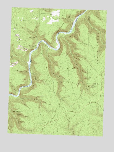
Snow Shoe NW, PA USGS Topographic Map
Click on map above to begin viewing in our Map Viewer.

This topographic map contains these locations and features:
Feature Name Type Latitude Longitude GNIS ID View Map
Bear HillSummitN41.1323°W77.9683°1168878View Map
BirchPopulated PlaceN41.1956°W77.9761°1203097View Map
Birch Island RunStreamN41.1962°W77.9742°1169638View Map
Black Stump RunStreamN41.2109°W77.9656°1169740View Map
Black Stump SidingLocaleN41.2123°W77.9642°1169741View Map
Bloom DraftValleyN41.1726°W77.8980°1192166View Map
Bloom Draft TrailTrailN41.1748°W77.8867°1192167View Map
Bog Ore RunStreamN41.1751°W77.9325°1169936View Map
Bougher RunStreamN41.1617°W77.9883°1170031View Map
Bougher Run TrailTrailN41.1523°W77.9525°1170032View Map
Buckshot HollowValleyN41.1576°W77.9576°1170583View Map
Burns RunStreamN41.2462°W77.9047°1170739View Map
Burnt Shanty RunStreamN41.1834°W77.9361°1170751View Map
Camp BloomLocaleN41.1745°W77.8894°1170978View Map
Camp MillerLocaleN41.2448°W77.9461°1171054View Map
Delaney HollowValleyN41.2196°W77.9658°1173119View Map
Dry RunStreamN41.2448°W77.9103°1173534View Map
Eddy Lick TrailTrailN41.1903°W77.8872°1173984View Map
Elderton CampLocaleN41.1609°W77.9150°1196959View Map
Fields RunStreamN41.2117°W77.9481°1174738View Map
Fields Run TrailTrailN41.1942°W77.9458°1192459View Map
First ForkStreamN41.2148°W77.9225°1174781View Map
Fisher HollowValleyN41.1365°W77.9861°1174816View Map
Frenchman HollowValleyN41.1797°W77.9051°1175228View Map
Frenchman TrailTrailN41.1784°W77.9078°1175229View Map
Gaines (historical)LocaleN41.2131°W77.9478°1196961View Map
Gaines RunStreamN41.1967°W77.9456°1175380View Map
Grove HillSummitN41.2326°W77.9939°1176276View Map
Grove RunStreamN41.2162°W77.9619°1176280View Map
Grove Run TrailTrailN41.2284°W77.9789°1192567View Map
Har Brac TrailTrailN41.1556°W77.9144°1176489View Map
Holt HollowValleyN41.1546°W77.9578°1177239View Map
Horse ForkStreamN41.2012°W77.9158°1177437View Map
J U Hollow TrailTrailN41.1342°W77.9011°1192676View Map
Jews Run Jeep TrailTrailN41.2470°W77.8897°1192691View Map
Ju Hollow TrailTrailN41.1345°W77.9014°1178178View Map
Kellys Field TrailTrailN41.2442°W77.9244°1178340View Map
Kyler ForkStreamN41.1742°W77.9014°1178719View Map
Kyler TrailTrailN41.1651°W77.9172°1178723View Map
Leaning Pine RunStreamN41.1787°W77.9714°1179088View Map
Little Birch Island RunStreamN41.2026°W77.9931°1179476View Map
Little Bougher RunStreamN41.1664°W77.9867°1179478View Map
Log HollowValleyN41.1905°W77.9079°1179804View Map
Log HollowValleyN41.2324°W77.8931°1179805View Map
Log Hollow TrailTrailN41.1881°W77.8956°1192830View Map
Lonely TrailTrailN41.1965°W77.9322°1192833View Map
McCormack HillSummitN41.2090°W77.9803°1180657View Map
Moores RunStreamN41.1845°W77.9719°1181514View Map
Morris RunStreamN41.2376°W77.9164°1181574View Map
Morris Run TrailTrailN41.2384°W77.9286°1192964View Map
Owl RunStreamN41.2170°W77.8783°1183160View Map
Packer TrailTrailN41.1920°W77.9158°1193076View Map
Panther Fire TowerPillarN41.1609°W77.8931°1183250View Map
Panther HollowValleyN41.1821°W77.9044°1183255View Map
Panther Run TrailTrailN41.1540°W77.8792°1193086View Map
Perry TrailTrailN41.2065°W77.9250°1193109View Map
Pine Camp (historical)LocaleN41.1426°W77.9722°1196958View Map
Plantation TrailTrailN41.2003°W77.8900°1184001View Map
Second ForkStreamN41.2051°W77.9181°1187209View Map
Shade ForkStreamN41.2248°W77.9672°1187290View Map
South Fork Bougher RunStreamN41.1598°W77.9822°1188059View Map
Spruce RunStreamN41.1481°W77.9997°1188349View Map
Spruce Run TrailTrailN41.1387°W77.9881°1188358View Map
State CampLocaleN41.1576°W77.8925°1188425View Map
Sugarcamp RunStreamN41.1865°W77.9739°1188990View Map
Tanglefoot HollowValleyN41.1424°W77.9910°1189256View Map
Township of BurnsideCivilN41.1291°W77.9725°1216120View Map
Twin HollowsPopulated PlaceN41.1728°W77.9675°1204842View Map
Walnut Bottom Camp (historical)LocaleN41.2034°W77.9506°1196963View Map
West Branch Spruce RunStreamN41.1428°W77.9931°1193635View Map
West View CampLocaleN41.2395°W77.9850°1196960View Map
Wildcat HollowValleyN41.1477°W77.9975°1191406View Map
Wolf Branch TrailTrailN41.1437°W77.9156°1191649View Map
Wrigley HollowValleyN41.1594°W77.9641°1191815View Map
Yost Run TrailTrailN41.2026°W77.9181°1193702View Map
Zanmore (historical)LocaleN41.2212°W77.9406°1196962View Map

Note: Coordinates in the location and feature list above are referenced to NAD83 datum.


Copyright (C) 2008-2024 Ryan Niemi / Sunset Dynamics ... All Rights Reserved