TopoQuest Logo
Do you find TopoQuest useful?
Help keep TopoQuest running and adding new maps/features by donating!
Bitcoin:  19c7KJd3qBynnjoSw5npx9KScwjBe4ifkT
Litecoin:  LXs6TkuXGGXo1vDsWCkWVdjQX94eUKd6ui
Home View Maps Find Maps Find Places Resources & Links


Smithboro, Georgia Topographic Map

USGS Map Title: Smithboro, GA
USGS Map MRC: 33083C5
DRG (GeoTIFF) Download: o33083c5.tif


Neighboring USGS Topographic Map Quads:


  Farrar, GA  
33083D6
 

  Shady Dale, GA  
33083D5
 

  Rock Eagle Lake, GA  
33083D4
 

  Monticello, GA  
33083C6
 

  Smithboro, GA  
33083C5
 

  Eatonton, GA  
33083C4
 

  Hillsboro, GA  
33083B6
 

  Stanfordville, GA  
33083B5
 

  Resseaus Crossroads, GA  
33083B4


Map MRC Location:

N34°
W84°
N34°
W83°
H8 H7 H6 H5 H4 H3 H2 H1
G8 G7 G6 G5 G4 G3 G2 G1
F8 F7 F6 F5 F4 F3 F2 F1
E8 E7 E6 E5 E4 E3 E2 E1
D8 D7 D6 D5 D4 D3 D2 D1
C8 C7 C6 C5 C4 C3 C2 C1
B8 B7 B6 B5 B4 B3 B2 B1
A8 A7 A6 A5 A4 A3 A2 A1
N33°
W84°
N33°
W83°

Smithboro, GA USGS 1:24K Topographic Map Preview:
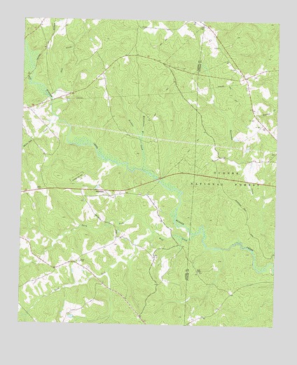
Smithboro, GA USGS Topographic Map
Click on map above to begin viewing in our Map Viewer.

This topographic map contains these locations and features:
Feature Name Type Latitude Longitude GNIS ID View Map
AikentonPopulated PlaceN33.3724°W83.5485°346115View Map
Apollo (historical)Populated PlaceN33.3654°W83.5277°347184View Map
Avalona Church (historical)ChurchN33.3210°W83.5013°347185View Map
Broddus CreekStreamN33.3137°W83.5652°327225View Map
Corinth Church (historical)ChurchN33.3532°W83.5118°347196View Map
Gammon Bridge (historical)BridgeN33.3090°W83.5574°346128View Map
Henderson School (historical)SchoolN33.2535°W83.5652°346135View Map
Howard BranchStreamN33.3085°W83.5560°346142View Map
Howard Store (historical)LocaleN33.3037°W83.5632°346143View Map
Jack CreekStreamN33.3432°W83.6107°328288View Map
Jasper County Emergency Services Station 5 PiedmontBuildingN33.2768°W83.5951°2604859View Map
Jordan CemeteryCemeteryN33.3007°W83.5953°346151View Map
Lazenberry Hunt CampLocaleN33.2637°W83.5174°330703View Map
Little CreekStreamN33.2815°W83.5252°347226View Map
Murder Creek Hunt CampLocaleN33.2979°W83.5304°330702View Map
Murder Creek Research Natural AreaLocaleN33.2790°W83.5113°330698View Map
New Hope Church (historical)ChurchN33.3185°W83.5160°347239View Map
North Fork Wolf CreekStreamN33.2887°W83.5596°329051View Map
Paw Chapel School (historical)SchoolN33.3346°W83.5621°346174View Map
Piedmont (historical)Populated PlaceN33.2751°W83.5977°346172View Map
Reids ChapelChurchN33.2726°W83.5374°329397View Map
Salem School (historical)SchoolN33.3299°W83.5021°347258View Map
Shoal CreekStreamN33.3490°W83.6213°329682View Map
Smith School (historical)ChurchN33.3015°W83.5938°346184View Map
SmithboroPopulated PlaceN33.3054°W83.5838°333072View Map
Smithboro Baptist ChurchChurchN33.3007°W83.5941°346185View Map
South Fork Wolf CreekStreamN33.2885°W83.5591°329773View Map
White Oak CreekStreamN33.3351°W83.6082°330246View Map
Whitehouse BranchStreamN33.3265°W83.5666°330254View Map
Wolf CreekStreamN33.2882°W83.5391°330329View Map

Note: Coordinates in the location and feature list above are referenced to NAD83 datum.


Copyright (C) 2008-2024 Ryan Niemi / Sunset Dynamics ... All Rights Reserved