TopoQuest Logo
Do you find TopoQuest useful?
Help keep TopoQuest running and adding new maps/features by donating!
Bitcoin:  19c7KJd3qBynnjoSw5npx9KScwjBe4ifkT
Litecoin:  LXs6TkuXGGXo1vDsWCkWVdjQX94eUKd6ui
Home View Maps Find Maps Find Places Resources & Links


Skull Valley, Arizona Topographic Map

USGS Map Title: Skull Valley, AZ
USGS Map MRC: 34112E6
DRG (GeoTIFF) Download: o34112e6.tif


Neighboring USGS Topographic Map Quads:


  Smith Mesa, AZ  
34112F7
 

  Mount Josh, AZ  
34112F6
 

  Jerome Canyon, AZ  
34112F5
 

  Martin Mountain, AZ  
34112E7
 

  Skull Valley, AZ  
34112E6
 

  Iron Springs, AZ  
34112E5
 

  Bismarck Mesa, AZ  
34112D7
 

  Kirkland, AZ  
34112D6
 

  Wilhoit, AZ  
34112D5


Map MRC Location:

N35°
W113°
N35°
W112°
H8 H7 H6 H5 H4 H3 H2 H1
G8 G7 G6 G5 G4 G3 G2 G1
F8 F7 F6 F5 F4 F3 F2 F1
E8 E7 E6 E5 E4 E3 E2 E1
D8 D7 D6 D5 D4 D3 D2 D1
C8 C7 C6 C5 C4 C3 C2 C1
B8 B7 B6 B5 B4 B3 B2 B1
A8 A7 A6 A5 A4 A3 A2 A1
N34°
W113°
N34°
W112°

Skull Valley, AZ USGS 1:24K Topographic Map Preview:
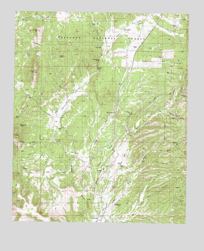
Skull Valley, AZ USGS Topographic Map
Click on map above to begin viewing in our Map Viewer.

This topographic map contains these locations and features:
Feature Name Type Latitude Longitude GNIS ID View Map
Bar U Bar RanchLocaleN34.6136°W112.7496°25968View Map
Burnt WashStreamN34.6228°W112.7368°27037View Map
Contreras RanchLocaleN34.6178°W112.6343°38360View Map
Cornfield MountainSummitN34.6145°W112.7341°27957View Map
Cornfield TankReservoirN34.6085°W112.7216°41099View Map
D One TankReservoirN34.6180°W112.6925°38388View Map
Dead Mule CanyonValleyN34.5017°W112.6782°28329View Map
Ferguson ValleyValleyN34.5586°W112.7210°28974View Map
Gardener WashStreamN34.5147°W112.6893°29257View Map
Goat CampLocaleN34.5278°W112.6338°29350View Map
Gold Star MineMineN34.5175°W112.6277°29391View Map
Grasshopper SpringSpringN34.5576°W112.7467°29544View Map
Juniper SpringSpringN34.5992°W112.7182°30677View Map
Logan WashStreamN34.5303°W112.6766°31192View Map
Old Poley RanchLocaleN34.6150°W112.6705°38672View Map
Poley RanchLocaleN34.6145°W112.6655°33088View Map
RamsgateLocaleN34.5792°W112.6274°33359View Map
Shea Water SpringSpringN34.5918°W112.6912°34315View Map
Skull ValleyPopulated PlaceN34.5053°W112.6855°34495View Map
Skull Valley CemeteryCemeteryN34.5308°W112.6861°38813View Map
Skull Valley Elementary SchoolSchoolN34.5019°W112.6871°38814View Map
Skull Valley Post OfficePost OfficeN34.5030°W112.6836°2670057View Map
Skull Valley WashStreamN34.5378°W112.7063°41117View Map
Skully ValleyValleyN34.5411°W112.7091°41106View Map
Spruce CanyonValleyN34.5664°W112.6418°34749View Map
Tonto Pasture SpringSpringN34.5967°W112.6894°35384View Map
Tonto Ranger Station SpringSpringN34.6050°W112.6930°38879View Map
Tonto Springs Ranger StationLocaleN34.6017°W112.6849°35387View Map
Tonto TankReservoirN34.6042°W112.7049°38880View Map
Tonto WashStreamN34.6064°W112.6841°35391View Map
Tubb SpringSpringN34.5621°W112.7468°35491View Map
Whiskey SpringSpringN34.5997°W112.7027°36057View Map
Woolsey SpringSpringN34.5655°W112.6778°42822View Map
Woolsey WashStreamN34.5386°W112.7038°36398View Map
Yav'Pe Ma'Ta AirportAirportN34.5083°W112.6811°45504View Map
Young MountainSummitN34.5900°W112.7363°36484View Map
Young Mountain Number One TankReservoirN34.5823°W112.7323°41105View Map
Young TankReservoirN34.5848°W112.7383°41101View Map

Note: Coordinates in the location and feature list above are referenced to NAD83 datum.


Copyright (C) 2008-2024 Ryan Niemi / Sunset Dynamics ... All Rights Reserved