TopoQuest Logo
Do you find TopoQuest useful?
Help keep TopoQuest running and adding new maps/features by donating!
Bitcoin:  19c7KJd3qBynnjoSw5npx9KScwjBe4ifkT
Litecoin:  LXs6TkuXGGXo1vDsWCkWVdjQX94eUKd6ui
Home View Maps Find Maps Find Places Resources & Links


Skidway Lake, Michigan Topographic Map

USGS Map Title: Skidway Lake, MI
USGS Map MRC: 44084B1
DRG (GeoTIFF) Download: o44084b1.tif


Neighboring USGS Topographic Map Quads:


  West Branch, MI  
44084C2
 

  Selkirk, MI  
44084C1
 

  Sage Lake, MI  
44083C8
 

  Sterling NW, MI  
44084B2
 

  Skidway Lake, MI  
44084B1
 

  Prescott, MI  
44083B8
 

  Sterling SW, MI  
44084A2
 

  Sterling, MI  
44084A1
 

  Omer SW, MI  
44083A8


Map MRC Location:

N45°
W85°
N45°
W84°
H8 H7 H6 H5 H4 H3 H2 H1
G8 G7 G6 G5 G4 G3 G2 G1
F8 F7 F6 F5 F4 F3 F2 F1
E8 E7 E6 E5 E4 E3 E2 E1
D8 D7 D6 D5 D4 D3 D2 D1
C8 C7 C6 C5 C4 C3 C2 C1
B8 B7 B6 B5 B4 B3 B2 B1
A8 A7 A6 A5 A4 A3 A2 A1
N44°
W85°
N44°
W84°

Skidway Lake, MI USGS 1:24K Topographic Map Preview:
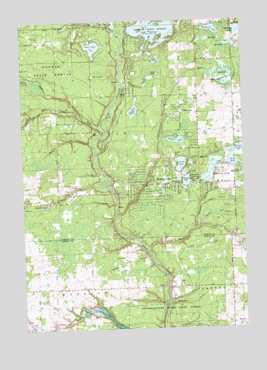
Skidway Lake, MI USGS Topographic Map
Click on map above to begin viewing in our Map Viewer.

This topographic map contains these locations and features:
Feature Name Type Latitude Longitude GNIS ID View Map
AlgerPopulated PlaceN44.1256°W84.1211°619941View Map
Alger Bible Baptist ChurchChurchN44.1264°W84.1197°2515110View Map
Alger Post OfficePost OfficeN44.1261°W84.1197°2515111View Map
Alger StationLocaleN44.1267°W84.1236°2515093View Map
Alger United Methodist ChurchChurchN44.1269°W84.1192°2515109View Map
Arenac County Emergency Medical Services AlgerBuildingN44.1288°W84.1226°2662142View Map
Birch LakeLakeN44.2291°W84.0120°621405View Map
Black LakeLakeN44.1935°W84.0181°621510View Map
Boss LakeLakeN44.2424°W84.0196°621752View Map
Boughner LakeLakeN44.2464°W84.0165°621768View Map
Bovee LakeLakeN44.2286°W84.0478°621785View Map
Bush LakeLakeN44.1917°W84.0354°1623727View Map
Cabin LakeLakeN44.2395°W84.0840°622416View Map
Chandlers LakeLakeN44.1747°W84.1119°623074View Map
Convenant Cove CampLocaleN44.2025°W84.0319°623716View Map
Cursten CreekStreamN44.1370°W84.0433°624226View Map
Eddy CreekStreamN44.2028°W84.0814°625344View Map
Elbow LakeLakeN44.2010°W84.0389°625426View Map
Elbow LakePopulated PlaceN44.2153°W84.0356°625429View Map
Feeding Ground CreekStreamN44.1653°W84.0283°625865View Map
Feeding Ground LakeLakeN44.1864°W84.0199°625866View Map
Forest LakeReservoirN44.1271°W84.0750°626274View Map
Grass LakeLakeN44.2280°W84.0836°627196View Map
Grass LakeLakeN44.2367°W84.0566°627197View Map
Hardwood Lake CampgroundLocaleN44.2444°W84.0050°2503017View Map
Harwood CreekStreamN44.2006°W84.0869°627912View Map
Hettinger CreekStreamN44.1350°W84.0431°628167View Map
Hewey LakeLakeN44.1978°W84.0024°628171View Map
Indian LakeLakeN44.2248°W84.0096°628989View Map
Lake OgemawReservoirN44.2467°W84.0496°633959View Map
Little Feeding Ground LakeLakeN44.1911°W84.0161°630620View Map
Little Mud LakeLakeN44.1871°W84.0008°630703View Map
Long LakeLakeN44.2403°W84.0067°630940View Map
Lost LakeLakeN44.1919°W84.0294°631088View Map
Mansfield CreekStreamN44.1561°W84.0536°631416View Map
Mills CemeteryCemeteryN44.2222°W84.0350°2503050View Map
Mills CreekStreamN44.1739°W84.0250°632423View Map
Mills LakeLakeN44.1929°W84.0058°632426View Map
Mills Township Fire DepartmentBuildingN44.1869°W84.0725°2626713View Map
Mills Township Newman ParkParkN44.1875°W84.0047°2503014View Map
Moffatt BridgeBridgeN44.1414°W84.0439°1623516View Map
Moffatt Township Volunteer Fire DepartmentBuildingN44.1287°W84.1226°2626949View Map
Mud CreekStreamN44.1806°W84.0189°632879View Map
North Eddy CreekStreamN44.2117°W84.0911°633568View Map
Norway LakeLakeN44.2131°W84.0613°633756View Map
Ogemaw County Emergency Medical Services Authority Mills TownshipBuildingN44.1847°W84.0700°2662093View Map
Prather CreekStreamN44.2245°W84.0686°635399View Map
Rifle River CampLocaleN44.1786°W84.0706°635920View Map
Saint Joseph ChurchChurchN44.1269°W84.1214°2515108View Map
Saint Stephens ChurchChurchN44.1839°W84.0128°637055View Map
Silver CreekStreamN44.1714°W84.0731°637906View Map
Silver LakeLakeN44.2343°W84.0483°637947View Map
Skidway LakeLakeN44.1848°W84.0323°638055View Map
Skidway LakePopulated PlaceN44.1834°W84.0353°638056View Map
Skidway Lake Baptist ChurchChurchN44.2128°W84.0250°2503019View Map
Skidway Lake Census Designated PlaceCensusN44.1919°W84.0467°2393238View Map
Skidway Lake Post OfficePost OfficeN44.1834°W84.0353°1926618View Map
South Eddy CreekStreamN44.2117°W84.0911°638341View Map
Spring CreekStreamN44.1672°W84.0278°638560View Map
Sterling Area Health CenterHospitalN44.1833°W84.0500°2503009View Map
Township of MillsCivilN44.2049°W84.0653°1626746View Map
Turtle LakeLakeN44.1952°W84.0397°1615201View Map
West Branch Rifle RiverStreamN44.2428°W84.0678°1616063View Map

Note: Coordinates in the location and feature list above are referenced to NAD83 datum.


Copyright (C) 2008-2024 Ryan Niemi / Sunset Dynamics ... All Rights Reserved