TopoQuest Logo
Do you find TopoQuest useful?
Help keep TopoQuest running and adding new maps/features by donating!
Bitcoin:  19c7KJd3qBynnjoSw5npx9KScwjBe4ifkT
Litecoin:  LXs6TkuXGGXo1vDsWCkWVdjQX94eUKd6ui
Home View Maps Find Maps Find Places Resources & Links


Sims Mountain, California Topographic Map

USGS Map Title: Sims Mountain, CA
USGS Map MRC: 40123F5
DRG (GeoTIFF) Download: o40123f5.tif


Neighboring USGS Topographic Map Quads:


  Grouse Mountain, CA  
40123G6
 

  Hennessy Peak, CA  
40123G5
 

  Ironside Mountain, CA  
40123G4
 

  Board Camp Mountain, CA  
40123F6
 

  Sims Mountain, CA  
40123F5
 

  Hyampom Mountain, CA  
40123F4
 

  Showers Mountain, CA  
40123E6
 

  Blake Mountain, CA  
40123E5
 

  Hyampom, CA  
40123E4


Map MRC Location:

N41°
W124°
N41°
W123°
H8 H7 H6 H5 H4 H3 H2 H1
G8 G7 G6 G5 G4 G3 G2 G1
F8 F7 F6 F5 F4 F3 F2 F1
E8 E7 E6 E5 E4 E3 E2 E1
D8 D7 D6 D5 D4 D3 D2 D1
C8 C7 C6 C5 C4 C3 C2 C1
B8 B7 B6 B5 B4 B3 B2 B1
A8 A7 A6 A5 A4 A3 A2 A1
N40°
W124°
N40°
W123°

Sims Mountain, CA USGS 1:24K Topographic Map Preview:
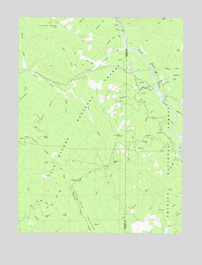
Sims Mountain, CA USGS Topographic Map
Click on map above to begin viewing in our Map Viewer.

This topographic map contains these locations and features:
Feature Name Type Latitude Longitude GNIS ID View Map
Bear CreekStreamN40.7071°W123.5859°218815View Map
Bennett PeakSummitN40.6663°W123.5542°1658035View Map
Big CreekStreamN40.6604°W123.5539°219167View Map
Big SlideSlopeN40.7243°W123.5734°219255View Map
Big Slide CreekStreamN40.6688°W123.5042°219256View Map
Black Fox RockPillarN40.6546°W123.5828°219359View Map
Breckeen CreekStreamN40.7399°W123.5487°219793View Map
Buckeye CreekStreamN40.6949°W123.5067°220030View Map
Canyon CreekStreamN40.6857°W123.5092°220556View Map
Castle RockPillarN40.7496°W123.5173°254721View Map
Dan East CabinLocaleN40.6346°W123.6053°221996View Map
Dan East CreekStreamN40.6404°W123.6159°221997View Map
Dan East TrailTrailN40.6432°W123.5975°221998View Map
Devils CanyonValleyN40.7057°W123.5959°222287View Map
Grapevine CreekStreamN40.7065°W123.5214°224448View Map
Grouse CreekStreamN40.7329°W123.5453°224657View Map
Hog RanchLocaleN40.7313°W123.5059°225408View Map
Lake MountainLakeN40.6815°W123.5520°229210View Map
Lake Mountain RanchLocaleN40.6776°W123.5281°226802View Map
Last Chance CreekStreamN40.7162°W123.6242°226913View Map
Last Chance RidgeRidgeN40.6824°W123.6223°226919View Map
Last Chance TrailTrailN40.6471°W123.5828°226922View Map
Lucy GulchValleyN40.6474°W123.5300°227831View Map
Manzanita RanchLocaleN40.7093°W123.5284°228044View Map
Monroe CreekStreamN40.6738°W123.5031°228926View Map
Mosquito CreekStreamN40.7190°W123.6198°229110View Map
Mule BridgeBridgeN40.7190°W123.5237°252044View Map
Mule SpringSpringN40.6804°W123.6064°229315View Map
Panther CreekStreamN40.7104°W123.5200°230303View Map
Potato HillSummitN40.6657°W123.6059°1659427View Map
Saddle GulchValleyN40.6985°W123.5167°232101View Map
Sims CreekStreamN40.7137°W123.5814°233168View Map
Sims MountainSummitN40.7449°W123.6081°233169View Map
Slide Creek CampgroundLocaleN40.6679°W123.5050°276147View Map
Slide Creek CampgroundLocaleN40.6682°W123.5028°233282View Map
Smith OpeningFlatN40.6346°W123.5892°233344View Map
Trappers CreekStreamN40.7060°W123.5909°236520View Map
Twin Lakes CreekStreamN40.6815°W123.5034°236702View Map
Underwood CreekStreamN40.7199°W123.5231°236779View Map
Waterbarrel OpeningFlatN40.6571°W123.6028°237330View Map
Wise StationLocaleN40.7157°W123.5834°238076View Map

Note: Coordinates in the location and feature list above are referenced to NAD83 datum.


Copyright (C) 2008-2024 Ryan Niemi / Sunset Dynamics ... All Rights Reserved