TopoQuest Logo
Do you find TopoQuest useful?
Help keep TopoQuest running and adding new maps/features by donating!
Bitcoin:  19c7KJd3qBynnjoSw5npx9KScwjBe4ifkT
Litecoin:  LXs6TkuXGGXo1vDsWCkWVdjQX94eUKd6ui
Home View Maps Find Maps Find Places Resources & Links


Shorter, Alabama Topographic Map

USGS Map Title: Shorter, AL
USGS Map MRC: 32085D8
DRG (GeoTIFF) Download: o32085d8.tif


Neighboring USGS Topographic Map Quads:


  Claud, AL  
32086E1
 

  Tallassee, AL  
32085E8
 

  Carrville, AL  
32085E7
 

  Brassell, AL  
32086D1
 

  Shorter, AL  
32085D8
 

  La Place, AL  
32085D7
 

  Mount Meigs, AL  
32086C1
 

  Chesson, AL  
32085C8
 

  Hardaway, AL  
32085C7


Map MRC Location:

N33°
W86°
N33°
W85°
H8 H7 H6 H5 H4 H3 H2 H1
G8 G7 G6 G5 G4 G3 G2 G1
F8 F7 F6 F5 F4 F3 F2 F1
E8 E7 E6 E5 E4 E3 E2 E1
D8 D7 D6 D5 D4 D3 D2 D1
C8 C7 C6 C5 C4 C3 C2 C1
B8 B7 B6 B5 B4 B3 B2 B1
A8 A7 A6 A5 A4 A3 A2 A1
N32°
W86°
N32°
W85°

Shorter, AL USGS 1:24K Topographic Map Preview:
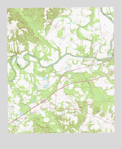
Shorter, AL USGS Topographic Map
Click on map above to begin viewing in our Map Viewer.

This topographic map contains these locations and features:
Feature Name Type Latitude Longitude GNIS ID View Map
Auburn University Agricultural Experiment StationLocaleN32.4974°W85.8922°137138View Map
Auburn University Experiment StationLocaleN32.4404°W85.8875°163783View Map
Autossee (historical)LocaleN32.4404°W85.9430°158140View Map
Calabee ChurchChurchN32.3857°W85.8844°163784View Map
CalebeePopulated PlaceN32.3854°W85.8844°156144View Map
Calebee CreekStreamN32.4429°W85.9477°151710View Map
Cubahatchee Baptist ChurchChurchN32.3954°W85.9252°116947View Map
Cubahatchee CreekStreamN32.4274°W85.9955°151750View Map
Cubahatchee Lookout TowerTowerN32.4007°W85.9169°164313View Map
Exit 22CrossingN32.4071°W85.9583°155533View Map
Exit 26CrossingN32.4278°W85.8997°2130657View Map
First Baptist ChurchChurchN32.4012°W85.9441°134014View Map
Fort Decatur (historical)MilitaryN32.4522°W85.8767°134015View Map
GoodwynPopulated PlaceN32.4379°W85.9338°156417View Map
Hall Mitchell ChurchChurchN32.4112°W85.9619°163662View Map
Larsen Store (historical)LocaleN32.3865°W85.9838°134028View Map
Mary Magdeline Baptist ChurchChurchN32.4007°W85.9061°134034View Map
MilsteadPopulated PlaceN32.4426°W85.8975°156715View Map
New Hope ChurchChurchN32.4010°W85.9944°134043View Map
O'Daniel BridgeBridgeN32.4493°W85.8977°154689View Map
Oak Grove ChurchChurchN32.4799°W85.9869°124087View Map
Oak Grove School (historical)SchoolN32.4799°W85.9872°137277View Map
Piney Grove ChurchChurchN32.4224°W85.9680°152941View Map
Polecat SpringsReservoirN32.3961°W85.8969°125097View Map
Prairie Farm SchoolSchoolN32.3824°W85.9911°125239View Map
Reeves Airport (historical)AirportN32.4821°W85.8847°1959588View Map
Robinson BendBendN32.4460°W85.9833°137301View Map
Rock Springs ChurchChurchN32.4768°W85.9955°125777View Map
Rock Springs School (historical)SchoolN32.4757°W85.9955°137304View Map
Saint Pauls ChurchChurchN32.3907°W85.9791°153290View Map
ShorterPopulated PlaceN32.3949°W85.9169°126817View Map
Shorter Fire DepartmentBuildingN32.3992°W85.9485°2691117View Map
Shorter Post OfficePost OfficeN32.3994°W85.9491°2789071View Map
Shorter Town Police DepartmentBuildingN32.3992°W85.9485°2751840View Map
Shorters ChurchChurchN32.3826°W85.9897°126818View Map
Shorters Station (historical)LocaleN32.4154°W85.9650°134057View Map
Sun Rise School (historical)SchoolN32.4201°W85.9675°134060View Map
Tallassee Municipal Airport (historical)AirportN32.4835°W85.8833°129436View Map
Town of ShorterCivilN32.4005°W85.9435°2407329View Map
Tuckabatchie (historical)LocaleN32.4946°W85.8930°164268View Map
Tuckabatchie BottomsFlatN32.4821°W85.8833°1959593View Map
Tuckabatchie MonumentParkN32.4840°W85.8827°137341View Map
Tumkeehatchee CreekStreamN32.4496°W85.9397°158096View Map
Tumlame BranchStreamN32.4860°W85.9750°128122View Map
TysonvillePopulated PlaceN32.4004°W85.9986°155282View Map
Tysonville CemeteryCemeteryN32.3993°W85.9877°163802View Map
Wallahatchee CreekStreamN32.4510°W85.9086°155292View Map
Wolfe High SchoolSchoolN32.4032°W85.9063°154021View Map
Wolfe-Shorter High SchoolSchoolN32.3926°W85.9222°165530View Map

Note: Coordinates in the location and feature list above are referenced to NAD83 datum.


Copyright (C) 2008-2024 Ryan Niemi / Sunset Dynamics ... All Rights Reserved