TopoQuest Logo
Do you find TopoQuest useful?
Help keep TopoQuest running and adding new maps/features by donating!
Bitcoin:  19c7KJd3qBynnjoSw5npx9KScwjBe4ifkT
Litecoin:  LXs6TkuXGGXo1vDsWCkWVdjQX94eUKd6ui
Home View Maps Find Maps Find Places Resources & Links


Shirley, West Virginia Topographic Map

USGS Map Title: Shirley, WV
USGS Map MRC: 39080D7
DRG (GeoTIFF) Download: o39080d7.tif


Neighboring USGS Topographic Map Quads:


  Paden City, WV  
39080E8
 

  Porters Falls, WV  
39080E7
 

  Pine Grove, WV  
39080E6
 

  Middlebourne, WV  
39080D8
 

  Shirley, WV  
39080D7
 

  Center Point, WV  
39080D6
 

  Pennsboro, WV  
39080C8
 

  West Union, WV  
39080C7
 

  Smithburg, WV  
39080C6


Map MRC Location:

N40°
W81°
N40°
W80°
H8 H7 H6 H5 H4 H3 H2 H1
G8 G7 G6 G5 G4 G3 G2 G1
F8 F7 F6 F5 F4 F3 F2 F1
E8 E7 E6 E5 E4 E3 E2 E1
D8 D7 D6 D5 D4 D3 D2 D1
C8 C7 C6 C5 C4 C3 C2 C1
B8 B7 B6 B5 B4 B3 B2 B1
A8 A7 A6 A5 A4 A3 A2 A1
N39°
W81°
N39°
W80°

Shirley, WV USGS 1:24K Topographic Map Preview:
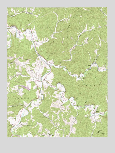
Shirley, WV USGS Topographic Map
Click on map above to begin viewing in our Map Viewer.

This topographic map contains these locations and features:
Feature Name Type Latitude Longitude GNIS ID View Map
AkronPopulated PlaceN39.4148°W80.8057°1678605View Map
Alma Post OfficePost OfficeN39.4323°W80.8401°1678607View Map
Alma Volunteer Fire DepartmentBuildingN39.4266°W80.8394°2577625View Map
Arthur I Boreman Elementary SchoolSchoolN39.4758°W80.8590°2088121View Map
Avondale School (historical)SchoolN39.4770°W80.7759°1678612View Map
Beechwood CemeteryCemeteryN39.4315°W80.8343°1535567View Map
Big MosesPopulated PlaceN39.4315°W80.7843°1553897View Map
Big RunStreamN39.4426°W80.8104°1535935View Map
Big RunStreamN39.3784°W80.8682°1535950View Map
Big Run ChurchChurchN39.4634°W80.7884°1535959View Map
Big Run School (historical)SchoolN39.3759°W80.8687°1678617View Map
BluePopulated PlaceN39.4476°W80.8254°1549599View Map
Blue RidgeRidgeN39.4737°W80.8001°1536130View Map
Blue RunStreamN39.4473°W80.8276°1536133View Map
BooherPopulated PlaceN39.4440°W80.7712°1553947View Map
Booher RunStreamN39.4348°W80.7776°1536223View Map
Booher Run School (historical)SchoolN39.4345°W80.7670°1678621View Map
Camp RunStreamN39.3976°W80.7648°1536948View Map
CentervillePopulated PlaceN39.4320°W80.8401°1554098View Map
Conaway RunStreamN39.4229°W80.8326°1537560View Map
Conaway Run DamDamN39.4217°W80.8498°1559318View Map
Conaway Run Wildlife Management AreaParkN39.4256°W80.8568°1678627View Map
Doe RunStreamN39.3954°W80.7690°1538231View Map
Elder RunStreamN39.4631°W80.7893°1538587View Map
Elder School (historical)SchoolN39.4579°W80.7965°1678631View Map
FrewPopulated PlaceN39.4673°W80.8362°1549694View Map
Gorrell Run ChurchChurchN39.4945°W80.8476°1539539View Map
Gorrell Run School (historical)SchoolN39.4954°W80.8482°1678644View Map
Groves RunStreamN39.4317°W80.7851°1539774View Map
Indian CreekStreamN39.4442°W80.8234°1540674View Map
Jefferson RunStreamN39.4117°W80.8345°1540848View Map
Jefferson School (historical)SchoolN39.3867°W80.8165°1678650View Map
Josephs MillsLocaleN39.3873°W80.8640°1541027View Map
Jug Wildlife Management AreaParkN39.4654°W80.8734°1678705View Map
Labell RunStreamN39.4098°W80.7912°1541300View Map
Labell School (historical)SchoolN39.4098°W80.7904°1678654View Map
Little Camp Mistake RunStreamN39.3762°W80.8504°1542054View Map
Low Gap ChurchChurchN39.3837°W80.8015°1542505View Map
Low Gap School (historical)SchoolN39.3837°W80.8012°1678662View Map
Mackey RunStreamN39.4040°W80.7798°1542672View Map
McElroy CreekStreamN39.4301°W80.8318°1542995View Map
McGee RunStreamN39.3934°W80.8582°1542998View Map
MeekerPopulated PlaceN39.4662°W80.7879°1555103View Map
Morris School (historical)SchoolN39.4476°W80.7657°1678671View Map
Morrison RunStreamN39.4087°W80.8029°1543590View Map
Mount Aris ChurchChurchN39.4651°W80.8390°1543612View Map
Mount Moriah ChurchChurchN39.4295°W80.8343°1543680View Map
Mount Nebo CemeteryCemeteryN39.4959°W80.7832°1543684View Map
Mount Nebo School (historical)SchoolN39.4951°W80.7795°1678672View Map
Muddy CreekStreamN39.4670°W80.8426°1543926View Map
Muddy Creek School (historical)SchoolN39.4765°W80.8159°1678674View Map
Oak Grove School (historical)SchoolN39.4406°W80.7518°1678676View Map
Pierpont CemeteryCemeteryN39.4378°W80.8451°1544808View Map
Pitts RunStreamN39.4498°W80.8326°1544966View Map
Pratt RunStreamN39.4034°W80.7854°1545234View Map
Purgatory RunStreamN39.4034°W80.8518°1545323View Map
Riggs ChapelChurchN39.3867°W80.8673°1545599View Map
Ripley ChapelChurchN39.4290°W80.8415°1545758View Map
Rising Sun School (historical)SchoolN39.4809°W80.7518°1678684View Map
Ross RunStreamN39.3876°W80.8612°1546094View Map
Ross Run School (historical)SchoolN39.3862°W80.8462°1678686View Map
Sandy RunStreamN39.3959°W80.7690°1546415View Map
ShirleyPopulated PlaceN39.3981°W80.7651°1546696View Map
Shirley Post OfficePost OfficeN39.3978°W80.7666°1678692View Map
Shirley Volunteer Fire DepartmentBuildingN39.3997°W80.7686°2577593View Map
Smith CemeteryCemeteryN39.4756°W80.8440°1546981View Map
South DistrictCivilN39.4210°W80.8497°1928359View Map
Spring Hill CemeteryCemeteryN39.3865°W80.8679°1547199View Map
SunnysidePopulated PlaceN39.4234°W80.8184°1678703View Map
TylerPopulated PlaceN39.4331°W80.8268°1555847View Map
Tyler County Emergency Medical Services Unit 3 - Alma Emergency Medical ServicesBuildingN39.4267°W80.8394°2581047View Map
Underwood CemeteryCemeteryN39.3970°W80.7545°1548458View Map
Victory ChurchChurchN39.4459°W80.7668°1548662View Map
Wheeler RunStreamN39.4287°W80.8320°1548993View Map
WilburPopulated PlaceN39.3765°W80.8245°1549127View Map
Wilbur CemeteryCemeteryN39.3784°W80.8245°1678922View Map
Woodburn RunStreamN39.4465°W80.7654°1549368View Map

Note: Coordinates in the location and feature list above are referenced to NAD83 datum.


Copyright (C) 2008-2024 Ryan Niemi / Sunset Dynamics ... All Rights Reserved