TopoQuest Logo
Do you find TopoQuest useful?
Help keep TopoQuest running and adding new maps/features by donating!
Bitcoin:  19c7KJd3qBynnjoSw5npx9KScwjBe4ifkT
Litecoin:  LXs6TkuXGGXo1vDsWCkWVdjQX94eUKd6ui
Home View Maps Find Maps Find Places Resources & Links


Sherwood Peak, California Topographic Map

USGS Map Title: Sherwood Peak, CA
USGS Map MRC: 39123E5
DRG (GeoTIFF) Download: o39123e5.tif


Neighboring USGS Topographic Map Quads:


  Lincoln Ridge, CA  
39123F6
 

  Cahto Peak, CA  
39123F5
 

  Laytonville, CA  
39123F4
 

  Dutchmans Knoll, CA  
39123E6
 

  Sherwood Peak, CA  
39123E5
 

  Longvale, CA  
39123E4
 

  Noyo Hill, CA  
39123D6
 

  Northspur, CA  
39123D5
 

  Burbeck, CA  
39123D4


Map MRC Location:

N40°
W124°
N40°
W123°
H8 H7 H6 H5 H4 H3 H2 H1
G8 G7 G6 G5 G4 G3 G2 G1
F8 F7 F6 F5 F4 F3 F2 F1
E8 E7 E6 E5 E4 E3 E2 E1
D8 D7 D6 D5 D4 D3 D2 D1
C8 C7 C6 C5 C4 C3 C2 C1
B8 B7 B6 B5 B4 B3 B2 B1
A8 A7 A6 A5 A4 A3 A2 A1
N39°
W124°
N39°
W123°

Sherwood Peak, CA USGS 1:24K Topographic Map Preview:
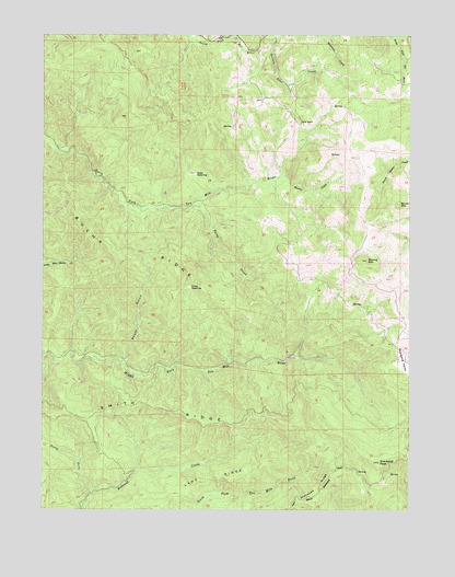
Sherwood Peak, CA USGS Topographic Map
Click on map above to begin viewing in our Map Viewer.

This topographic map contains these locations and features:
Feature Name Type Latitude Longitude GNIS ID View Map
Ames OpeningFlatN39.5585°W123.5758°218240View Map
Baxman RanchLocaleN39.5393°W123.5053°1724060View Map
Booth GulchValleyN39.5388°W123.5989°219653View Map
Brush MountainSummitN39.5804°W123.5047°219934View Map
Bucha RidgeRidgeN39.5663°W123.5964°219967View Map
Case OpeningFlatN39.5882°W123.5739°220669View Map
Clarke RanchLocaleN39.6015°W123.5383°221168View Map
Lake RidgeRidgeN39.5079°W123.5717°226808View Map
Little Rock CreekStreamN39.6235°W123.5656°227349View Map
North Fork Redwood CreekStreamN39.5043°W123.6092°229714View Map
Patsy CreekStreamN39.5802°W123.5728°230405View Map
Section Four CreekStreamN39.6240°W123.5461°265981View Map
Sherwood PeakSummitN39.5124°W123.5114°232985View Map
Sherwood RidgeRidgeN39.5066°W123.5320°232987View Map
Smith RidgeRidgeN39.5268°W123.5845°234722View Map
Stanley CreekStreamN39.5877°W123.5447°235373View Map
Strong MountainSummitN39.5657°W123.5153°235604View Map

Note: Coordinates in the location and feature list above are referenced to NAD83 datum.


Copyright (C) 2008-2024 Ryan Niemi / Sunset Dynamics ... All Rights Reserved