TopoQuest Logo
Do you find TopoQuest useful?
Help keep TopoQuest running and adding new maps/features by donating!
Bitcoin:  19c7KJd3qBynnjoSw5npx9KScwjBe4ifkT
Litecoin:  LXs6TkuXGGXo1vDsWCkWVdjQX94eUKd6ui
Home View Maps Find Maps Find Places Resources & Links


Black Diamond Peak, Arizona Topographic Map

USGS Map Title: Black Diamond Peak, AZ
USGS Map MRC: 31109G8
DRG (GeoTIFF) Download: o31109g8.tif


Neighboring USGS Topographic Map Quads:


  Knob Hill, AZ  
31110H1
 

  Cochise Stronghold, AZ  
31109H8
 

  Pearce, AZ  
31109H7
 

  Haberstock Hill, AZ  
31110G1
 

  Black Diamond Peak, AZ  
31109G8
 

  Turquoise Mountain, AZ  
31109G7
 

  Tombstone, AZ  
31110F1
 

  Hay Mountain, AZ  
31109F8
 

  Outlaw Mountain, AZ  
31109F7


Map MRC Location:

N32°
W110°
N32°
W109°
H8 H7 H6 H5 H4 H3 H2 H1
G8 G7 G6 G5 G4 G3 G2 G1
F8 F7 F6 F5 F4 F3 F2 F1
E8 E7 E6 E5 E4 E3 E2 E1
D8 D7 D6 D5 D4 D3 D2 D1
C8 C7 C6 C5 C4 C3 C2 C1
B8 B7 B6 B5 B4 B3 B2 B1
A8 A7 A6 A5 A4 A3 A2 A1
N31°
W110°
N31°
W109°

Black Diamond Peak, AZ USGS 1:24K Topographic Map Preview:
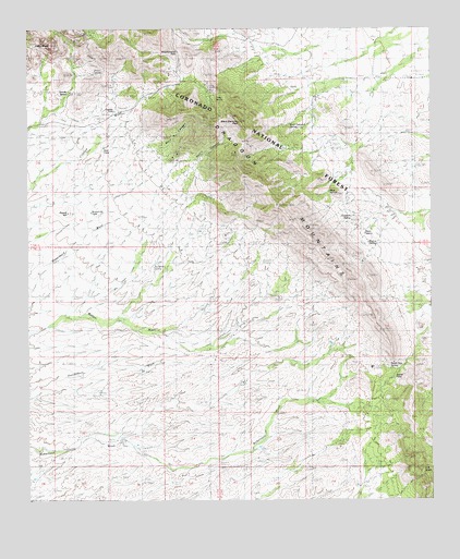
Black Diamond Peak, AZ USGS Topographic Map
Click on map above to begin viewing in our Map Viewer.

This topographic map contains these locations and features:
Feature Name Type Latitude Longitude GNIS ID View Map
Bennett RanchLocaleN31.7918°W109.9362°1242View Map
Black DiamondPopulated PlaceN31.8437°W109.9067°24324View Map
Black Diamond PeakSummitN31.8515°W109.9362°1506View Map
Black Diamond TankReservoirN31.8466°W109.9052°21950View Map
Buckshot SpringSpringN31.8115°W109.9620°2111View Map
Caslink SpringSpringN31.8695°W109.8840°21975View Map
Diamond SpringSpringN31.8487°W109.9228°22021View Map
Dragoon CampLocaleN31.8431°W109.9162°4090View Map
Dragoon Camp TankReservoirN31.8431°W109.9201°22029View Map
Escapule MineMineN31.8509°W109.9423°4478View Map
Festerling MineMineN31.8604°W109.9462°4578View Map
Forest TankReservoirN31.8421°W109.8879°22051View Map
Gilda SpringSpringN31.8565°W109.9422°5035View Map
Goodrich SpringSpringN31.8250°W109.9005°22061View Map
Gordon TankReservoirN31.8532°W109.9735°5181View Map
Granite SpringSpringN31.8579°W109.9882°5255View Map
Henry CanyonValleyN31.8390°W109.9506°22067View Map
Kendall RanchLocaleN31.7598°W109.8890°6661View Map
Majo SpringSpringN31.8343°W109.9062°22146View Map
Middlemarch CanyonValleyN31.8706°W109.9290°8024View Map
Middlemarch PassGapN31.8668°W109.9540°7991View Map
Neely SpringSpringN31.8229°W109.8959°22147View Map
OK NotchGapN31.7604°W109.8798°8834View Map
Old Home RanchLocaleN31.7643°W109.9051°8949View Map
Old Robertson RanchLocaleN31.7756°W109.9134°8966View Map
Pinon SpringSpringN31.8639°W109.9798°22172View Map
Sala RanchLocaleN31.8551°W109.9887°10729View Map
SheepsheadSummitN31.8715°W109.9931°11205View Map
South PassGapN31.7845°W109.8853°11626View Map
South Pass SpringSpringN31.7849°W109.8883°11627View Map
Standard Tungsten MineMineN31.8631°W109.9559°11769View Map
Tomcat TankReservoirN31.8527°W109.9159°21951View Map
Walnut SpringsSpringN31.8176°W109.8926°13327View Map

Note: Coordinates in the location and feature list above are referenced to NAD83 datum.


Copyright (C) 2008-2024 Ryan Niemi / Sunset Dynamics ... All Rights Reserved