TopoQuest Logo
Do you find TopoQuest useful?
Help keep TopoQuest running and adding new maps/features by donating!
Bitcoin:  19c7KJd3qBynnjoSw5npx9KScwjBe4ifkT
Litecoin:  LXs6TkuXGGXo1vDsWCkWVdjQX94eUKd6ui
Home View Maps Find Maps Find Places Resources & Links


Sherman Mountains West, Wyoming Topographic Map

USGS Map Title: Sherman Mountains West, WY
USGS Map MRC: 41105B4
DRG (GeoTIFF) Download: o41105b4.tif


Neighboring USGS Topographic Map Quads:


  Laramie, WY  
41105C5
 

  Pilot Hill, WY  
41105C4
 

  Green Top Mountain, WY  
41105C3
 

  Red Buttes, WY  
41105B5
 

  Sherman Mountains West, WY  
41105B4
 

  Sherman Mountains East, WY  
41105B3
 

  Best Ranch, WY  
41105A5
 

  Dale Creek, WY  
41105A4
 

  Buford, WY  
41105A3


Map MRC Location:

N42°
W106°
N42°
W105°
H8 H7 H6 H5 H4 H3 H2 H1
G8 G7 G6 G5 G4 G3 G2 G1
F8 F7 F6 F5 F4 F3 F2 F1
E8 E7 E6 E5 E4 E3 E2 E1
D8 D7 D6 D5 D4 D3 D2 D1
C8 C7 C6 C5 C4 C3 C2 C1
B8 B7 B6 B5 B4 B3 B2 B1
A8 A7 A6 A5 A4 A3 A2 A1
N41°
W106°
N41°
W105°

Sherman Mountains West, WY USGS 1:24K Topographic Map Preview:
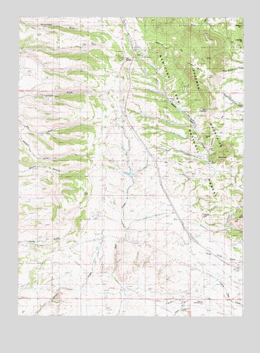
Sherman Mountains West, WY USGS Topographic Map
Click on map above to begin viewing in our Map Viewer.

This topographic map contains these locations and features:
Feature Name Type Latitude Longitude GNIS ID View Map
Ames MonumentPillarN41.1305°W105.3980°1597739View Map
Bennet HillParkN41.1989°W105.3975°1598110View Map
Bisbee HillSummitN41.2458°W105.3769°1598195View Map
Browns LandingLocaleN41.2280°W105.4025°1598408View Map
Hidden Valley Picnic AreaLocaleN41.2325°W105.4330°1605017View Map
Lincoln TrailTrailN41.2283°W105.4311°1600927View Map
Lower Blair Picnic AreaLocaleN41.1886°W105.3933°1605047View Map
Markley HillSummitN41.2391°W105.3764°1601259View Map
Mellody RanchLocaleN41.1755°W105.4305°1601350View Map
Old Sherman CemeteryCemeteryN41.1354°W105.4006°2774557View Map
Perue RanchLocaleN41.1703°W105.4475°1602104View Map
Point CrawfordSummitN41.2105°W105.3955°1602220View Map
Poland HillSummitN41.1669°W105.3986°1602235View Map
Pole MountainSummitN41.2319°W105.3903°1940332View Map
Pole Mountain Ranger StationLocaleN41.2280°W105.4372°1602248View Map
Pole Mountain TrailTrailN41.2366°W105.4122°1602249View Map
Pole Mountain Work CenterLocaleN41.2278°W105.4367°1605045View Map
Sherman MountainsRangeN41.1958°W105.3825°1602890View Map
The SummitLocaleN41.2319°W105.4408°1603622View Map
Turtle RockSummitN41.1661°W105.3755°1603811View Map
Upper Blair Picnic AreaLocaleN41.1933°W105.3933°1605046View Map
Vedauwoo Fire DepartmentBuildingN41.1603°W105.4079°2673618View Map
Wallis Recreation AreaParkN41.2030°W105.4055°1603969View Map
Warren Sheep CampLocaleN41.1678°W105.4192°1603991View Map
Williams Number 3 DamDamN41.1850°W105.4355°1609035View Map
Williams Number 3 ReservoirReservoirN41.1845°W105.4384°1609036View Map

Note: Coordinates in the location and feature list above are referenced to NAD83 datum.


Copyright (C) 2008-2024 Ryan Niemi / Sunset Dynamics ... All Rights Reserved