TopoQuest Logo
Do you find TopoQuest useful?
Help keep TopoQuest running and adding new maps/features by donating!
Bitcoin:  19c7KJd3qBynnjoSw5npx9KScwjBe4ifkT
Litecoin:  LXs6TkuXGGXo1vDsWCkWVdjQX94eUKd6ui
Home View Maps Find Maps Find Places Resources & Links


Sherburn, Minnesota Topographic Map

USGS Map Title: Sherburn, MN
USGS Map MRC: 43094F6
DRG (GeoTIFF) Download: o43094f6.tif


Neighboring USGS Topographic Map Quads:


  Mountain Lake SE, MN  
43094G7
 

  Trimont, MN  
43094G6
 

  Saint James SE, MN  
43094G5
 

  Alpha, MN  
43094F7
 

  Sherburn, MN  
43094F6
 

  Welcome, MN  
43094F5
 

  Dunnell, MN  
43094E7
 

  Ceylon, MN  
43094E6
 

  Wilbert, MN  
43094E5


Map MRC Location:

N44°
W95°
N44°
W94°
H8 H7 H6 H5 H4 H3 H2 H1
G8 G7 G6 G5 G4 G3 G2 G1
F8 F7 F6 F5 F4 F3 F2 F1
E8 E7 E6 E5 E4 E3 E2 E1
D8 D7 D6 D5 D4 D3 D2 D1
C8 C7 C6 C5 C4 C3 C2 C1
B8 B7 B6 B5 B4 B3 B2 B1
A8 A7 A6 A5 A4 A3 A2 A1
N43°
W95°
N43°
W94°

Sherburn, MN USGS 1:24K Topographic Map Preview:
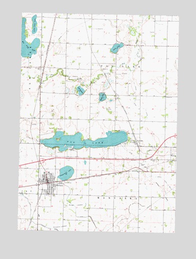
Sherburn, MN USGS Topographic Map
Click on map above to begin viewing in our Map Viewer.

This topographic map contains these locations and features:
Feature Name Type Latitude Longitude GNIS ID View Map
Assembly of God ChurchChurchN43.6522°W94.7269°2049489View Map
Big Twin LakeLakeN43.7325°W94.7472°640146View Map
Caven Mobile Home ParkPopulated PlaceN43.6519°W94.7253°2049478View Map
Caven's Landing CampgroundLocaleN43.6522°W94.7269°2049476View Map
City of SherburnCivilN43.6548°W94.7273°2395873View Map
Clam LakeLakeN43.7309°W94.6747°641231View Map
Elm Creek CemeteryCemeteryN43.7179°W94.7348°643297View Map
Emmanuel ChurchChurchN43.7030°W94.6344°643359View Map
First Congregational ChurchChurchN43.6572°W94.7303°2049485View Map
Fox LakeLakeN43.6770°W94.6978°643859View Map
Fox LakePopulated PlaceN43.6766°W94.6589°643865View Map
Fox Lake Golf ClubLocaleN43.6702°W94.7191°2049493View Map
Foxlake Post Office (historical)Post OfficeN43.6766°W94.6589°2049424View Map
Interchange 87CrossingN43.6650°W94.7322°2049543View Map
Judicial Ditch Number SeventyoneCanalN43.6783°W94.7453°645979View Map
Judicial Ditch Number ThirtysevenCanalN43.6905°W94.7319°645913View Map
Judicial Ditch Number TwentyfiveCanalN43.7011°W94.6594°645867View Map
Lake SeymourLakeN43.7059°W94.7021°651881View Map
Little Twin LakeLakeN43.7431°W94.7402°646956View Map
Manyaska LakebedFlatN43.6275°W94.7161°647461View Map
Martin County West High SchoolSchoolN43.6580°W94.7297°2049491View Map
Munger LakebedFlatN43.6402°W94.7044°648383View Map
P and J Modern Trailer CourtPopulated PlaceN43.6522°W94.7269°2049477View Map
Rooney RunStreamN43.7177°W94.6630°654551View Map
Round LakeLakeN43.7023°W94.6851°650319View Map
Saint John's Lutheran ChurchChurchN43.6497°W94.7272°2049484View Map
Saint Luke's ChurchChurchN43.6497°W94.7236°2049487View Map
Saint Lukes CemeteryCemeteryN43.6531°W94.7138°650804View Map
SherburnLocaleN43.6522°W94.7261°2049482View Map
SherburnPopulated PlaceN43.6522°W94.7269°651955View Map
Sherburn - Welcome Police DepartmentBuildingN43.6538°W94.7264°2758553View Map
Sherburn Baptist ChurchChurchN43.6463°W94.7241°2049486View Map
Sherburn City CemeteryCemeteryN43.6455°W94.7278°2049531View Map
Sherburn ClinicHospitalN43.6527°W94.7275°2049483View Map
Sherburn Elementary SchoolSchoolN43.6583°W94.7264°2049490View Map
Sherburn LibraryBuildingN43.6527°W94.7275°2049481View Map
Sherburn Post OfficePost OfficeN43.6538°W94.7275°2049492View Map
Sherburn Southside Mobile ParkPopulated PlaceN43.6488°W94.7300°2049479View Map
Sherburn Volunteer Fire DepartmentBuildingN43.6613°W94.7299°2049480View Map
Temperance LakeLakeN43.6583°W94.7126°653072View Map
Township of Fox LakeCivilN43.7177°W94.6740°664212View Map
Township of ManyaskaCivilN43.6298°W94.6742°664897View Map
United Methodist ChurchChurchN43.6552°W94.7275°2049488View Map
Weber IslandIslandN43.6777°W94.7194°653880View Map
Welcome CemeteryCemeteryN43.6663°W94.6417°653900View Map

Note: Coordinates in the location and feature list above are referenced to NAD83 datum.


Copyright (C) 2008-2024 Ryan Niemi / Sunset Dynamics ... All Rights Reserved