TopoQuest Logo
Do you find TopoQuest useful?
Help keep TopoQuest running and adding new maps/features by donating!
Bitcoin:  19c7KJd3qBynnjoSw5npx9KScwjBe4ifkT
Litecoin:  LXs6TkuXGGXo1vDsWCkWVdjQX94eUKd6ui
Home View Maps Find Maps Find Places Resources & Links


Shelter Cove, California Topographic Map

USGS Map Title: Shelter Cove, CA
USGS Map MRC: 40124A1
DRG (GeoTIFF) Download: o40124a1.tif


Neighboring USGS Topographic Map Quads:


  Shubrick Peak, CA  
40124B2
 

  Honeydew, CA  
40124B1
 

  Ettersburg, CA  
40123B8


  Shelter Cove, CA  
40124A1
 

  Briceland, CA  
40123A8


  Bear Harbor, CA  
39123H8


Map MRC Location:

N41°
W125°
N41°
W124°
H8 H7 H6 H5 H4 H3 H2 H1
G8 G7 G6 G5 G4 G3 G2 G1
F8 F7 F6 F5 F4 F3 F2 F1
E8 E7 E6 E5 E4 E3 E2 E1
D8 D7 D6 D5 D4 D3 D2 D1
C8 C7 C6 C5 C4 C3 C2 C1
B8 B7 B6 B5 B4 B3 B2 B1
A8 A7 A6 A5 A4 A3 A2 A1
N40°
W125°
N40°
W124°

Shelter Cove, CA USGS 1:24K Topographic Map Preview:
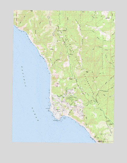
Shelter Cove, CA USGS Topographic Map
Click on map above to begin viewing in our Map Viewer.

This topographic map contains these locations and features:
Feature Name Type Latitude Longitude GNIS ID View Map
Big Finley CreekStreamN40.0896°W124.0006°219183View Map
Buck CreekStreamN40.1085°W124.1217°219981View Map
Chamisal MountainSummitN40.0140°W124.0045°254737View Map
Chemise CreekStreamN40.0040°W124.0270°220933View Map
Dead Mans GulchValleyN40.0254°W124.0578°222104View Map
Gitchell CreekStreamN40.0938°W124.1025°224190View Map
Grasshopper HillSummitN40.1179°W124.0136°1658654View Map
Horse MountainSummitN40.0876°W124.0814°1658783View Map
Horse Mountain CampgroundLocaleN40.1057°W124.0664°225613View Map
Horse Mountain CreekStreamN40.0685°W124.0828°225614View Map
Horse Mountain RidgeRidgeN40.1213°W124.0834°225615View Map
Humboldt CreekStreamN40.0460°W124.0809°225745View Map
Kaluna CliffCliffN40.0557°W124.0703°226414View Map
Little Finley CreekStreamN40.0999°W124.0023°227258View Map
McKee CreekStreamN40.0135°W124.0364°228386View Map
Nadelos CampgroundLocaleN40.0210°W124.0061°229406View Map
Nooning GroundFlatN40.0496°W124.0123°229579View Map
Paradise RidgeRidgeN40.1051°W124.0453°230323View Map
Pepperwood SpringSpringN40.0611°W124.0527°230518View Map
Point DelgadaCapeN40.0215°W124.0692°230850View Map
Queen PeakSummitN40.0671°W124.0331°1659448View Map
Shelter CoveBayN40.0243°W124.0636°232947View Map
Shelter CovePopulated PlaceN40.0304°W124.0731°1659640View Map
Shelter Cove AirportAirportN40.0254°W124.0699°1654008View Map
Shelter Cove Census Designated PlaceCensusN40.0390°W124.0558°2611448View Map
Shelter Cove Volunteer Fire DepartmentBuildingN40.0285°W124.0654°2622137View Map
Telegraph CreekStreamN40.0474°W124.0809°236081View Map
Tolkan CampgroundLocaleN40.0835°W124.0578°236422View Map
Wailaki CampgroundLocaleN40.0182°W124.0028°237159View Map

Note: Coordinates in the location and feature list above are referenced to NAD83 datum.


Copyright (C) 2008-2024 Ryan Niemi / Sunset Dynamics ... All Rights Reserved