TopoQuest Logo
Do you find TopoQuest useful?
Help keep TopoQuest running and adding new maps/features by donating!
Bitcoin:  19c7KJd3qBynnjoSw5npx9KScwjBe4ifkT
Litecoin:  LXs6TkuXGGXo1vDsWCkWVdjQX94eUKd6ui
Home View Maps Find Maps Find Places Resources & Links


Shannon, Illinois Topographic Map

USGS Map Title: Shannon, IL
USGS Map MRC: 42089B6
DRG (GeoTIFF) Download: o42089b6.tif


Neighboring USGS Topographic Map Quads:


  Pearl City, IL  
42089C7
 

  Freeport West, IL  
42089C6
 

  Freeport East, IL  
42089C5
 

  Boone Branch, IL  
42089B7
 

  Shannon, IL  
42089B6
 

  Forreston North, IL  
42089B5
 

  Lanark, IL  
42089A7
 

  Brookville, IL  
42089A6
 

  Forreston South, IL  
42089A5


Map MRC Location:

N43°
W90°
N43°
W89°
H8 H7 H6 H5 H4 H3 H2 H1
G8 G7 G6 G5 G4 G3 G2 G1
F8 F7 F6 F5 F4 F3 F2 F1
E8 E7 E6 E5 E4 E3 E2 E1
D8 D7 D6 D5 D4 D3 D2 D1
C8 C7 C6 C5 C4 C3 C2 C1
B8 B7 B6 B5 B4 B3 B2 B1
A8 A7 A6 A5 A4 A3 A2 A1
N42°
W90°
N42°
W89°

Shannon, IL USGS 1:24K Topographic Map Preview:
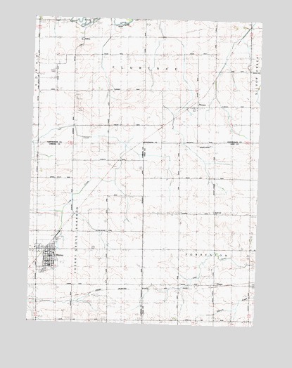
Shannon, IL USGS Topographic Map
Click on map above to begin viewing in our Map Viewer.

This topographic map contains these locations and features:
Feature Name Type Latitude Longitude GNIS ID View Map
Bethel United Methodist ChurchChurchN42.1520°W89.7390°1785399View Map
BoltonPopulated PlaceN42.2420°W89.7254°422485View Map
Brethren CemeteryCemeteryN42.1458°W89.7434°1785401View Map
Eastland Junior High SchoolSchoolN42.1484°W89.7404°1785414View Map
Evergreen School (historical)SchoolN42.1556°W89.6884°408129View Map
FlorencePopulated PlaceN42.2145°W89.6598°408469View Map
Gravel Hill School (historical)SchoolN42.1578°W89.6476°409342View Map
HarperPopulated PlaceN42.1414°W89.6473°409820View Map
Janssen Airport (historical)AirportN42.2257°W89.7384°427801View Map
Keller School (historical)SchoolN42.2297°W89.6315°411360View Map
Lane Evangelical United Baptist CemeteryCemeteryN42.2139°W89.6601°1821251View Map
Lost Creek School (historical)SchoolN42.1845°W89.7259°412651View Map
May School (historical)SchoolN42.2361°W89.6896°413154View Map
Moring Airport (historical)AirportN42.1984°W89.6557°427036View Map
Mount Union School (historical)SchoolN42.1259°W89.6871°414090View Map
Pleasant Hill School (historical)SchoolN42.1275°W89.6479°415869View Map
Pleasant View School (historical)SchoolN42.1264°W89.7257°415942View Map
Prairie Dell CemeteryCemeteryN42.1717°W89.6484°1808279View Map
Prairie Dell ChurchChurchN42.1706°W89.6490°416134View Map
Prairie Dell School (historical)SchoolN42.1853°W89.6476°416137View Map
Saint Wendelins Catholic ChurchChurchN42.1539°W89.7387°1967950View Map
ShannonPopulated PlaceN42.1547°W89.7398°418284View Map
Shannon Ambulance ServiceBuildingN42.1539°W89.7400°2674029View Map
Shannon Baptist ChurchChurchN42.1559°W89.7440°1967951View Map
Shannon City HallBuildingN42.1545°W89.7390°1967952View Map
Shannon Fire Protection DistrictBuildingN42.1541°W89.7399°2640304View Map
Shannon Post OfficePost OfficeN42.1548°W89.7404°2788625View Map
Shannon Village Police DepartmentBuildingN42.1544°W89.7390°2757099View Map
Shell CemeteryCemeteryN42.1553°W89.7165°418341View Map
Sneek AirportAirportN42.1845°W89.6758°2679086View Map
Swale QuarryMineN42.2125°W89.7246°1967577View Map
Township of FlorenceCivilN42.2404°W89.6919°429008View Map
Township of ForrestonCivilN42.1565°W89.6287°429013View Map
Union School (historical)SchoolN42.1850°W89.6871°420138View Map
Union School (historical)SchoolN42.2203°W89.7465°420140View Map
Van Brocklin ChurchChurchN42.2492°W89.7185°1821278View Map
Van Brocklin School (historical)SchoolN42.2486°W89.7154°420214View Map
Village of ShannonCivilN42.1524°W89.7401°2399791View Map
Wall School (historical)SchoolN42.2131°W89.7084°420425View Map

Note: Coordinates in the location and feature list above are referenced to NAD83 datum.


Copyright (C) 2008-2024 Ryan Niemi / Sunset Dynamics ... All Rights Reserved