TopoQuest Logo
Do you find TopoQuest useful?
Help keep TopoQuest running and adding new maps/features by donating!
Bitcoin:  19c7KJd3qBynnjoSw5npx9KScwjBe4ifkT
Litecoin:  LXs6TkuXGGXo1vDsWCkWVdjQX94eUKd6ui
Home View Maps Find Maps Find Places Resources & Links


Service Creek, Oregon Topographic Map

USGS Map Title: Service Creek, OR
USGS Map MRC: 44120G1
DRG (GeoTIFF) Download: o44120g1.tif


Neighboring USGS Topographic Map Quads:


  Fossil South, OR  
44120H2
 

  Kinzua, OR  
44120H1
 

  Wheeler Point, OR  
44119H8
 

  Rowe Creek, OR  
44120G2
 

  Service Creek, OR  
44120G1
 

  Masiker Mountain, OR  
44119G8
 

  Sutton Mountain, OR  
44120F2
 

  Toney Butte, OR  
44120F1
 

  Richmond, OR  
44119F8


Map MRC Location:

N45°
W121°
N45°
W120°
H8 H7 H6 H5 H4 H3 H2 H1
G8 G7 G6 G5 G4 G3 G2 G1
F8 F7 F6 F5 F4 F3 F2 F1
E8 E7 E6 E5 E4 E3 E2 E1
D8 D7 D6 D5 D4 D3 D2 D1
C8 C7 C6 C5 C4 C3 C2 C1
B8 B7 B6 B5 B4 B3 B2 B1
A8 A7 A6 A5 A4 A3 A2 A1
N44°
W121°
N44°
W120°

Service Creek, OR USGS 1:24K Topographic Map Preview:
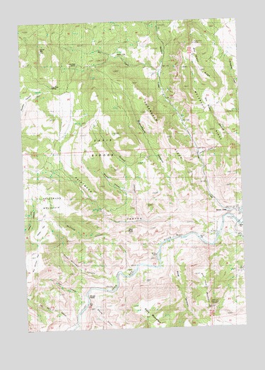
Service Creek, OR USGS Topographic Map
Click on map above to begin viewing in our Map Viewer.

This topographic map contains these locations and features:
Feature Name Type Latitude Longitude GNIS ID View Map
Ben Glenn RidgeRidgeN44.8576°W120.0256°1117508View Map
Big Juniper FlatFlatN44.7782°W120.1239°1117638View Map
Blowfly CanyonValleyN44.8054°W120.0645°1117828View Map
Corral MountainSummitN44.8632°W120.1142°1119301View Map
Davis RidgesRidgeN44.8224°W120.0814°1119715View Map
Deer CanyonValleyN44.7643°W120.0931°1119808View Map
Dutch FlatFlatN44.8632°W120.0667°1120230View Map
Heidtmann CanyonValleyN44.7937°W120.0170°1121735View Map
Heidtmann CanyonValleyN44.7944°W120.0236°2628175View Map
Heidtmann MountainSummitN44.8060°W120.1097°1121736View Map
Indian FlatFlatN44.7924°W120.1186°1122222View Map
Jenkins CreekStreamN44.8193°W120.0247°1122401View Map
McClung CanyonValleyN44.7924°W120.0739°1123913View Map
Mill CreekStreamN44.8546°W120.0470°1124156View Map
Muleshoe RidgeRidgeN44.8299°W120.0183°1124526View Map
Ox Head SpringSpringN44.8588°W120.0934°1125100View Map
Pine CanyonValleyN44.7843°W120.0372°1125385View Map
Roland CanyonValleyN44.7943°W120.0583°1126265View Map
Rosenbaum CanyonValleyN44.7976°W120.0367°1126305View Map
Rosenbaum RidgeRidgeN44.8274°W120.0433°1126306View Map
Rowe Williams CanyonValleyN44.7710°W120.0789°1126343View Map
Service CreekPopulated PlaceN44.7976°W120.0083°1126751View Map
Service CreekStreamN44.7971°W120.0025°1126752View Map
Service Creek Boat LaunchLocaleN44.7915°W120.0022°2700119View Map
Service Creek Post Office (historical)Post OfficeN44.7976°W120.0083°1165930View Map
Shell Rock MountainRidgeN44.7654°W120.0247°1126858View Map
Shoofly CanyonValleyN44.7657°W120.0895°1126909View Map
Shoofly CreekStreamN44.7654°W120.0903°1126910View Map
Shoofly RapidsRapidsN44.7630°W120.0909°1133429View Map
Tap Horn CanyonValleyN44.7532°W120.0986°1127892View Map
Tittie ButteSummitN44.7890°W120.0670°1128133View Map
Two Pipes SpringsSpringN44.8484°W120.1087°1128382View Map
Wagner CanyonValleyN44.7707°W120.0789°1132271View Map

Note: Coordinates in the location and feature list above are referenced to NAD83 datum.


Copyright (C) 2008-2024 Ryan Niemi / Sunset Dynamics ... All Rights Reserved