TopoQuest Logo
Do you find TopoQuest useful?
Help keep TopoQuest running and adding new maps/features by donating!
Bitcoin:  19c7KJd3qBynnjoSw5npx9KScwjBe4ifkT
Litecoin:  LXs6TkuXGGXo1vDsWCkWVdjQX94eUKd6ui
Home View Maps Find Maps Find Places Resources & Links


Scotia, California Topographic Map

USGS Map Title: Scotia, CA
USGS Map MRC: 40124D1
DRG (GeoTIFF) Download: o40124d1.tif


Neighboring USGS Topographic Map Quads:


  Fortuna, CA  
40124E2
 

  Hydesville, CA  
40124E1
 

  Owl Creek, CA  
40123E8
 

  Taylor Peak, CA  
40124D2
 

  Scotia, CA  
40124D1
 

  Redcrest, CA  
40123D8
 

  Buckeye Mountain, CA  
40124C2
 

  Bull Creek, CA  
40124C1
 

  Weott, CA  
40123C8


Map MRC Location:

N41°
W125°
N41°
W124°
H8 H7 H6 H5 H4 H3 H2 H1
G8 G7 G6 G5 G4 G3 G2 G1
F8 F7 F6 F5 F4 F3 F2 F1
E8 E7 E6 E5 E4 E3 E2 E1
D8 D7 D6 D5 D4 D3 D2 D1
C8 C7 C6 C5 C4 C3 C2 C1
B8 B7 B6 B5 B4 B3 B2 B1
A8 A7 A6 A5 A4 A3 A2 A1
N40°
W125°
N40°
W124°

Scotia, CA USGS 1:24K Topographic Map Preview:
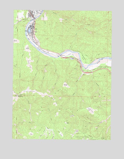
Scotia, CA USGS Topographic Map
Click on map above to begin viewing in our Map Viewer.

This topographic map contains these locations and features:
Feature Name Type Latitude Longitude GNIS ID View Map
Barkdull PrairieFlatN40.4287°W124.0600°218669View Map
Brushy CreekStreamN40.3918°W124.1006°219947View Map
Dean CreekStreamN40.4921°W124.1012°222143View Map
Dinner CreekStreamN40.4557°W124.0800°222403View Map
Elinor (historical)Populated PlaceN40.4501°W124.0159°1665220View Map
Elinor FlatFlatN40.4512°W124.0364°223095View Map
Elinor Junction (historical)LocaleN40.4524°W124.0345°1665221View Map
Fleisher Memorial BridgeBridgeN40.4562°W124.0675°252022View Map
Giacomini PrairieFlatN40.4465°W124.1059°224144View Map
Greenlow CreekStreamN40.4451°W124.0309°224589View Map
Happy ValleyValleyN40.3851°W124.0692°224905View Map
Harmonica CreekStreamN40.3843°W124.0762°224944View Map
Harrow PrairieFlatN40.4035°W124.0262°224974View Map
Hubbard PrairieFlatN40.3982°W124.0500°225719View Map
Jordan CreekStreamN40.4449°W124.0364°226347View Map
Juhaze PrairieFlatN40.4618°W124.1089°226369View Map
KEKA-FM (Eureka)TowerN40.4199°W124.0845°1662856View Map
Kiler CreekStreamN40.4593°W124.0909°226574View Map
Monument CreekStreamN40.4743°W124.1103°228989View Map
Monument RidgeRidgeN40.4232°W124.1067°228995View Map
Mount PierceSummitN40.4171°W124.1209°1654378View Map
Murphy Memorial BridgeBridgeN40.4912°W124.1006°252045View Map
Nelson CreekStreamN40.3851°W124.0825°229463View Map
Peavine RidgeRidgeN40.3760°W124.0078°234443View Map
Pullen CreekStreamN40.3843°W124.0764°231085View Map
Rio DellPopulated PlaceN40.4993°W124.1064°277614View Map
Rio Dell Police DepartmentBuildingN40.4989°W124.1067°2751044View Map
Rio Dell Post OfficePost OfficeN40.4949°W124.1035°2760048View Map
ScotiaPopulated PlaceN40.4824°W124.1009°232715View Map
Scotia Census Designated PlaceCensusN40.4775°W124.1032°2611446View Map
Scotia Log Pond 205 DamDamN40.4799°W124.1062°1663784View Map
Scotia Post OfficePost OfficeN40.4838°W124.1019°2760050View Map
Scotia Volunteer Fire DepartmentBuildingN40.4814°W124.1035°2622134View Map
Snow PrairieFlatN40.3832°W124.0439°234778View Map
South Fork Bear CreekStreamN40.3910°W124.0153°234967View Map
StaffordPopulated PlaceN40.4540°W124.0537°235340View Map
Stanwood A Murphy Elementary SchoolSchoolN40.4821°W124.1009°1682027View Map
Stitz CreekStreamN40.4607°W124.0542°235495View Map
Tank GulchValleyN40.4962°W124.0906°236009View Map
Turner OpeningAreaN40.3910°W124.0581°236660View Map
Twin CreekStreamN40.4540°W124.0717°236687View Map
West Fork Bear CreekStreamN40.3921°W124.0209°237461View Map

Note: Coordinates in the location and feature list above are referenced to NAD83 datum.


Copyright (C) 2008-2024 Ryan Niemi / Sunset Dynamics ... All Rights Reserved