TopoQuest Logo
Do you find TopoQuest useful?
Help keep TopoQuest running and adding new maps/features by donating!
Bitcoin:  19c7KJd3qBynnjoSw5npx9KScwjBe4ifkT
Litecoin:  LXs6TkuXGGXo1vDsWCkWVdjQX94eUKd6ui
Home View Maps Find Maps Find Places Resources & Links


Scooba, Mississippi Topographic Map

USGS Map Title: Scooba, MS
USGS Map MRC: 32088G4
DRG (GeoTIFF) Download: o32088g4.tif


Neighboring USGS Topographic Map Quads:


  Shuqualak, MS  
32088H5
 

  Paulette, MS  
32088H4
 

  Panola, AL  
32088H3
 

  Townsend, MS  
32088G5
 

  Scooba, MS  
32088G4
 

  Geiger, AL  
32088G3
 

  Oak Grove, MS  
32088F5
 

  Porterville, MS  
32088F4
 

  Emelle, AL  
32088F3


Map MRC Location:

N33°
W89°
N33°
W88°
H8 H7 H6 H5 H4 H3 H2 H1
G8 G7 G6 G5 G4 G3 G2 G1
F8 F7 F6 F5 F4 F3 F2 F1
E8 E7 E6 E5 E4 E3 E2 E1
D8 D7 D6 D5 D4 D3 D2 D1
C8 C7 C6 C5 C4 C3 C2 C1
B8 B7 B6 B5 B4 B3 B2 B1
A8 A7 A6 A5 A4 A3 A2 A1
N32°
W89°
N32°
W88°

Scooba, MS USGS 1:24K Topographic Map Preview:
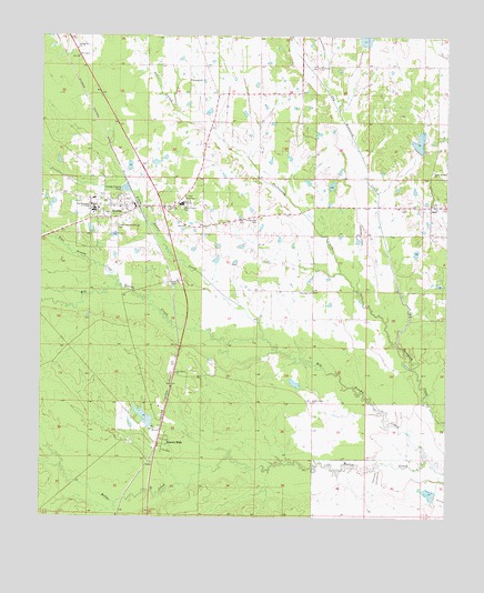
Scooba, MS USGS Topographic Map
Click on map above to begin viewing in our Map Viewer.

This topographic map contains these locations and features:
Feature Name Type Latitude Longitude GNIS ID View Map
3 Mile Corner Volunteer Fire DepartmentBuildingN32.8591°W88.4456°2666104View Map
Big Scooba CreekStreamN32.7651°W88.3806°667143View Map
Blue ChapelChurchN32.8332°W88.4567°667284View Map
Blue Chapel CemeteryCemeteryN32.8304°W88.4575°667285View Map
Bodka Valley ChurchChurchN32.7801°W88.4167°667362View Map
Carlton Fleming Pond DamDamN32.7751°W88.4150°681644View Map
Cedar Lawn Memorial CemeteryCemeteryN32.8257°W88.4781°668213View Map
Dale BranchStreamN32.8551°W88.4589°669076View Map
East Kemper Elementary SchoolSchoolN32.8329°W88.4839°707958View Map
Electric MillsPopulated PlaceN32.7693°W88.4639°669716View Map
Flat Scooba CreekStreamN32.8104°W88.4770°670029View Map
GilesPopulated PlaceN32.8310°W88.3800°691884View Map
Giles Airport (historical)AirportN32.8279°W88.4014°680357View Map
Giles CemeteryCemeteryN32.8318°W88.3792°707962View Map
Hatchette (historical)Populated PlaceN32.8112°W88.4603°707965View Map
Kemper ChurchChurchN32.8635°W88.4556°672093View Map
Larry Bell Pond DamDamN32.7618°W88.3750°681631View Map
Little Scooba CreekStreamN32.7965°W88.4323°672685View Map
Odessa Briggs Pond DamDamN32.8401°W88.4667°681692View Map
Old Scooba (historical)Populated PlaceN32.8279°W88.4334°707983View Map
Old Scooba CemeteryCemeteryN32.8279°W88.4348°675250View Map
Providence ChurchChurchN32.7876°W88.4586°676382View Map
Pushacoona CreekStreamN32.7943°W88.3895°676426View Map
ScoobaPopulated PlaceN32.8282°W88.4764°677458View Map
Scooba Post OfficePost OfficeN32.8308°W88.4725°2768785View Map
Scooba Volunteer Fire DepartmentBuildingN32.8302°W88.4702°2666092View Map
Shammack Creek Structure 2 DamDamN32.8701°W88.4034°681711View Map
Spencer High SchoolSchoolN32.8315°W88.4578°678052View Map
Spring Hill ChurchChurchN32.8718°W88.4898°678124View Map
Sunflower ChurchChurchN32.8671°W88.4161°678415View Map
Sunny Mount Giles ChurchChurchN32.8399°W88.3792°678424View Map
Supervisor District 1CivilN32.8397°W88.4881°704460View Map
Town of ScoobaCivilN32.8302°W88.4771°2407297View Map
Union Hall ChurchChurchN32.8087°W88.4173°679093View Map
Weyerhauser Lumber Company Pond DamDamN32.7735°W88.4667°681643View Map

Note: Coordinates in the location and feature list above are referenced to NAD83 datum.


Copyright (C) 2008-2024 Ryan Niemi / Sunset Dynamics ... All Rights Reserved