TopoQuest Logo
Do you find TopoQuest useful?
Help keep TopoQuest running and adding new maps/features by donating!
Bitcoin:  19c7KJd3qBynnjoSw5npx9KScwjBe4ifkT
Litecoin:  LXs6TkuXGGXo1vDsWCkWVdjQX94eUKd6ui
Home View Maps Find Maps Find Places Resources & Links


Sawyer, Kentucky Topographic Map

USGS Map Title: Sawyer, KY
USGS Map MRC: 36084H3
DRG (GeoTIFF) Download: o36084h3.tif


Neighboring USGS Topographic Map Quads:


  Dykes, KY  
37084A4
 

  Ano, KY  
37084A3
 

  London SW, KY  
37084A2
 

  Hail, KY  
36084H4
 

  Sawyer, KY  
36084H3
 

  Vox, KY  
36084H2
 

  Wiborg, KY  
36084G4
 

  Cumberland Falls, KY  
36084G3
 

  Wofford, KY  
36084G2


Map MRC Location:

N37°
W85°
N37°
W84°
H8 H7 H6 H5 H4 H3 H2 H1
G8 G7 G6 G5 G4 G3 G2 G1
F8 F7 F6 F5 F4 F3 F2 F1
E8 E7 E6 E5 E4 E3 E2 E1
D8 D7 D6 D5 D4 D3 D2 D1
C8 C7 C6 C5 C4 C3 C2 C1
B8 B7 B6 B5 B4 B3 B2 B1
A8 A7 A6 A5 A4 A3 A2 A1
N36°
W85°
N36°
W84°

Sawyer, KY USGS 1:24K Topographic Map Preview:
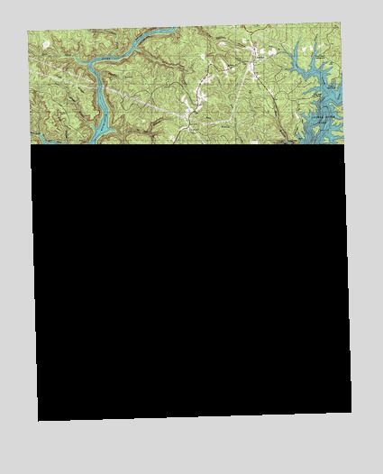
Sawyer, KY USGS Topographic Map
Click on map above to begin viewing in our Map Viewer.

This topographic map contains these locations and features:
Feature Name Type Latitude Longitude GNIS ID View Map
Bald Rock Volunteer Fire DepartmentBuildingN36.9875°W84.2910°2637294View Map
BaldrockPopulated PlaceN36.9904°W84.2835°510371View Map
Baldrock ChurchChurchN36.9862°W84.2952°516614View Map
Baldrock Conservation CenterLocaleN36.9934°W84.2855°516618View Map
Bark CampLocaleN36.9131°W84.2541°510393View Map
Bark Camp CreekStreamN36.9084°W84.3072°510394View Map
Bark Camp Shelter CampgroundLocaleN36.9079°W84.3077°517074View Map
Bark Camp TrailTrailN36.9101°W84.2922°516596View Map
Barnett RidgeRidgeN36.9112°W84.3535°510415View Map
Bear CreekStreamN36.9892°W84.3513°510463View Map
Bee CreekStreamN36.9226°W84.3097°510505View Map
Ben BranchStreamN36.9890°W84.2680°510548View Map
Big Lick BranchStreamN36.9642°W84.3694°510674View Map
Bridge BranchStreamN36.9476°W84.3019°510909View Map
Broad Gap HollowValleyN36.8836°W84.3234°510933View Map
Camp CreekStreamN36.8990°W84.3197°511148View Map
Campbell BranchStreamN36.9442°W84.3355°511158View Map
Cliffside TrailTrailN36.9445°W84.3249°516601View Map
Cold Spring HollowValleyN36.9375°W84.3441°511460View Map
Cox BranchStreamN36.9181°W84.3633°511607View Map
Craig CreekStreamN36.9726°W84.2585°511617View Map
Craig Creek Boat RampLocaleN36.9806°W84.2544°516616View Map
Craig Creek CampgroundLocaleN36.9926°W84.2591°516615View Map
Curd Garden RidgeRidgeN36.8917°W84.2733°511681View Map
Darbs BranchStreamN36.8851°W84.2580°511714View Map
Dave BranchStreamN36.9620°W84.2724°511726View Map
Devil CreekStreamN36.9004°W84.3160°511793View Map
Dutch BranchStreamN36.9629°W84.3488°511966View Map
Dutch Branch OverlookParkN36.9608°W84.3483°2723105View Map
Eagle - Sawyer Fire DepartmentBuildingN36.8775°W84.3610°2636342View Map
Fall CreekStreamN36.9559°W84.2858°512118View Map
Fish Trap BranchStreamN36.9429°W84.3674°512169View Map
Fishing CreekStreamN36.9381°W84.2972°512172View Map
Flat BranchStreamN36.9320°W84.3124°512183View Map
Franklin School Number 2SchoolN36.9206°W84.2510°517148View Map
Good BranchStreamN36.9845°W84.2608°512340View Map
Goodin BranchStreamN36.9590°W84.3558°512345View Map
Grassy BranchStreamN36.9037°W84.2899°512373View Map
Gulf RidgeRidgeN36.9831°W84.3572°512478View Map
Hamilton CemeteryCemeteryN36.9409°W84.3027°512535View Map
Holly Bay Boat RampLocaleN36.9826°W84.2602°516617View Map
Holly Bay MarinaLocaleN36.9770°W84.2585°517081View Map
Holly Bay Recreation AreaLocaleN36.9823°W84.2666°517080View Map
Ike BranchStreamN36.9540°W84.3577°512888View Map
Jackie BranchStreamN36.9042°W84.2794°512948View Map
Kentucky Youth RanchSchoolN36.9346°W84.2805°2710191View Map
Lakeside South TrailTrailN36.9415°W84.3488°516599View Map
Laurel RiverStreamN36.9462°W84.2960°513263View Map
Little MarinaLocaleN36.9465°W84.2958°516610View Map
London Dock MarinaLocaleN36.9601°W84.3558°517079View Map
Long BendBendN36.9673°W84.2585°513582View Map
Long BranchStreamN36.9390°W84.3372°513588View Map
Lower Troublesome CreekStreamN36.9912°W84.3410°513716View Map
Lower Twin BranchStreamN36.9470°W84.3233°513718View Map
Martins ForkStreamN36.8973°W84.2652°513813View Map
Mill BranchStreamN36.9520°W84.2902°513966View Map
Mill CreekStreamN36.9381°W84.3588°513983View Map
Mill Creek ChurchChurchN36.8856°W84.3730°516598View Map
Mouth of Laurel Boat RampLocaleN36.9459°W84.2944°517077View Map
Nathan McClure TrailTrailN36.9881°W84.3538°516777View Map
Ned BranchStreamN36.9676°W84.3433°514209View Map
Ned Branch TrailTrailN36.9670°W84.3310°516613View Map
Noes BreakwaterDamN36.9445°W84.2977°516609View Map
Peter BranchStreamN36.9631°W84.3610°514505View Map
Peter Branch TrailTrailN36.9640°W84.3647°516611View Map
Pole Bridge BranchStreamN36.9679°W84.3485°514670View Map
Pond SchoolSchoolN36.9592°W84.3274°514701View Map
Poynters ChurchChurchN36.9886°W84.2898°517064View Map
Poynters SchoolSchoolN36.9865°W84.2944°514759View Map
Price CemeteryCemeteryN36.9217°W84.3208°514767View Map
Rock BranchStreamN36.8865°W84.3172°515017View Map
Rock CreekStreamN36.9934°W84.3316°515023View Map
Rock RidgeRidgeN36.9290°W84.3699°515035View Map
Rockcastle Boat RampLocaleN36.9606°W84.3541°516612View Map
Rockcastle CampgroundLocaleN36.9617°W84.3466°517078View Map
Rockcastle RiverStreamN36.9601°W84.3569°515038View Map
Rose BranchStreamN36.9667°W84.2927°515102View Map
Ross BranchStreamN36.9362°W84.3363°515114View Map
Sam BranchStreamN36.9762°W84.2552°515205View Map
Sandy Poplar RidgeRidgeN36.8751°W84.2624°515243View Map
SawyerPopulated PlaceN36.9001°W84.3516°515267View Map
Sawyer Boat RampLocaleN36.9392°W84.3388°516597View Map
Sawyer CampgroundLocaleN36.9386°W84.3383°517076View Map
Sawyer CampsiteLocaleN36.9478°W84.2917°2710242View Map
Sawyer ChurchChurchN36.9145°W84.3352°516595View Map
Sawyer SchoolSchoolN36.9142°W84.3347°515268View Map
Sheltowee Trace TrailTrailN36.9376°W84.2958°516579View Map
South Mill Creek SchoolSchoolN36.8845°W84.3713°515555View Map
Spice Mortar BranchStreamN36.8812°W84.2538°515590View Map
Star Creek Shelter CampgroundLocaleN36.8854°W84.3138°517075View Map
Stillhouse BranchStreamN36.9373°W84.2510°515709View Map
Sulphur ForkStreamN36.9123°W84.3655°515807View Map
Taylor BranchStreamN36.8790°W84.3349°515878View Map
Tweed BranchStreamN36.9851°W84.3460°516072View Map
Twin Branch Shelter CampgroundLocaleN36.9470°W84.3219°516608View Map
Twin Branch TrailTrailN36.9548°W84.3255°516605View Map
Upper Troublesome CreekStreamN36.9959°W84.3319°516156View Map
Upper Twin BranchStreamN36.9467°W84.3222°516158View Map
Walker BranchStreamN36.9426°W84.2505°516205View Map
Whetstone BranchStreamN36.9448°W84.3172°516286View Map
Whitman BranchStreamN36.9495°W84.2891°516342View Map
Wilson HollowValleyN36.9374°W84.3507°516407View Map
Youngs Chapel Baptist ChurchChurchN36.9131°W84.2555°516514View Map

Note: Coordinates in the location and feature list above are referenced to NAD83 datum.


Copyright (C) 2008-2024 Ryan Niemi / Sunset Dynamics ... All Rights Reserved