TopoQuest Logo
Do you find TopoQuest useful?
Help keep TopoQuest running and adding new maps/features by donating!
Bitcoin:  19c7KJd3qBynnjoSw5npx9KScwjBe4ifkT
Litecoin:  LXs6TkuXGGXo1vDsWCkWVdjQX94eUKd6ui
Home View Maps Find Maps Find Places Resources & Links


Sawtooth Ridge, Montana Topographic Map

USGS Map Title: Sawtooth Ridge, MT
USGS Map MRC: 47112E6
DRG (GeoTIFF) Download: o47112e6.tif


Neighboring USGS Topographic Map Quads:


  Arsenic Mountain, MT  
47112F7
 

  Castle Reef, MT  
47112F6
 

  Split Rock Lake, MT  
47112F5
 

  Patricks Basin, MT  
47112E7
 

  Sawtooth Ridge, MT  
47112E6
 

  Barr Creek, MT  
47112E5
 

  Wood Lake, MT  
47112D7
 

  Double Falls, MT  
47112D6
 

  Nilan Reservoir, MT  
47112D5


Map MRC Location:

N48°
W113°
N48°
W112°
H8 H7 H6 H5 H4 H3 H2 H1
G8 G7 G6 G5 G4 G3 G2 G1
F8 F7 F6 F5 F4 F3 F2 F1
E8 E7 E6 E5 E4 E3 E2 E1
D8 D7 D6 D5 D4 D3 D2 D1
C8 C7 C6 C5 C4 C3 C2 C1
B8 B7 B6 B5 B4 B3 B2 B1
A8 A7 A6 A5 A4 A3 A2 A1
N47°
W113°
N47°
W112°

Sawtooth Ridge, MT USGS 1:24K Topographic Map Preview:
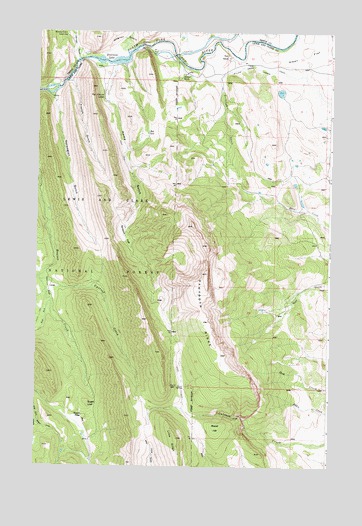
Sawtooth Ridge, MT USGS Topographic Map
Click on map above to begin viewing in our Map Viewer.

This topographic map contains these locations and features:
Feature Name Type Latitude Longitude GNIS ID View Map
Agropyron FlatsFlatN47.5669°W112.7142°800335View Map
Alkali FlatFlatN47.6241°W112.6264°793963View Map
Buttolph CreekStreamN47.6113°W112.6734°800523View Map
Cutreef CreekStreamN47.5536°W112.7484°800663View Map
Diversion LakeReservoirN47.6173°W112.7176°800701View Map
French GulchValleyN47.6108°W112.7367°800817View Map
Hannan GulchValleyN47.6174°W112.7328°784520View Map
Hannan Gulch Guard StationLocaleN47.6241°W112.7384°784521View Map
Home GulchValleyN47.6144°W112.7178°800955View Map
Home Gulch CampgroundLocaleN47.6152°W112.7259°794642View Map
Marshall Post Office (historical)Post OfficeN47.6180°W112.6981°1789138View Map
Neal RanchLocaleN47.6180°W112.6689°801211View Map
Norwegian GulchValleyN47.6069°W112.7450°801247View Map
Red LakeLakeN47.5961°W112.7032°801345View Map
Roost HillSummitN47.5113°W112.6728°801387View Map
Sawmill FlatFlatN47.5511°W112.7439°801409View Map
Sawtooth RidgeRidgeN47.5505°W112.6778°801416View Map
Stecker RanchLocaleN47.6130°W112.6878°801536View Map
Stoner PlacePopulated PlaceN47.5144°W112.7300°801544View Map
Sugar LoafSummitN47.5180°W112.7270°801555View Map
Sun Canyon LodgeLocaleN47.6066°W112.7225°801564View Map
Sun River Diversion DamDamN47.6216°W112.7059°795637View Map
Sun River Game RangeReserveN47.5730°W112.6278°793974View Map
Willow Creek Feeder CanalCanalN47.6102°W112.6320°801706View Map

Note: Coordinates in the location and feature list above are referenced to NAD83 datum.


Copyright (C) 2008-2024 Ryan Niemi / Sunset Dynamics ... All Rights Reserved