TopoQuest Logo
Do you find TopoQuest useful?
Help keep TopoQuest running and adding new maps/features by donating!
Bitcoin:  19c7KJd3qBynnjoSw5npx9KScwjBe4ifkT
Litecoin:  LXs6TkuXGGXo1vDsWCkWVdjQX94eUKd6ui
Home View Maps Find Maps Find Places Resources & Links


Savery, Wyoming Topographic Map

USGS Map Title: Savery, WY
USGS Map MRC: 41107A4
DRG (GeoTIFF) Download: o41107a4.tif


Neighboring USGS Topographic Map Quads:


  Smiley Draw, WY  
41107B5
 

  Browns Hill, WY  
41107B4
 

  Tullis, WY  
41107B3
 

  Dixon, WY  
41107A5
 

  Savery, WY  
41107A4
 

  Grieve Reservoir, WY  
41107A3
 

  Fortification NE, CO  
40107H5
 

  Bakers Peak, CO  
40107H4
 

  Fly Creek, CO  
40107H3


Map MRC Location:

N42°
W108°
N42°
W107°
H8 H7 H6 H5 H4 H3 H2 H1
G8 G7 G6 G5 G4 G3 G2 G1
F8 F7 F6 F5 F4 F3 F2 F1
E8 E7 E6 E5 E4 E3 E2 E1
D8 D7 D6 D5 D4 D3 D2 D1
C8 C7 C6 C5 C4 C3 C2 C1
B8 B7 B6 B5 B4 B3 B2 B1
A8 A7 A6 A5 A4 A3 A2 A1
N41°
W108°
N41°
W107°

Savery, WY USGS 1:24K Topographic Map Preview:
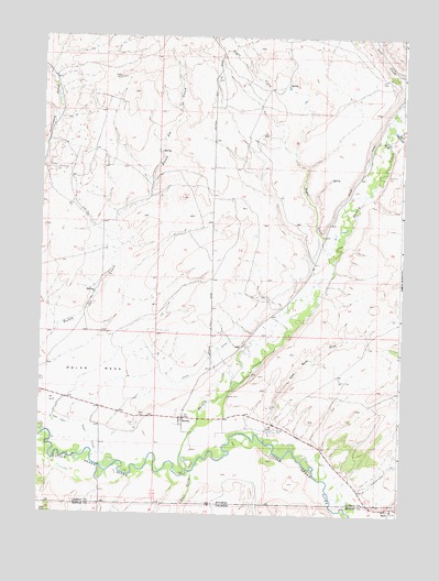
Savery, WY USGS Topographic Map
Click on map above to begin viewing in our Map Viewer.

This topographic map contains these locations and features:
Feature Name Type Latitude Longitude GNIS ID View Map
Angier MineMineN41.0341°W107.4431°1725979View Map
Baker CemeteryCemeteryN41.0030°W107.4823°1585061View Map
Baker CemeteryCemeteryN41.0257°W107.4651°2774415View Map
Beeler MineMineN41.0366°W107.4262°1725980View Map
Big GulchValleyN41.1011°W107.3781°1598152View Map
Coal Bank DrawValleyN41.0208°W107.4195°1598821View Map
Company Bank MineMineN41.0269°W107.4192°1725981View Map
Darling MineMineN41.0339°W107.4284°1725982View Map
Dixon AirportAirportN41.0356°W107.4938°1608983View Map
Dolan MesaSummitN41.0355°W107.4909°1587694View Map
Easom MineMineN41.0308°W107.4237°1725983View Map
McIntosh DrawValleyN41.0020°W107.3776°1601307View Map
Negro CreekStreamN41.0655°W107.3981°1591989View Map
Pioneer MineMineN41.0308°W107.4342°1592844View Map
Putt CreekStreamN41.0111°W107.4476°169749View Map
Reader CemeteryCemeteryN41.0219°W107.4176°1593225View Map
SaveryPopulated PlaceN41.0250°W107.4498°1593956View Map
Savery CreekStreamN41.0102°W107.4490°1602737View Map
Savery Post OfficePost OfficeN41.0247°W107.4512°2783234View Map

Note: Coordinates in the location and feature list above are referenced to NAD83 datum.


Copyright (C) 2008-2024 Ryan Niemi / Sunset Dynamics ... All Rights Reserved