TopoQuest Logo
Do you find TopoQuest useful?
Help keep TopoQuest running and adding new maps/features by donating!
Bitcoin:  19c7KJd3qBynnjoSw5npx9KScwjBe4ifkT
Litecoin:  LXs6TkuXGGXo1vDsWCkWVdjQX94eUKd6ui
Home View Maps Find Maps Find Places Resources & Links


Sattley, California Topographic Map

USGS Map Title: Sattley, CA
USGS Map MRC: 39120E4
DRG (GeoTIFF) Download: o39120e4.tif


Neighboring USGS Topographic Map Quads:


  Clio, CA  
39120F5
 

  Calpine, CA  
39120F4
 

  Antelope Valley, CA  
39120F3
 

  Haypress Valley, CA  
39120E5
 

  Sattley, CA  
39120E4
 

  Sierraville, CA  
39120E3
 

  English Mountain, CA  
39120D5
 

  Webber Peak, CA  
39120D4
 

  Independence Lake, CA  
39120D3


Map MRC Location:

N40°
W121°
N40°
W120°
H8 H7 H6 H5 H4 H3 H2 H1
G8 G7 G6 G5 G4 G3 G2 G1
F8 F7 F6 F5 F4 F3 F2 F1
E8 E7 E6 E5 E4 E3 E2 E1
D8 D7 D6 D5 D4 D3 D2 D1
C8 C7 C6 C5 C4 C3 C2 C1
B8 B7 B6 B5 B4 B3 B2 B1
A8 A7 A6 A5 A4 A3 A2 A1
N39°
W121°
N39°
W120°

Sattley, CA USGS 1:24K Topographic Map Preview:
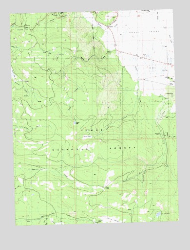
Sattley, CA USGS Topographic Map
Click on map above to begin viewing in our Map Viewer.

This topographic map contains these locations and features:
Feature Name Type Latitude Longitude GNIS ID View Map
Ahart CampLocaleN39.5013°W120.4672°218021View Map
Berry CreekStreamN39.6007°W120.4247°254609View Map
Big CanyonValleyN39.6230°W120.4638°219150View Map
Bonta SaddleGapN39.5207°W120.4316°252189View Map
Church CampLocaleN39.5310°W120.4672°221099View Map
Coburn LakeLakeN39.5595°W120.4535°221286View Map
Dark CanyonValleyN39.5785°W120.4052°222017View Map
Dark Canyon TrailTrailN39.5596°W120.4335°222020View Map
Franklin CabinLocaleN39.5977°W120.4344°1662470View Map
Franklin CabinLocaleN39.5982°W120.4513°223811View Map
Hamlin CreekStreamN39.6124°W120.4010°224849View Map
Henness PassGapN39.5027°W120.4394°225177View Map
Lake of The WoodsLakeN39.5042°W120.3915°238166View Map
Maiden ValleyValleyN39.5513°W120.4402°227956View Map
Nichols MillLocaleN39.5521°W120.3883°229541View Map
Randolph HillSummitN39.5741°W120.3780°231237View Map
SattleyPopulated PlaceN39.6160°W120.4272°232594View Map
Sattley Post OfficePost OfficeN39.6156°W120.4260°1733177View Map
Sierra County Fire Protection District 3 - SattleyBuildingN39.6155°W120.4265°2622120View Map
Sierraville CemeteryCemeteryN39.5841°W120.3797°1666603View Map
The MoundsSummitN39.6241°W120.3960°236195View Map
Turner CanyonValleyN39.6143°W120.4280°268492View Map
Wild Bill CanyonValleyN39.6010°W120.4244°1666605View Map
Yuba PassGapN39.6174°W120.4899°238294View Map
Yubas Pass CampgroundLocaleN39.6149°W120.4913°276094View Map

Note: Coordinates in the location and feature list above are referenced to NAD83 datum.


Copyright (C) 2008-2024 Ryan Niemi / Sunset Dynamics ... All Rights Reserved