TopoQuest Logo
Do you find TopoQuest useful?
Help keep TopoQuest running and adding new maps/features by donating!
Bitcoin:  19c7KJd3qBynnjoSw5npx9KScwjBe4ifkT
Litecoin:  LXs6TkuXGGXo1vDsWCkWVdjQX94eUKd6ui
Home View Maps Find Maps Find Places Resources & Links


Saranac, Michigan Topographic Map

USGS Map Title: Saranac, MI
USGS Map MRC: 42085H2
DRG (GeoTIFF) Download: o42085h2.tif


Neighboring USGS Topographic Map Quads:


  Smyrna, MI  
43085A3
 

  Belding, MI  
43085A2
 

  Shiloh, MI  
43085A1
 

  Lowell, MI  
42085H3
 

  Saranac, MI  
42085H2
 

  Ionia, MI  
42085H1
 

  Freeport, MI  
42085G3
 

  Lake Odessa, MI  
42085G2
 

  Woodbury, MI  
42085G1


Map MRC Location:

N43°
W86°
N43°
W85°
H8 H7 H6 H5 H4 H3 H2 H1
G8 G7 G6 G5 G4 G3 G2 G1
F8 F7 F6 F5 F4 F3 F2 F1
E8 E7 E6 E5 E4 E3 E2 E1
D8 D7 D6 D5 D4 D3 D2 D1
C8 C7 C6 C5 C4 C3 C2 C1
B8 B7 B6 B5 B4 B3 B2 B1
A8 A7 A6 A5 A4 A3 A2 A1
N42°
W86°
N42°
W85°

Saranac, MI USGS 1:24K Topographic Map Preview:
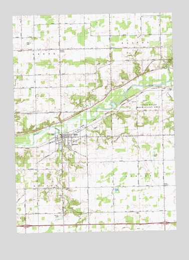
Saranac, MI USGS Topographic Map
Click on map above to begin viewing in our Map Viewer.

This topographic map contains these locations and features:
Feature Name Type Latitude Longitude GNIS ID View Map
Bellamy CreekStreamN42.9609°W85.1272°621050View Map
Berlin CenterPopulated PlaceN42.9006°W85.1342°1617440View Map
Cahoon LakeLakeN42.9840°W85.2397°622444View Map
Crooked CreekStreamN42.9395°W85.1922°624084View Map
Easton ChurchChurchN42.9806°W85.1733°625298View Map
Easton Post Office (historical)Post OfficeN42.9806°W85.1561°2581760View Map
Family Health Center-SaranacHospitalN42.9308°W85.2100°2582353View Map
Fisher LakeLakeN42.9181°W85.1425°626064View Map
Galilee Baptist ChurchChurchN42.9275°W85.2061°2582359View Map
Harker Middle SchoolSchoolN42.9256°W85.2078°2582357View Map
Interchange 59CrossingN42.8792°W85.2428°2581795View Map
Interchange 64CrossingN42.8792°W85.1314°2581794View Map
Ionia State Recreation AreaParkN42.9461°W85.1342°629063View Map
Keene Post Office (historical)Post OfficeN42.9806°W85.2339°2581761View Map
Lake CreekStreamN42.9331°W85.2147°1623469View Map
Leary DrainCanalN42.8756°W85.1506°630244View Map
Little CreekStreamN42.9003°W85.2153°630602View Map
Marker LakeLakeN42.8838°W85.2157°631574View Map
New Berlin Post Office (historical)Post OfficeN42.9006°W85.1339°2581741View Map
Peck LakeLakeN42.8987°W85.1715°634547View Map
Potters CornersLocaleN42.9803°W85.2133°635353View Map
Red CreekStreamN42.9409°W85.1895°635706View Map
Saint Anthony's Catholic ChurchChurchN42.9303°W85.1950°2582360View Map
SaranacPopulated PlaceN42.9295°W85.2131°637257View Map
Saranac CemeteryCemeteryN42.9296°W85.1990°2581786View Map
Saranac Community ChurchChurchN42.9272°W85.2139°2582358View Map
Saranac Community Fire DepartmentBuildingN42.9298°W85.2130°2582352View Map
Saranac Elementary SchoolSchoolN42.9250°W85.2042°2582356View Map
Saranac High SchoolSchoolN42.9272°W85.2036°2582355View Map
Saranac Historical MarkerParkN42.9314°W85.2035°2567820View Map
Saranac Post OfficePost OfficeN42.9297°W85.2128°2582351View Map
Saranac Public LibraryBuildingN42.9308°W85.2106°2582354View Map
Saranac Rest AreaLocaleN42.8778°W85.1598°2567802View Map
Saranac StationLocaleN42.9311°W85.2139°2582413View Map
Scheid ParkParkN42.9331°W85.2017°637329View Map
Sessions CreekStreamN42.9603°W85.1264°637584View Map
Sessions LakeLakeN42.9407°W85.1276°1617077View Map
Timberland CreekStreamN42.9586°W85.1517°1614870View Map
Township of BerlinCivilN42.9077°W85.1319°1625923View Map
Township of EastonCivilN42.9962°W85.1412°1626208View Map
Village of SaranacCivilN42.9294°W85.2105°2399184View Map
White CemeteryCemeteryN42.9438°W85.2404°1616298View Map

Note: Coordinates in the location and feature list above are referenced to NAD83 datum.


Copyright (C) 2008-2024 Ryan Niemi / Sunset Dynamics ... All Rights Reserved